This copy is copyright protected.
Copyright © 2025 Geographicus Rare Antique Maps
1824 Early American Promotional Map of Long Island
LongIsland-longislandcanalcompany-1824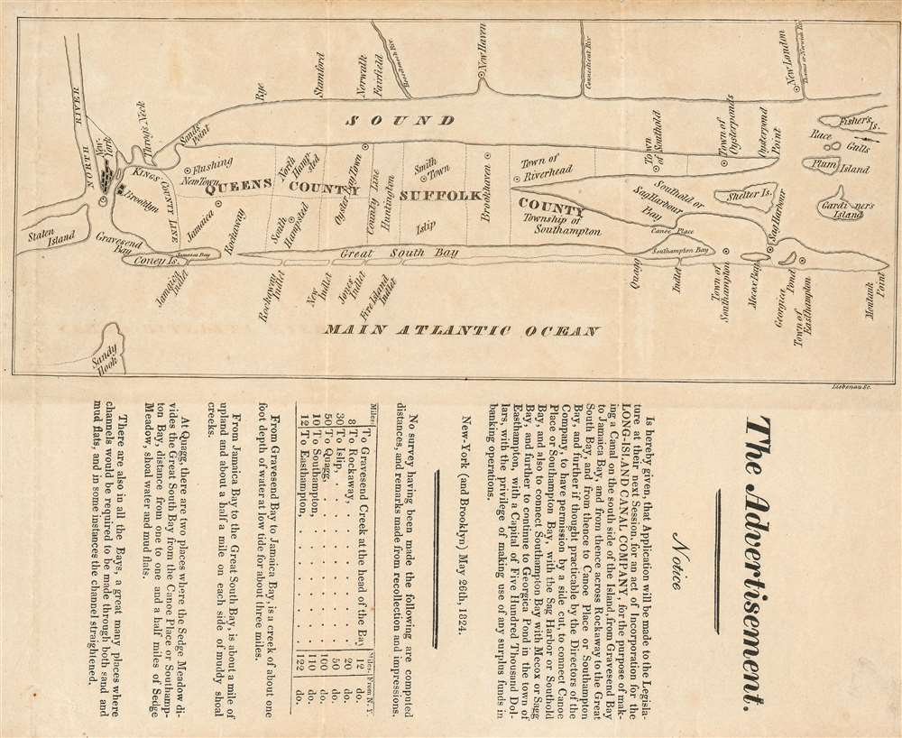

for the purpose of making a Canal on the south side of the Island, from Gravesend Bay to Jamaica Bay, and from hence across Rockaway to the Great South Bay, and from thence to Canoe Place or Southampton Bay, and further if thought practicable by the Directors of the Company, to have permission by a side cut, to connect Canoe Place or Southampton Bay, with there Sag Harbor or Southold Bay, and also to connect Southampton Bay with Mecox or Sagg Bay, and further to continue to Georgica Pond in the town of Easthampton…The text goes on to enumerate relevant distances, and describe the coastal conditions of the relevant areas. While there is documentary evidence that the company was indeed incorporated in 1828, there is no similar evidence that any of the company’s aims were ever achieved, or indeed even embarked upon. A significantly more modest canal connecting the Great Peconic Bay with Shinnecock Bay (Southhold Bay and Southampton Bay on the map, respectively) was eventually constructed in 1892.
Frederick Liebenau (fl. 1827-9) was an engraver in New York in the first part of the 19th century. It is possible that this is actually Heinrich Frederick Liebenau, born in Germany in 1770 but married at Trinity Church in New York in 1800, dying in New York in 1826, but we have only the loosest circumstantial evidence to draw this conclusion. More by this mapmaker...
Copyright © 2025 Geographicus Rare Antique Maps | Geographicus Rare Antique Maps
This copy is copyright protected.
Copyright © 2025 Geographicus Rare Antique Maps