1913 Cram / Bruner Map of Louisiana promoting Agriculture and Immigration
Louisiana-cram-1913$450.00


Title
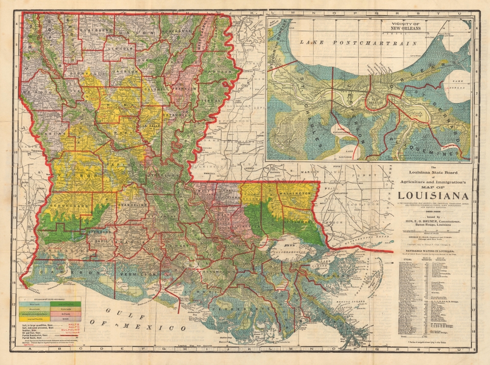
The Louisiana State Board of Agriculture and Immigration's Map of Louisiana. A Phytogeographic Map Showing the Principal Vegetation Areas, all Principal Commercial Points, Town Populations and Railway Distances.
1913 (dated) 25.25 x 18.75 in (64.135 x 47.625 cm) 1 : 1150000
1913 (dated) 25.25 x 18.75 in (64.135 x 47.625 cm) 1 : 1150000
Description
This is a 1913 thematic map of Louisiana illustrating terrain and agricultural potential issued by by George F. Cram for the Louisiana State Board of Agriculture and Immigration, under E. O. Bonner. After the American Civil War (1861 - 1865), Louisiana saw its many massive plantations largely abandoned, impossible to maintain and operate without slave labor. Their solution, from the late 19th century, was to encourage immigration through a series of broadside and cartographic publications.
A Closer Look
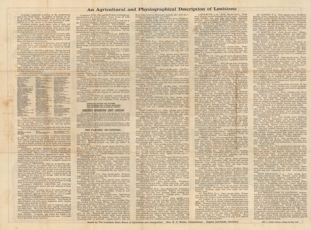
This colorful map details the state in full, with a focus on terrain, resources, and infrastructure. Color coding highlights different types of land, with red overprinting underscoring the resources available there. Extensive promotional text on the verso combines facts about the state, broken down by parish, with effusive text extolling climate, resources, and infrastructure. The map entreatsYOU SHOULD COME TO LOUISIANA, because: It is the best country for a man of moderate means. It has uplands, prairie lands and alluvial bottoms. The lands yield readily to cultivation, and profits are large. The winter does not destroy what it takes all summer to produce. There is an opportunity for everybody, rich and poor. The climate is mild and healthful. Everything that grows anywhere else can be produced here. Truck farming is a success. The products are ready early and bring high prices. No State offers better fields for manufactories. Education is paramount; schools are plentiful and tuition free. Her people are warm-hearted and anxious to welcome you. Her lands are cheap, fertile, and the most productive in the world. Her government is always for the greatest good of the greatest number of people.
Publication History and Census
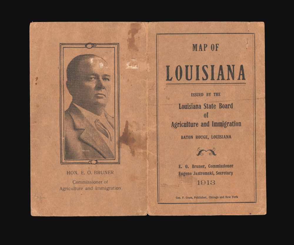
This map is part of a series published annually from about 1899 through 1917 by the Louisiana State Board of Agriculture and Immigration. Until 1906, they were published as broadsides by the Rand McNally Company. From 1907, engraving and printing shifted to George F. Cram (as here), who revised the format to a more practical double-sided folding map. The present map was ordered by E. O. Bruner, Commissioner of the Board of Agriculture and Immigration. Examples are scarce on the market, and we note some 14 holdings in OCLC, representing various editions.Cartographer
George Franklin Cram (May 20, 1842 - 1928) was an American map publisher active in the late 19th and early 20th centuries. During the American Civil War, Cram served as a staff cartographer for the Union General Ulysses S. Grant and participated in Sherman's 'March to the Sea'. In 1867, after being discharged from the army, George Cram moved to Chicago, where he founded 'Blanchard and Cram' with his uncle Rufus Blanchard Evanston. Blanchard and Cram was a supply house for the book trade - though they also published a few maps during this period. This short lived business was destroyed in the 1871 by the Great Chicago Fire. After the fire, recognizing a business opportunity in the burgeoning railroad industry, Cram reinvented himself as cartographic publisher, opening the Cram Map Depot. Like fellow Chicago publisher Rand McNally, Cram took advantage of the economical wax engraving processes to inexpensively produce maps in vast quantities. His signature publication, the Unrivaled Atlas of the World became the world's best-selling atlas and was published from the 1880s to 1952. On retiring in 1921, Cram sold his company to Edward A. Peterson of the National Map Company (Scarborough Company). Peterson moved the company to Indianapolis where, following Cram's death, he rebranded the National Map Company as the George F. Cram Company, surely thinking to capitalize on the established identity of the firm. In 1930 he entered the globe market for which the firm was best known from the mid-20th century. In time the firm expanded globally passing becoming a major concern. Loren B. Douthit became company president in 1968 and the Douthit family ran the business until Herff Jones, Inc., bought the company in 2005. More by this mapmaker...
Condition
Very good. Minor archival verso reinforcements at some fold intersections and along margins.
References
OCLC 69121063.