Digital Image: 1588 Livio and Giulio Sanuto Map of Morocco and Marrakesh
Marrakesh-sanuto-1588_d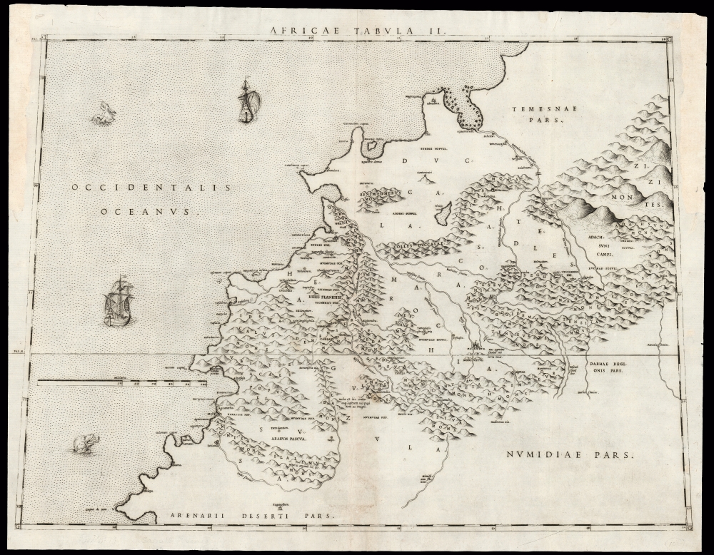

Title
Africae Tabula II.
1588 (undated) 15.5 x 21 in (39.37 x 53.34 cm) 1 : 1403000
1588 (undated) 15.5 x 21 in (39.37 x 53.34 cm) 1 : 1403000
Description
FOR THE ORIGINAL ANTIQUE MAP, WITH HISTORICAL ANALYSIS, CLICK HERE.
Digital Map Information
Geographicus maintains an archive of high-resolution rare map scans. We scan our maps at 300 DPI or higher, with newer images being 600 DPI, (either TIFF or JPEG, depending on when the scan was done) which is most cases in suitable for enlargement and printing.
Delivery
Once you purchase our digital scan service, you will receive a download link via email - usually within seconds. Digital orders are delivered as ZIP files, an industry standard file compression protocol that any computer should be able to unpack. Some of our files are very large, and can take some time to download. Most files are saved into your computer's 'Downloads' folder. All delivery is electronic. No physical product is shipped.
Credit and Scope of Use
You can use your digial image any way you want! Our digital images are unrestricted by copyright and can be used, modified, and published freely. The textual description that accompanies the original antique map is not included in the sale of digital images and remains protected by copyright. That said, we put significant care and effort into scanning and editing these maps, and we’d appreciate a credit when possible. Should you wish to credit us, please use the following credit line:
Courtesy of Geographicus Rare Antique Maps (http://www.geographicus.com).
How Large Can I Print?
In general, at 300 DPI, you should at least be able to double the size of the actual image, more so with our 600 DPI images. So, if the original was 10 x 12 inches, you can print at 20 x 24 inches, without quality loss. If your display requirements can accommodate some loss in image quality, you can make it even larger. That being said, no quality of scan will allow you to blow up at 10 x 12 inch map to wall size without significant quality loss. For more information, it is best consult a printer or reprographics specialist.
Refunds
If the high resolution image you ordered is unavailable, we will fully refund your purchase. Otherwise, digital images scans are a service, not a tangible product, and cannot be returned or refunded once the download link is used.
Cartographer S
Livio Sanuto (1520 – 1576) was a Venetian cartographer and scientific instrument maker produced, with his engraver brother, Giulio (fl. 1540-1588) – an array of some of the most important geographical works produced in Venice during the second half of the sixteenth century. These included a 27-inch globe and the 1588 12-sheet atlas, Geografia della Africa. Among Livio and Giulio's works were some, if not all of the maps prepared for Ruscelli's 1561 Ptolemy. More by this mapmaker...
Giulio Sanuto (fl. 1540 – 1580) was a Venetian engraver. He was born the illegitimate son of Cavaliere Francesco di Angelo Sanuto; With his brother, the cartographer and scientific instrument maker Livio Sanuto (1520 – 1576) he produced an array of some of the most important geographical works produced in Venice during the second half of the sixteenth century. These included a 27-inch globe and the 1588 12-sheet atlas, Geografia della Africa. Giulio's career is singluar among Venice's engraves in that it appears to have been equally based on artistic, figurative work as well as his cartographic works. Giulio is more broadly known for a small but sought-after selection of decorative engravings; no more than twelve of these can be attributed confidently to him, including the monumental Apollo and Marsyas, measuring over 1.30 meters wide. Whilst Sanuto's engravings were generally based upon the designs of other artists, his work was both ambitious and grand, and he often signed these works. Learn More...
Johannes Leo Africanus, born al-Hasan Muhammad al-Wazzan al-Fasi, الحسن محمد الوزان الفاسي)(c. 1494 – c. 1554) was a Berber Andalusi diplomat and author who is best known for his 1526 book Cosmographia et geographia de Affrica, later published by Giovanni Battista Ramusio as Descrittione dell’Africa (Description of Africa) in 1550, the 16th century's most authoritative text on the geography of the north parts of Africa. He was born al-Hasan Muhammad al-Wazzan al-Fasin in Granada around the year 1494; his family moved to Fez soon after. There studied at the University of al-Qarawiyyin; As a young man he accompanied an uncle on a diplomatic mission, reaching as far as the city of Timbuktu in the Songhai Empire. 1517 found him working as a diplomat in the service of the Sultan of Fez, on a mission to Constantinople. He was a witness to the Ottoman conquest of Egypt. His return to Tunis in 1518 would be interrupted by his capture by Spanish pirates, and his imprisonment on Rhodes. His erudition saved him from a lifetime as a galley slave: An example for the ages of the value of an education, he was instead sent to Rome and presented to Pope Leo X. He was not only freed, but also given a pension as an inducement to remain in Rome. There he converted to Catholicism, and was in 1520 baptized with the Latin name Johannes Leo de Medicis. Following the death of his patron Leo X in 1521 Leo Africanus traveled Italy four years, and wrote: his works included an Arabic-Hebrew-Latin medical vocabulary, and an Arabic grammar. He returned to Rome in 1526, where he would write his African geography: although it is unlikely that he had firsthand knowledge of every place he described, he certainly would have been in a position to share knowledge of other travelers, and his access to the great library of Timbuktu may have availed him of much knowledge otherwise beyond reach.
Africanus' African geography would remain in manuscript until it was committed to print in Giovanni Battista Ramusio's Voyages as Della descrittione dell’Africa et delle cose notabili che ivi sono, per Giovan Lioni Africano. It would be reprinted five times, and later be published in other languages.
Leo Africanus' life following the completion of his Geography is uncertain. He may have remained in Rome until his death; he may have eluded the 1527 Sack of Rome, returning to Tunis until his death there. Another theory sends him from Tunis back to Morocco, where he still had relatives. Despite his intentions to do so (expressed in the text of his Africa book) Leo Africanus produced no further books that have survived. Learn More...
Source
Sanuto, L., Geografia di M Livio Sanuto Distinta in XII Libri, (Venice: Zenaro) 1588.
References
OCLC 796358674. Not in Afriterra. Not in Norwich. Bifolco, S. / Ronca, F. Cartografia e Topografia Italiana del XVI Secolo. pp. 2525-6.