Digital Image: 1926 Kahn Lithograph 'The Human as an Industrial Palace'
MenschIndustriepalast-kahn-1926_d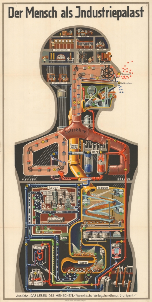

Title
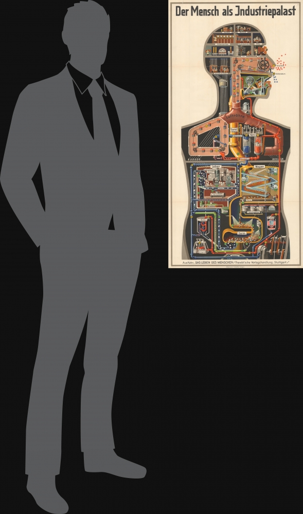
Der Mensch als Industriepalast.
1926 (undated) 37.5 x 18.75 in (95.25 x 47.625 cm)
1926 (undated) 37.5 x 18.75 in (95.25 x 47.625 cm)
Description
FOR THE ORIGINAL ANTIQUE MAP, WITH HISTORICAL ANALYSIS, CLICK HERE.
Digital Map Information
Geographicus maintains an archive of high-resolution rare map scans. We scan our maps at 300 DPI or higher, with newer images being 600 DPI, (either TIFF or JPEG, depending on when the scan was done) which is most cases in suitable for enlargement and printing.
Delivery
Once you purchase our digital scan service, you will receive a download link via email - usually within seconds. Digital orders are delivered as ZIP files, an industry standard file compression protocol that any computer should be able to unpack. Some of our files are very large, and can take some time to download. Most files are saved into your computer's 'Downloads' folder. All delivery is electronic. No physical product is shipped.
Credit and Scope of Use
You can use your digial image any way you want! Our digital images are unrestricted by copyright and can be used, modified, and published freely. The textual description that accompanies the original antique map is not included in the sale of digital images and remains protected by copyright. That said, we put significant care and effort into scanning and editing these maps, and we’d appreciate a credit when possible. Should you wish to credit us, please use the following credit line:
Courtesy of Geographicus Rare Antique Maps (http://www.geographicus.com).
How Large Can I Print?
In general, at 300 DPI, you should at least be able to double the size of the actual image, more so with our 600 DPI images. So, if the original was 10 x 12 inches, you can print at 20 x 24 inches, without quality loss. If your display requirements can accommodate some loss in image quality, you can make it even larger. That being said, no quality of scan will allow you to blow up at 10 x 12 inch map to wall size without significant quality loss. For more information, it is best consult a printer or reprographics specialist.
Refunds
If the high resolution image you ordered is unavailable, we will fully refund your purchase. Otherwise, digital images scans are a service, not a tangible product, and cannot be returned or refunded once the download link is used.
Cartographer
Fritz Kahn (September 29, 1888 - January 14, 1968) was a German-Jewish writer and physician known for his innovative and memorable infographics relating to medical and scientific topics. Kahn's life was defined by frequent travel; having been born in Halle, during his childhood he briefly emigrated to the United States and then returned to Germany, moving several times before settling in Berlin, where he finished his gymnasium. He then attended medical school at the University of Berlin but retained a wide interest in multiple fields of science. In addition to serving as a medic in the First World War, he published articles on scientific topics in popular publications (his father was also a writer and physician), and joined expeditions to the Arctic and Sahara Desert. With the rise of Hitler, he emigrated to Palestine and then to Paris. After being detained by France in the early phase of the Second World War (due to his German citizenship), he was able to secure release and then gradually make his way to the U.S. In the postwar period, he primarily settled in Switzerland but also spent periods in the U.S. and Denmark. Kahn published more than 20 books throughout his lifetime, which were especially known for their striking illustrations (conceived by Kahn and drawn by others). He was especially fond of comparing the human body to a mechanical instrument and considered it the most sophisticated machine in the world. Kahn's works were suppressed in Germany by the Nazis, retroactively obscuring his prominence during the Weimar period, but he gained a degree of international recognition in the postwar period. More by this mapmaker...
References
OCLC 41614082. Sappol, M., Body modern : Fritz Kahn, scientific illustration, and the homuncular subject (University of Minnesota Press, 2017).