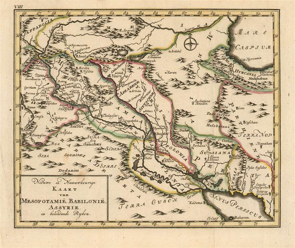
This rare 1780 map of Mesopotamia presents the region of modern-day Syria, Iraq and western Iran. the map is centered on the courses of the Tigris and Euphrates, spanning north and south from the Caspian Sea to the Persian Gulf and west to east from Baalbek in Lebanon to Shiraz in Iran. The map's topography is based on contemporary cartographic data, but it was not intended to depict the 18th century Near East: rather, the place names are drawn from Biblical sources, reinforced with geographical data of ancient geographers - primarily referencing the period of the Bablylonian Captivity. Other features include Mount Ararat, reputed to be the mountain where Noah's ark came to rest after The Flood.
Publication History and Census
This map was engraved by Jacob van der Schley for Martinus de Bruyn's Bybelsche huis en zak-Atlas, an atlas of fifteen maps intended to accompany Johan Jacob Schmidt's 1776 Bybelsche Geögraphicus . The atlas was not produced until 1780 and was relegated to a small, solitary edition. Consequently all of the maps of the atlas are rare. OCLC shows only nine examples of the zak-Atlas in institutional collections. No separate copies of this map are listed in OCLC, and we do not see any examples in catalogue or auction records.
Cartographer
Jacob Van der Schley (1715 - 1779) was a prominent Amsterdam engraver and draftsman based out of Amsterdam. Schley apprenticed under portrait engraver Bernard Picart, whose style he imitated. He is said to have completed several of Picart's portraits following his master's death. While Schley is primarily known for his work as a portraitist and illustrator, he also has a considerable cartographic corpus. He is known to have worked with Bellin, Hondt, and Provost, among others. More by this mapmaker...
Source
De Bruyn, Martinus Bybelsche huis en zak-AtlasAmsterdam, 1780.
Very good condition; a very faint stain, else excellent with original outline color.
Not in OCLC. An uncatalogued map.