This item has been sold, but you can get on the Waitlist to be notified if another example becomes available, or purchase a digital scan.
1908 Poates Map of Mexico and the Mexican Central Railway
MexicanCentralRR-poates-1908$275.00

Title
Mexico. Map of the Mexican Central Railway and Connections.
1908 (undated) 21 x 26.5 in (53.34 x 67.31 cm) 1 : 3620000
1908 (undated) 21 x 26.5 in (53.34 x 67.31 cm) 1 : 3620000
Description
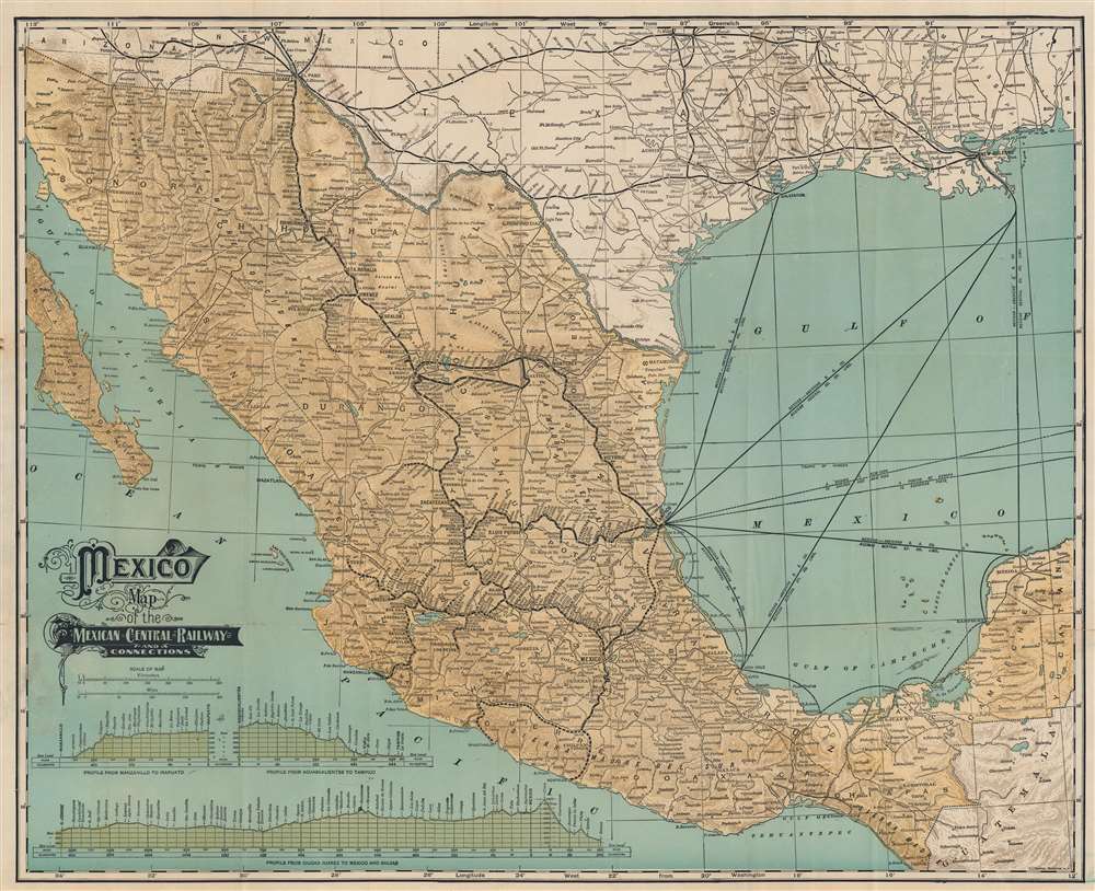
This is a c. 1908 Leonard L. Poates map of Mexico and the Mexican Central Railway - illustrating Mexico on the cusp of the Mexican Revolution (1910 - 1920). At the time, foreign investment was flooding into Mexico, much of which went to finance major infrastructure projects - like the Mexican Central. The operation of the Mexican Central Railroad provided a major artery of trade, both within Mexico and internationally with the United States - an artery that would soon be uprooted by revolution.
Railways and Steamship Routes
Black lines highlight the Mexican Central Railway's routes from Ciudad Juarez on the U.S.-Mexico border south to Balsas, Guerrero. Cities and towns serviced by the railroad are identified, including Mexico City, Tampico, Zacatecas, San Luis Potosi, Guadalajara, Chihuahua, Jimenez, and Monterey. Dashed lines mark projected rail lines. In the Caribbean, steamship routes operated by the Mexican-American Steam Ship Company and Mexican Central Railway Company Limited are noted. These routes connect Vera Cruz, Tampico, and Campeche with Galveston and New Orleans. Smaller railways in Mexico are illustrated by smaller black lines, including the Ferrocarriles de Sonora and the Ferrocarriles Internacional. Railway connections in the southern United States, such as with the Texas and Pacific Railway, the Southern Pacific Railroad, and the Rock Island Route, are illustrated and labeled.Mexican Central Railway
The Mexican Central Railway (Ferrocarril Central Mexicano) was one of the major pre-nationalization Mexican railroad lines. Incorporated in Massachusetts in 1880, the MCR opened the main line in March 1884, linking Mexico City to Ciudad Juárez, across the Rio Grande from El Paso, with connections to the Southern Pacific Railroad, Texas and Pacific Railway, and Atchison, Topeka and Santa Fe Railway. Other major branches included Irapuato to Guadalajara (1888), Chicalote to Tampico (1890), and Guadalajara to Manzanillo (1908). The Mexican Central acquired control in June 1901 of the Monterey and Mexican Gulf Railroad, which connected the Mexican International Railroad at Reata (near Monterrey) to Tampico, and connected its main line with this line at the Monterrey end through a branch from Gómez Palacio. The Mexico, Cuernavaca and Pacific Railroad, owner of an unfinished line from Mexico City to Acapulco (completed to Rio Balsas), joined the system in November 1902, and in 1905 the Mexican Central bought the Coahuila and Pacific Railway (Torreón to Saltillo), which paralleled the branch from Gómez Palacio to Monterrey and was to be operated jointly with the National Railroad of Mexico. The Mexican government nationalized the Mexican Central in 1906, transferring ownership in 1909 to the Ferrocarriles Nacionales de México (National Railways of Mexico).Publication History and Census
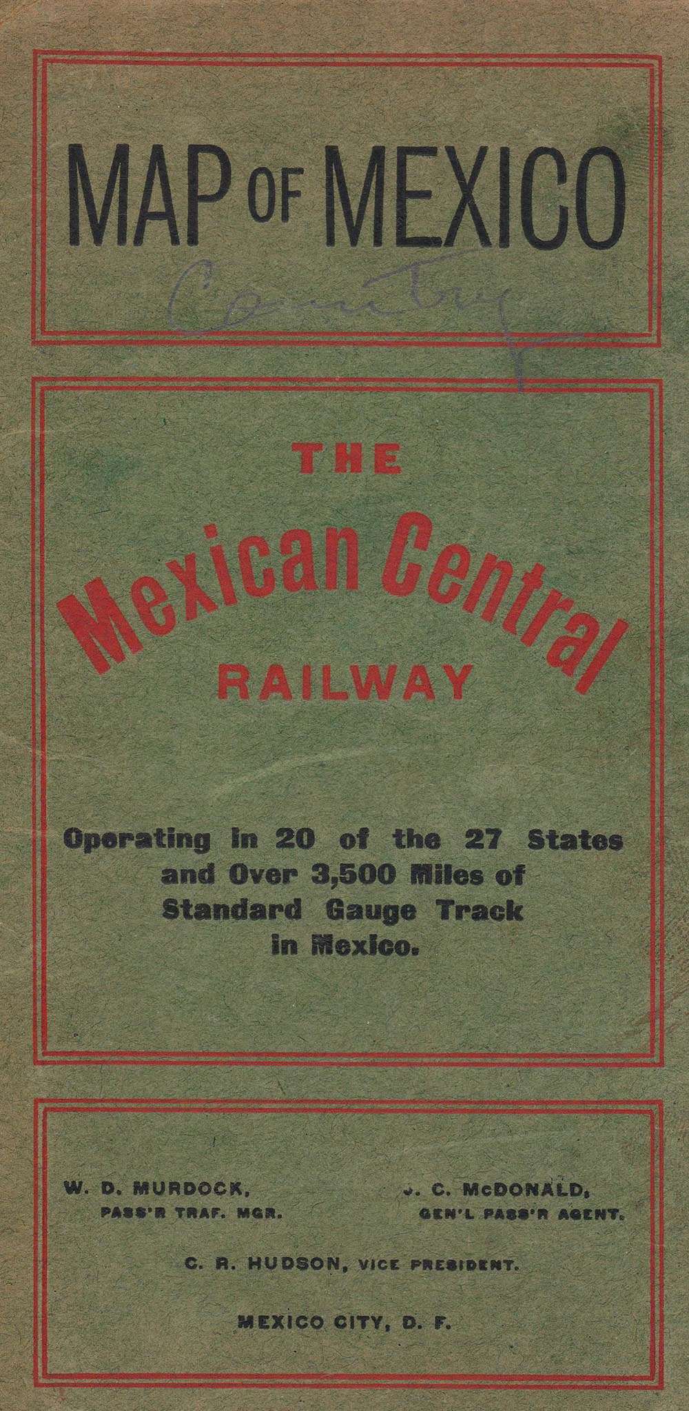
This map was created and published by L. L. Poates Company for the Mexican Central Railway. Although undated, the content of the map - for example the identification of C. R. Hudson as the Vice President, suggests it must have been issued between 1808 and 1814, when Hudson resigned. It is also of note that the Manzanillo-Guadalajara line is here complete, meaning the earliest possible date is 1908, when said line opened. Four examples are cataloged in OCLC and are part of the collections at the University of Chicago, the University of Illinois at Urbana Champaign, the Denver Public Library, University of California Berkeley.Cartographer
Leonard L. Poates (c. 1860 - October 8, 1938) was an American engraver and publisher. Poates founded the L. L. Poates Engraving Company in New York City sometime in the 1910s. By 1921, Poates was living in Long Beach, California, with his wife Ida L. Kallenbach. They were married for fifty-three years and Leonard died on the fiffty-third wedding anniversary. More by this mapmaker...
Condition
Good. Verso repairs to fold separations and at fold intersections. Attached to part of original binder. Accompanied by detached front cover of original binder.
References
OCLC 21706456.


