This copy is copyright protected.
Copyright © 2025 Geographicus Rare Antique Maps
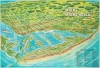
1976 Desormiers Pictorial View of Miami and Miami Beach, Florida
MiamiBeach-desormiers-1976


Copyright © 2025 Geographicus Rare Antique Maps | Geographicus Rare Antique Maps
This copy is copyright protected.
Copyright © 2025 Geographicus Rare Antique Maps