This copy is copyright protected.
Copyright © 2025 Geographicus Rare Antique Maps
Digital Image: 1948 Hudson Map Company City Plan or Map of Minneapolis, Minnesota
Minneapolis-hudson-1948_d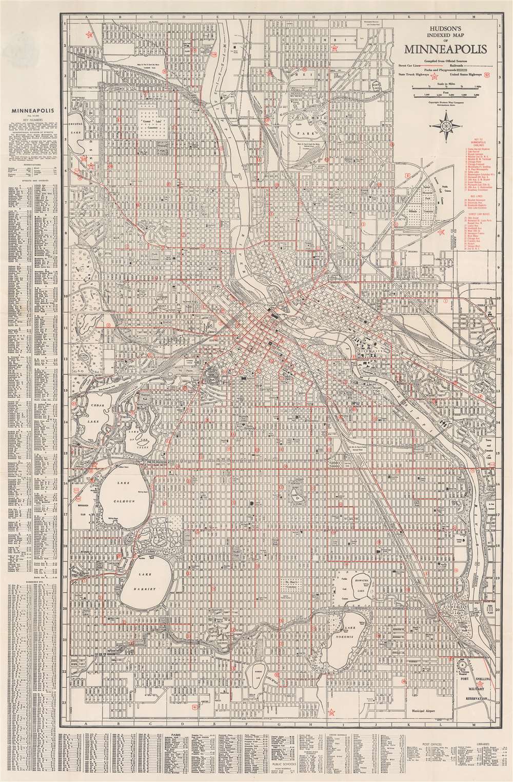


FOR THE ORIGINAL ANTIQUE MAP, WITH HISTORICAL ANALYSIS, CLICK HERE.
Digital Map Information
Geographicus maintains an archive of high-resolution rare map scans. We scan our maps at 300 DPI or higher, with newer images being 600 DPI, (either TIFF or JPEG, depending on when the scan was done) which is most cases in suitable for enlargement and printing.
Delivery
Once you purchase our digital scan service, you will receive a download link via email - usually within seconds. Digital orders are delivered as ZIP files, an industry standard file compression protocol that any computer should be able to unpack. Some of our files are very large, and can take some time to download. Most files are saved into your computer's 'Downloads' folder. All delivery is electronic. No physical product is shipped.
Credit and Scope of Use
You can use your digial image any way you want! Our digital images are unrestricted by copyright and can be used, modified, and published freely. The textual description that accompanies the original antique map is not included in the sale of digital images and remains protected by copyright. That said, we put significant care and effort into scanning and editing these maps, and we’d appreciate a credit when possible. Should you wish to credit us, please use the following credit line:
Courtesy of Geographicus Rare Antique Maps (http://www.geographicus.com).
How Large Can I Print?
In general, at 300 DPI, you should at least be able to double the size of the actual image, more so with our 600 DPI images. So, if the original was 10 x 12 inches, you can print at 20 x 24 inches, without quality loss. If your display requirements can accommodate some loss in image quality, you can make it even larger. That being said, no quality of scan will allow you to blow up at 10 x 12 inch map to wall size without significant quality loss. For more information, it is best consult a printer or reprographics specialist.
Refunds
If the high resolution image you ordered is unavailable, we will fully refund your purchase. Otherwise, digital images scans are a service, not a tangible product, and cannot be returned or refunded once the download link is used.
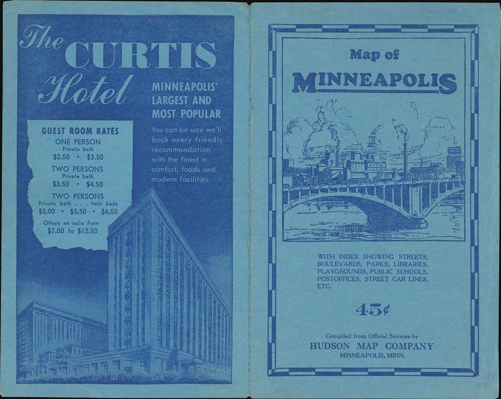
The Hudson Map Company (1892 - present) was founded in Minneapolis in 1892 by Horace B. Hudson. Hudson began his business with a small handbook of Minneapolis that was soon recognized as essential to visitors as well as those who were just moving into the area. Initially located in downtown Minneapolis, the firm quickly began expanding and published maps and handbooks for citizens and businesses. In the early 1900s Charles L. Hall moved to Minneapolis and, having worked for a company that specialized in making promotional maps, soon began working for the Hudson Map Company. Hall and another employee, Walter Eng, bought the Hudson Map Company from Hudson a few years later. Hall and Eng changed direction slightly by opening a map store (which remained in business until 2011, when the Hudson Map Company decided that it was going to focus more on internet sales). Eng retired in 1945 and Hall became the sole owner of the business. Kenneth Hall, Charles Hall's son, joined the business in 1952 was president by 1965. In 1972, Charles T. Hall became a part of the family business, and in 1997 Joshua T. Hall, the fourth generation of the Hall family to work at the Hudson Map Company, joined the firm as a cartographer. The Hudson Map Company was sold in 2012 to its current owner. More by this mapmaker...
Copyright © 2025 Geographicus Rare Antique Maps | Geographicus Rare Antique Maps
This copy is copyright protected.
Copyright © 2025 Geographicus Rare Antique Maps