This copy is copyright protected.
Copyright © 2024 Geographicus Rare Antique Maps
1928 or Showa 3 Bi-lingual Japanese Map or Plan of Mitsui Kawasaki Wharf, Japan
MitsuiKawasaki-showa3-1928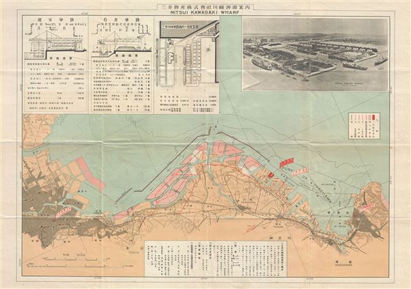

Copyright © 2024 Geographicus Rare Antique Maps | Geographicus Rare Antique Maps
This copy is copyright protected.
Copyright © 2024 Geographicus Rare Antique Maps