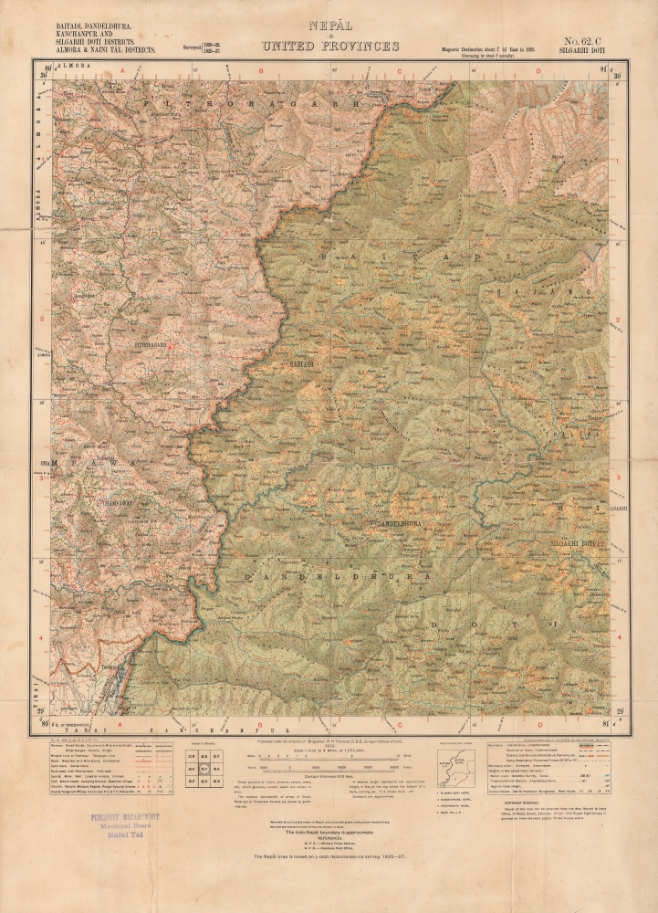
1932 Survey of India Map of Western Nepal
NepalSudurpashchim-surveyofindia-1932$1,000.00

Title
Nepal and United Provinces, No. 62. C Silgarhi Doti; Baitadi, Dandeldhura, Kanchanpur and Silgarhi Doti Districts. Almora and Naini Tal Districts.
1932 (dated) 22.75 x 16.5 in (57.785 x 41.91 cm) 1 : 253440
1932 (dated) 22.75 x 16.5 in (57.785 x 41.91 cm) 1 : 253440
Description
An absorbing 1932 Survey of India map of western Nepal. It highlights the remarkable terrain of the region, which sits on the border with Uttarakhand.
A Closer Look
The map largely corresponds with today's Sudurpashchim (Far-West) Province in Nepal, along the border with Uttarakhand state in India (then known as the United Provinces, previously the United Provinces of Agra and Oudh), taking in part or the entirety of the districts of Baitadi, Dadeldhura (here as Dandeldhura), Doti, Bajhang (Bajang), Darchula, and Kanchanpur. It reflects the steep mountains and dense forests of the region, and its consequent limited infrastructure. What means of communication that did exist were mostly narrow mule paths, with a somewhat wider cart path leading across the border to Tanakpur (with rail connection to Delhi). Mountain peaks are noted with their elevations, as are settlements, mostly situated in the valleys between mountains, and several other features. A small inset map to the right of the title displays the included districts of Nepal and border with India, which text below indicates is only approximate, following the Sharda (also known as the Kali or Mahakali) River.Zincography
At bottom-right, the map is noted as being heliozincographed in Calcutta. Zincography, or 'zinco' for short, is a planographic printing process similar to lithography. The process was known as early as 1801, when lithography inventor Alois Senefelder (1771 - 1834), in his original English patent for lithography, mentioned the possibility of using zinc plates over traditional limestone. The first zincographic process was subsequently patented in 1834 by Federico Lacelli. The process operates like traditional stone-lithography wherein ink applied to the plate is repelled by the hygroscopic areas and attracted to the fuchsine areas. It offers several advantages, most importantly, zinc plates are lighter and cheaper than lithographic stones, considerably economizing the process. As such, the process was embraced by various cartographic agencies that demanded mobility and economy, among them the British Ordinance Survey, the French Bureau Topographique, and many military mapping agencies. It was followed by photo-zincography, photo-lithography, and photogravure.Publication History and Census
This map was produced by the Survey of India in 1932, relying on surveys undertaken between 1920 and 1932. It was likely intended to be a predecessor to the Survey of India's highly important 1934 survey map of the entire country (also offered by Geographicus), the first modern survey map of Nepal. A stamp at bottom-left indicates that this example belonged to the Publicity Department of the municipality of Nainital, in Uttarakhand. The map is unrecorded in the OCLC but may exist in large collections of Survey of India maps at major British research institutions.Condition
Good. Creasing and wear along fold lines, with some loss (repaired on verso) at intersections. Sporadic soiling and foxing.

