This item has been sold, but you can get on the Waitlist to be notified if another example becomes available, or purchase a digital scan.
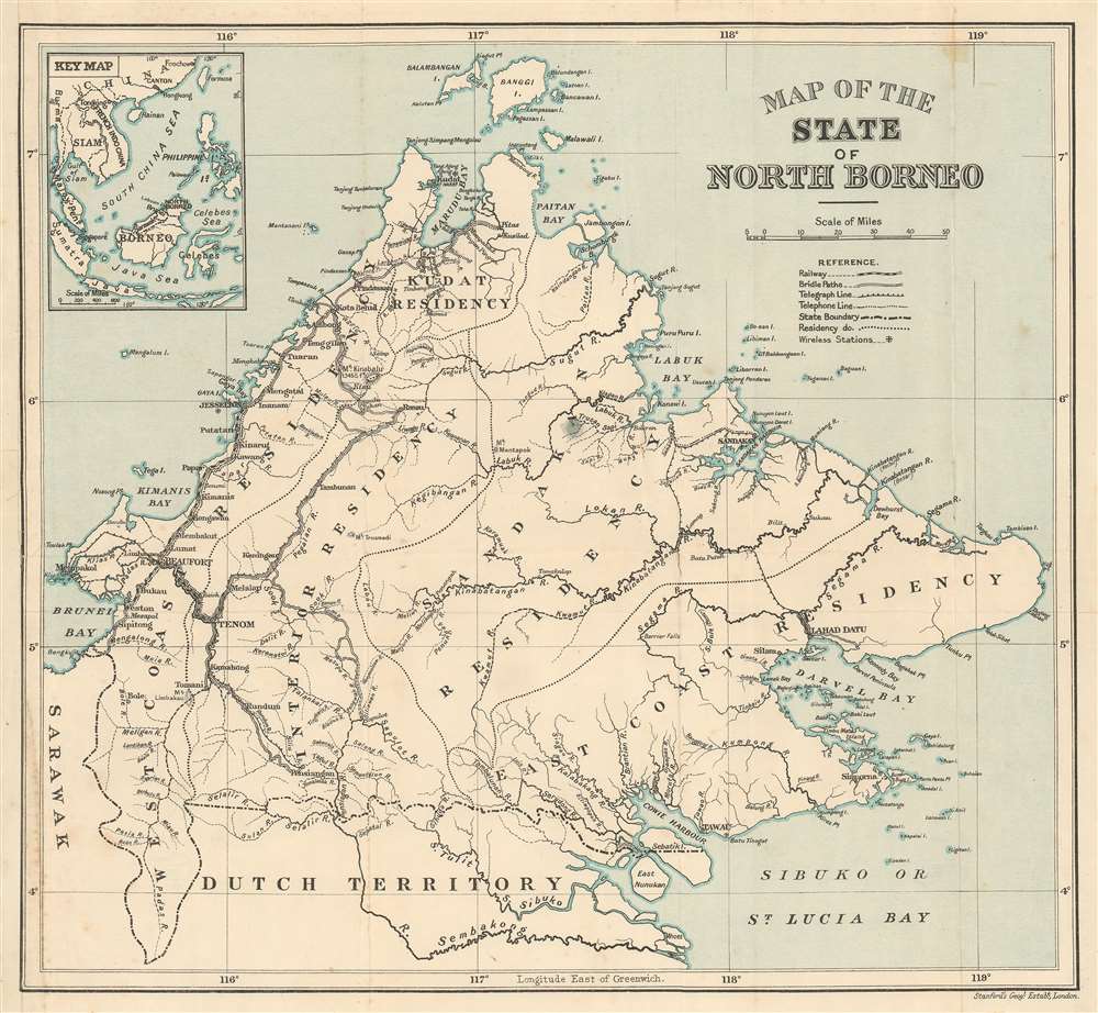
1926 Stanford Map of British North Borneo (Sabah, Malaysia)
NorthBorneo-stanford-1926
Title
1926 (undated) 13.5 x 14.5 in (34.29 x 36.83 cm) 1 : 1152000
Description
British North Borneo
The story of British North Borneo begins with the German businessman Gustav Overbeck (1830 - 1894). Overbeck, then acting at Austrian consul in Hong Kong, purchased land and trading rights to North Borneo from the American Trading Company of Borneo, owned by Joseph William Torrey (1828 - 1885), the heirs Thomas Bradley Harris (1826 - 1866), and a consortium of Chinese investors. North Borneo was, at the time, largely claimed by the Sultan of Brunei, to whom Overbeck appealed om 1878 for a renewed concession, resulting in Overbeck achieving legal control over all of North Borneo. Overbeck attempted to sell the territory unsuccessfully to Imperial Germany, Austria-Hungary, and the Kingdom of Italy, but none had an interest. Instead he turned to the British merchants Alfred (1844 - 1927) and Edward Dent (1846 - 1929), who offed administrative support and financing to develop the colony.Around this time, Spanish forces in the Philippines forced the surrender of the Sultan of Sulu, threating Overbeck's authority in North Borneo. Overbeck decided to cut his losses in 1879 and in 1881 transferred his remaining rights fully to the Dent brothers, who went on to establish the North Borneo Chartered Company. The joint stock company, supported by the British Crown, was able to overcome the Spanish-Philippine threat and began building territorial infrastructure. British North Borneo developed steadily under the North Borneo Chartered Company, becoming a formal British Protectorate in 1888. It remained under British control until World War II, when the Japanese invaded, destroying nearly all infrastructure. After the war, North Borneo was transferred to the British Colonial Office who administered it from Malaysia. With the founded of Malaysia in 1963, North Borneo became the Malay state of Sabah.
Publication History and Census
This map was published by Stanford's Geographical Establishment in London. The map is undated, but from the development of the railroad and telecommunication lines, we estimate it to have been produced c. 1926. This map is a considerable rarity, with no other examples known.Cartographer
Edward Stanford (May 27, 1827 - November 3, 1904) was one of the most prolific map publishing firms of the late 19th century. The company began as a partnership in 1848 between the 21 year old Edward Stanford and the established map dealer Trelawney Saunders. By 1853 the partnership had dissolved and Edward Stanford took full control of the business. A subsequent series of expansions and exciting new map issues finally led to the production of Stanford's masterwork, "Stanford's Library Map of London". This map is still available and remains somewhat accurate. At the time of publishing it was hailed by the Royal Geographical Society as "the most perfect map of London that has ever been issued". In 1882 Edward Stanford Sr. passed the firm on to his son, Edward Stanford Jr. who continued in his father's proud tradition. Today the Stanford firm still publishes maps and remains one of the most important and prolific cartographic publishers in the world. More by this mapmaker...

