This item has been sold, but you can get on the Waitlist to be notified if another example becomes available, or purchase a digital scan.
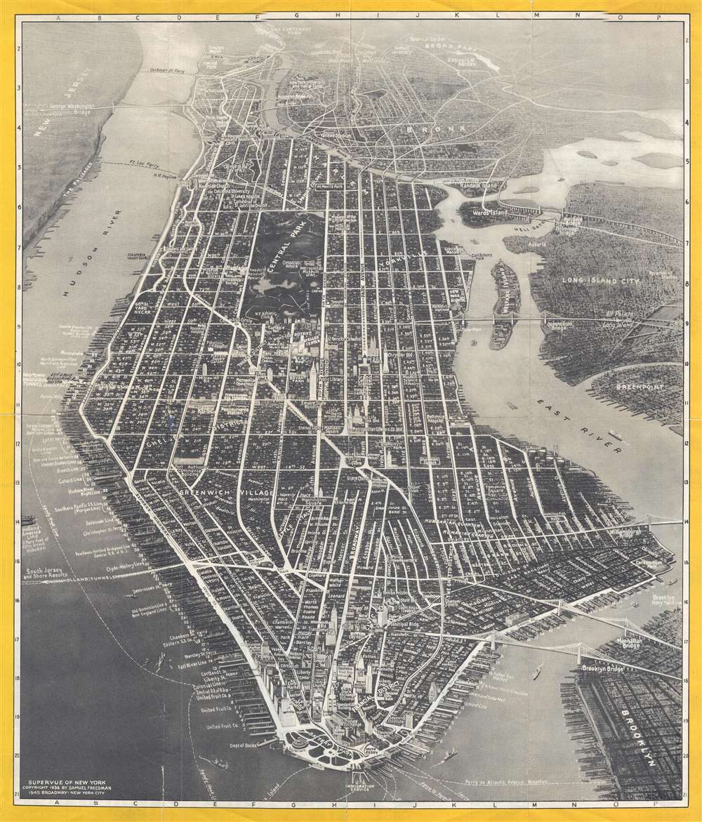
1936 Freedman Bird's Eye View SuperVue Map of New York City
NYCity-freedman-1936$112.50

Title
Supervue of New York.
1936 (dated) 17.5 x 15 in (44.45 x 38.1 cm)
1936 (dated) 17.5 x 15 in (44.45 x 38.1 cm)
Description
This is a stunning Samuel Freedman 1936 bird's eye view of New York City. The view covers all of Manhattan Island and extends from Liberty Island and the northern end of Governor's Island to the Harlem River, along with parts of New Jersey, the Bronx, Queens and Brooklyn. The map notes streets, piers, parks, squares, ferry lines, neighborhoods, and other topographical features. Major buildings and monuments such as the Statue of Liberty, the Empire State Building, Grand Central Station, City Hall, Rockefeller Center, and Central Park are rendered in profile along with several others. Bridges are also beautifully rendered and labeled, with ships sailing in the harbor. Advertising for the Knott Hotels situated around the city is printed on the verso.
This particular map was copyrighted by Samuel Freedman in 1936 and issued by Knott Hotels.
This particular map was copyrighted by Samuel Freedman in 1936 and issued by Knott Hotels.
Cartographer
Samuel Freedman (September 15, 1880 - 19xx) was a Russian-American printer and publisher active in New York City during the first half of the 20th century. Born in Bolnik, Lithuania, Freedman immigrated to the United States in 1887. Freedman owned his own printing shop by 1925 and continued to operate it through at least 1940. He was married to Anna Freedman, with whom he had at least three children, two daughters, and one son. We have been unable to locate any death records. More by this mapmaker...
Condition
Very good. Even overall toning. Wear along original fold lines. Verso repairs to fold separations. Text on verso.
References
OCLC 977218268.