1920 Bekins Map of Oakland, Berkeley, Alameda, and Environs, California
OaklandEastBay-bekins-1920$350.00

Title
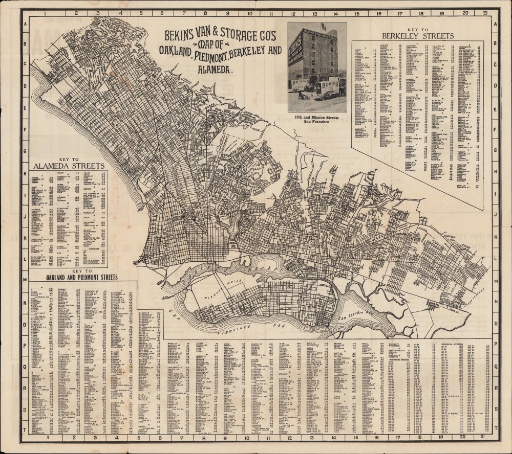
Bekins Van and Storage Co.'s Map of Oakland, Piedmont, Berkley and Alameda.
1920 (undated) 15.25 x 17 in (38.735 x 43.18 cm) 1 : 54000
1920 (undated) 15.25 x 17 in (38.735 x 43.18 cm) 1 : 54000
Description
A scarce indexed street plan or map of Oakland, Berkeley, Alameda, and other communities in the East Bay of the San Francisco Bay Area, produced c. 1920 by Bekins Van and Storage Company.
At left is the racetrack and park at Shell Mound in Emeryville, a major recreational destination for communities throughout the East Bay. However, around the time of this map's production, anti-gambling laws and then Prohibition seriously damaged the racetrack's business. The adjacent park also suffered, and both were shuttered by the mid-1920s. (Incidentally, part of the area of the former racetrack is now home to Pixar Animation Studios).
Alameda is in a transitional stage here; the now-island is the product of decades of dredging and land reclamation designed to wither clear marshlands for shipping or fortify it for development. Several streets on the island's south side appear to run straight into the water, indicating ongoing reclamation work.
The growing population of the East Bay demanded mass transit, a need met by the Key System. Beginning with the San Francisco, Oakland, and San Jose Railway, incorporated in 1902, a series of mergers and a reorganization resulted in the creation of the Key System Transit Company in 1923 (the name 'Key' was used colloquially for years beforehand, due to the shape of the system's network on a map). The Southern Pacific Railway also ran a competing streetcar (interurban electric) system that Key later acquired. Both networks terminated at 'moles' (piers) with ferry service to San Francisco.
The Key System was a popular and affordable means of passenger travel to San Francisco. However, the system was overburdened by demand, which became one of the main impetuses for building the Oakland-San Francisco Bay Bridge (opened in 1938). Even with the completion of the bridge, demand for the Key System remained high enough that the lower deck of the bridge originally included dual-track rail lines shared between Key, Southern Pacific (until its acquisition by Key), and Western Pacific, which terminated at San Francisco's Transbay Terminal. However, as with streetcar lines in other cities, Key's ridership plummeted in the postwar period and was defunct by 1960.
A Closer Look
Oriented towards the northeast, the map covers the cities of Oakland, Berkeley, Alameda, and Piedmont, as well as Emeryville and Albany (not named here). Streets are labeled and indexed according to a grid surrounding the map, along with waterways, public institutions (schools, cemeteries, parks, and the like), and two Bekins warehouses near the center towards the left. The University of California (Berkeley) is prominent towards the top. Mills College, the first women's college on the Pacific Coast (originally a seminary for women), appears at right near Evergreen Cemetery. A series of reservoirs in the hills at right provided the area with clean water. The grand Mountain View Cemetery near center was designed by Frederick Law Olmsted and is the final resting place of many of the leading business, political, and cultural figures of the early history of the area. The verso includes photographs and promotional text for Bekins.At left is the racetrack and park at Shell Mound in Emeryville, a major recreational destination for communities throughout the East Bay. However, around the time of this map's production, anti-gambling laws and then Prohibition seriously damaged the racetrack's business. The adjacent park also suffered, and both were shuttered by the mid-1920s. (Incidentally, part of the area of the former racetrack is now home to Pixar Animation Studios).
Alameda is in a transitional stage here; the now-island is the product of decades of dredging and land reclamation designed to wither clear marshlands for shipping or fortify it for development. Several streets on the island's south side appear to run straight into the water, indicating ongoing reclamation work.
The Emergence of the East Bay
This map was produced during a period of extremely rapid population growth in Oakland and the East Bay, an area that previously had been primarily farmland. Between 1900 and 1930, Oakland's population more than quadrupled from 67,000 to 284,000. Nearby cities and towns saw similar growth rates, driven by industrial development and the arrival of refugees from the 1906 San Francisco Earthquake and Fire. Oakland developed a special niche in automobile manufacturing and was known as 'the Detroit of the West.'The growing population of the East Bay demanded mass transit, a need met by the Key System. Beginning with the San Francisco, Oakland, and San Jose Railway, incorporated in 1902, a series of mergers and a reorganization resulted in the creation of the Key System Transit Company in 1923 (the name 'Key' was used colloquially for years beforehand, due to the shape of the system's network on a map). The Southern Pacific Railway also ran a competing streetcar (interurban electric) system that Key later acquired. Both networks terminated at 'moles' (piers) with ferry service to San Francisco.
The Key System was a popular and affordable means of passenger travel to San Francisco. However, the system was overburdened by demand, which became one of the main impetuses for building the Oakland-San Francisco Bay Bridge (opened in 1938). Even with the completion of the bridge, demand for the Key System remained high enough that the lower deck of the bridge originally included dual-track rail lines shared between Key, Southern Pacific (until its acquisition by Key), and Western Pacific, which terminated at San Francisco's Transbay Terminal. However, as with streetcar lines in other cities, Key's ridership plummeted in the postwar period and was defunct by 1960.
Publication History and Census
This map was produced by Bekins Van and Storage Company. It is undated, but from context, it can be assumed to be c. 1920. As mentioned above, the use of 'Key System' might suggest a date of 1923 or later, but this name was commonly used before the company formally adopted that name; other features on the map and photographs on the recto and verso suggest a date of 1920 or earlier. The only known institutional holdings of this map are with the University of California Berkeley, Cornell University, the Oakland Museum of California, and the Oakland Public Library (at the Oakland History Center).Cartographer
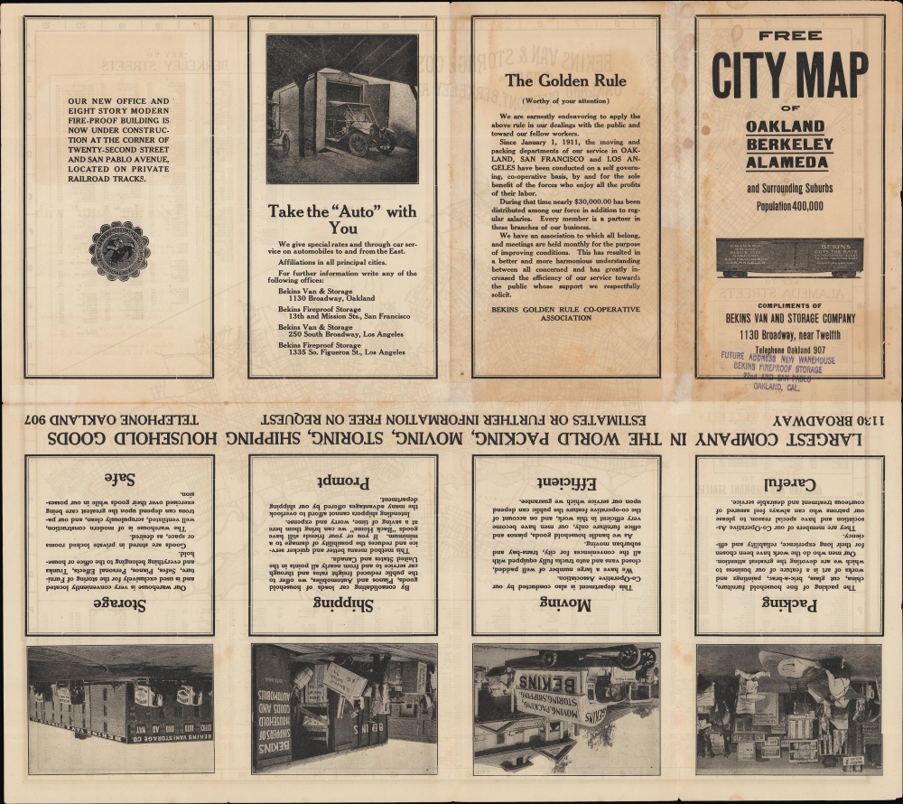
Bekins Van Lines (1891 - present) is one of the oldest moving companies in the United States, known primarily for residential moves. The company was founded by brothers John and Martin Bekins in 1891 in Sioux City, Iowa, using horse-drawn vans. The company was quick to embrace automobiles, switching from horse-drawn vans to motor trucks in 1903. It also expanded rapidly into California and other West Coast states, beginning operations in Los Angeles in 1894, anticipating the future population increase there (Martin Bekins eventually moved to the Eagle Rock neighborhood of Los Angeles and built an impressive mansion there). Bekins was also known for decades for producing plans or maps of cities where it operated. Sometimes, these were done in conjunction with regional mapmakers, such as Thomas Bros. or the Kroll Map Co., but more often, they were produced and published by Bekins itself. Though typically undated, the company's earliest maps (of San Francisco and Los Angeles) appeared in the first decade of the 20th century, and maps of many cities in the Plains States and American West continued to be produced until the 1970s. More by this mapmaker...
Condition
Good. Light wear along original folds. Light foxing and soiling. Several small tears along border professionally repaired. Text and images on verso.
References
OCLC 23826207, 63614544.