1914 Kenyon Pocket Map of Oklahoma
Oklahoma-kenyon-1914$450.00

Title
Map of the State of Oklahoma with Latest Official Census / Road Map of Oklahoma.
1914 (dated) 17.5 x 20 in (44.45 x 50.8 cm) 1 : 1013760
1914 (dated) 17.5 x 20 in (44.45 x 50.8 cm) 1 : 1013760
Description
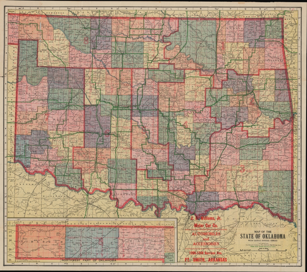
A product of the early automotive age, this is a 1914 Kenyon Company pocket map of Oklahoma. The map emerged in the same year that Henry Ford revolutionized American manufacturing by introducing the Assembly Line, a move that made the Model-T affordable to many and launched hte Automobile Age. This map is thus significant for its forward focus on auto-routes.
A Closer Look
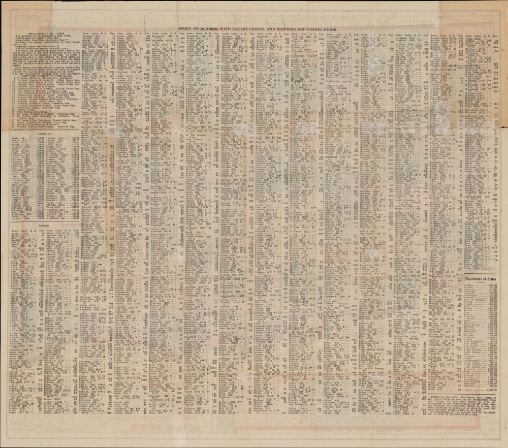
Coverage embraces Oklahoma, with counties shaded and subdivided by red survey meridians. The Oklahoma Panhandle is incorporated via an inset at bottom-left. The surrounding grid corresponds with an index on the verso. The verso also includes a legend explaining symbols for post offices, telegraph offices, and various methods of indicating railroad services and ownership. 'Chief auto routes' are traced in green, while black lines represent rail lines. Rivers and areas of elevation are illustrated, and red text indicates national parks and military bases (namely, Fort Sill towards bottom-left). Large red numbers denote congressional districts.The Early Automotive Age
This map predates the designation of U.S. Route 66 by twelve years, and highways were still a novelty at the time of publication (the same year Ford's Model-T began production). However, portions of the road network seen here were incorporated into Route 66, the 'main street of America,' namely the roads leading west from Oklahoma City towards Amarillo, including Clinton, home to the Oklahoma Route 66 Museum. Once the route was designated, Oklahoma would be home to more than 400 miles of the roadway, second only to New Mexico. Most highways, however, including eventually the interstate system, followed the routes of railways, such as the St. Louis - San Francisco Railway, which cuts a neat diagonal line across the state, rather than the many-right-angled roads seen here.From Indian Territory to Statehood
Although Oklahoma maintained a large population of Native Americans and had recently been an Indian Territory, it did not retain its Reservation System into the 20th century. Instead, as Oklahoma became a state, reservations were transitioned (often in reduced form) into local governments with a degree of autonomy for recognized tribes (of which there are now 38), explaining the variation in borders and county size in the eastern half of the state. However, the haphazardly-managed transition, which proceeded without existing reservations being formally disbanded, has resulted in persistent legal ambiguity. A 2020 U. S. Supreme Court ruling, McGirt v. Oklahoma, determined that tribes have the authority to prosecute (or not) crimes committed within their lands where the suspect is an American Indian, independent of the state government.Publication History and Census
This pocket map was prepared and published by the Kenyon Company in 1914. We note one example in institutional collections, at the David Rumsey Historical Map Collection at Stanford.Cartographer
The Kenyon Company, Map Makers (fl. 1874 - c. 1930) was an American printing and publishing firm based in Des Moines, Iowa. The company published maps, atlases, and books, and advertised their high-grade calendars in the Des Moines Tribune. More by this mapmaker...
Condition
Good. Light wear along original folds. 5 inch tear professionally repaired at top-left, several smaller tears professionally repaired. Some loss along fold lines. Text on verso.
References
Rumsey 5422.003.