1948 Lee Pictorial Map of Oxford, England
Oxford-lee-1948$550.00

Title
Oxford.
1948 (undated) 18.25 x 23 in (46.355 x 58.42 cm)
1948 (undated) 18.25 x 23 in (46.355 x 58.42 cm)
Description
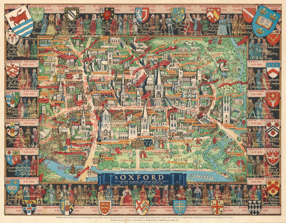
This is a wonderful c. 1948 Kerry Lee pictorial map of Oxford, England. Depicting Oxford in all its charm, Cathedral Church immediately draws the eye. Gold hued banners proclaim the city's many colleges, including Merton College, Balliol College, and Queen's College. Other golden hued banners mark more commonplace locations, such as the post office and several hotels. Red banners announce the locations of theatres, churches, the New Bodleian Library, the University Museum, and the Ashmolean Museum and Galleries. The Coats of Arms of Oxford's many colleges create the border, along with portraits of famous alumni.
Publication History and Census
This map was drawn by Kerry Lee (who appears on the lower right with his dog Jim) and was published by Lee's company, Pictorial Maps Ltd., 'for the Travel Association of Great Britain and N. Ireland (Tourist Division of the British Tourist and Holidays Board)'. It was printed in Great Britain by Chromoworks Ltd. There are at least two editions. One published for the U.K. market, and another, as here, published for the Travel Association of Great Britain and N. Ireland to encourage tourism in the U.K.Cartographer
Kerry Ernest Lee (December 4, 1902 - February, 1988) was a British commercial illustrator, artist, and publisher of pictorial maps active in the middle part of the 20th century. Lee was the founder of the London based Pictorial Maps Ltd. He was born in West Ham, Essex, England. Lee's earliest pictorial map work dates to about 1940, when he produced a pictorial map of Scandinavia During World War II, Lee was one of several artist who created dramatic military-educational cut-away images of German aircraft and war maps for the Air Intelligence branch of MI6, A.I.2. After the war, in 1946, he founded Pictorial Maps Ltd. to publish a series of historical and pictorial maps of popular English cities, among them Oxford, Cambridge, London, Stratford-upon-Avon, Birmingham, and Liverpool. He included comic self-portraits illustrating he and his dog Jim in many of the maps. The images proved popular and many were reprinted for sale in the United States by the Travel Association. The firm also employed other artists, including Denis M. Jones. Lee died in Dacorum, Hertfordshire, England. More by this mapmaker...
Condition
Very good. Soiling to margins.