1942 Robinson Map of the Philippines during World War II
PhilippineIslands-robinson-1942$1,200.00


Title
Philippine Is.
1942 (undated) 39.5 x 29.75 in (100.33 x 75.565 cm) 1 : 2027520
1942 (undated) 39.5 x 29.75 in (100.33 x 75.565 cm) 1 : 2027520
Description
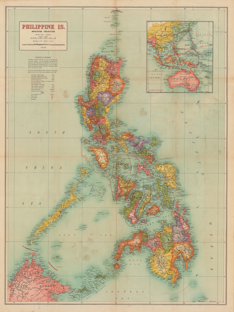
A colorful, large-format 1942 map of the Philippine Islands by H.E.C. Robinson, published soon after the islands' capture by Japanese forces in the opening phase of the Pacific War during World War II (1939 - 1945). The map was likely intended to capitalize on Australian interest in the war's progress as Imperial Japanese forces moved inexorably towards Australia.
The capture and control of the Philippines was vital to the success of Japanese plans to dominate the Pacific. Not only was the archipelago rich in natural resources, including rubber, oil, mineral resources, and wood, but it was also centrally located and well-positioned for expansion into the East Indies. Moreover, wresting control of the Philippines from the United States would effectively undermine American ability to wage war in the region.
The Japanese invasion of the Philippines commenced in tandem with the bombing of Pearl Harbor in December 1941. While Japanese forces advanced quickly through the archipelago, they promptly discovered that the thousands of islands and limited infrastructure made the Philippines almost impossible to fully control. While there may have been some goodwill towards Imperial Japan and its Greater East Asia Co-Prosperity Sphere in the abstract, the reality of occupation, defined by severe shortages and forced labor, won Japan few friends. The Japanese maintained a tenuous control over most of the Philippine Islands, but an active insurgency remained in the countryside. In 1944, U.S.-led Allied Forces began an aggressive and bloody campaign to retake the islands and successfully drove the Japanese out of the Philippines in 1945.
A Closer Look
The Philippine Islands are displayed with provinces color-coded. Cities, towns, islands, coastal features (points, coves, etc.), roads (existing and under construction), railways, and rivers are indicated throughout. A portion of British North Borneo appears at the bottom left, while an inset map of East Asia, Australia, and Oceania is included at the top right, displaying air routes between Manila and other major cities. Text below the title gives statistics on the Commonwealth's geography and population, and a historical note explains that the Philippines were invaded and occupied by Imperial Japan in late 1941 and early 1942. Manuscript updates in Japan inset in the upper right note bombing attacks on the Home Islands - likely a civilian closely following the war's progress.Japan's Invasion of the Philippines
As Japan slipped towards militarism in the 1920s and 1930s, the Philippines were increasingly regarded as a potential site for colonial expansion. In the early 20th century, Japan acknowledged American control of the Philippines in exchange for American recognition of Japanese interests in Korea. In the intervening years, thousands of Japanese traders and laborers settled in the Philippines and U.S.-Japan relations worsened considerably.The capture and control of the Philippines was vital to the success of Japanese plans to dominate the Pacific. Not only was the archipelago rich in natural resources, including rubber, oil, mineral resources, and wood, but it was also centrally located and well-positioned for expansion into the East Indies. Moreover, wresting control of the Philippines from the United States would effectively undermine American ability to wage war in the region.
The Japanese invasion of the Philippines commenced in tandem with the bombing of Pearl Harbor in December 1941. While Japanese forces advanced quickly through the archipelago, they promptly discovered that the thousands of islands and limited infrastructure made the Philippines almost impossible to fully control. While there may have been some goodwill towards Imperial Japan and its Greater East Asia Co-Prosperity Sphere in the abstract, the reality of occupation, defined by severe shortages and forced labor, won Japan few friends. The Japanese maintained a tenuous control over most of the Philippine Islands, but an active insurgency remained in the countryside. In 1944, U.S.-led Allied Forces began an aggressive and bloody campaign to retake the islands and successfully drove the Japanese out of the Philippines in 1945.
Publication History and Census
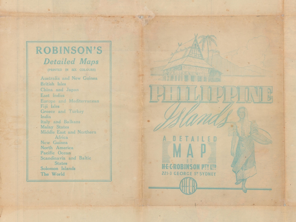
This map was prepared and published by Herbert Edward Cooper Robinson. It is undated, but given the reference to the Japanese invasion of the islands, it most likely dates from late 1942 or soon after. The OCLC notes examples at the University of California Berkeley, the University of Michigan, the National Library of Australia, and the State Library of South Australia.Cartographer
Herbert Edward Cooper Robinson (November 18, 1856 - January 17, 1933) was a Sydney based Australian cartographer active in the late 19th and early 20th centuries. Cooper was born in Winchester, England and emigrated to Australia with his family, settling in Geelong, Victoria. At around 20 - 25 years of age, Robinson moved to Sydney to join the public service, where he mastered cartographic draftsmanship at the Lands Department. In 1882 he left the Lands Office to found a private firm with the Messrs. Higginbotham and Harris, under the imprint of 'Messrs. Higginbotham, Robinson, and Harris.' Within 2 years, both Higginbotham and Harris left the firm, driving it into bankruptcy and leaving Robinson on his own. In 1895, Robinson set up his own map publishing business at Wentworth Court, moving in 1906 to Phillip Street, and in 1913 to permanent location at 221-223 George Street, Sydney. In 1917, the firm formally incorporated as 'H. E. C. Robinson Ltd.' Although based in Sydney, the firm received multiple government contracts and opened annex firms in the Canberra. Robinson is best known for Australian city and regional guides, but he also published Sir Edgeworth David’s gigantic 1932 Geological Map of the Commonwealth of Australia and Donald Mackay's 1930+ aerial surveys of Australia. In addition to his printing work, in 1885, he became a founding member of the Geographical Society of Australasia. He became a fellow of the Royal Geographical Society in the late 1920s. Robinson had two children, Cecil Robinson and Eileen Robinson Brooks, both of whom emigrated to America. His daughter, Eileen, became a famous American stage actress. More by this mapmaker...
Condition
Good. Wear along old fold lines. Some verso reinforcement at fold intersections. A few points of surface soiling. Tiny pinholes here and there likely indicating pin marking of battle sites. Pencil annotation in the upper right inset associated WWII activity.
References
OCLC 83269479.