This item has been sold, but you can get on the Waitlist to be notified if another example becomes available, or purchase a digital scan.
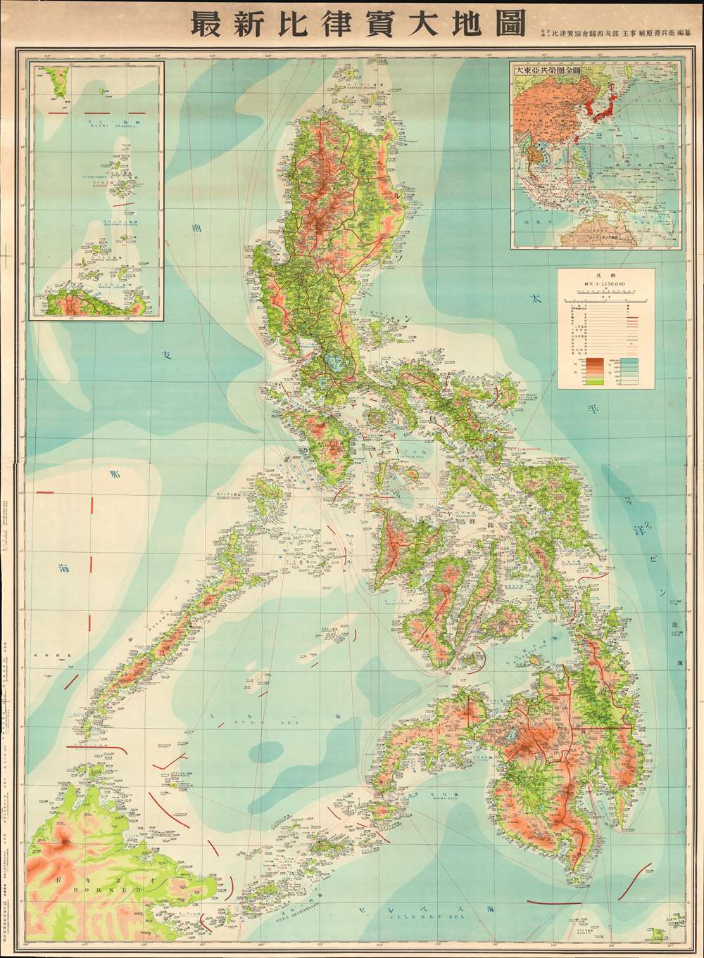
1943 Japanese Philippine Association World War II Wall Map of the Philippines
Philippines-philippineassociation-1943$1,250.00

Title
New Large Map of the Philippines. / 圖地大質律比新最
1943 (dated) 56.5 x 41.5 in (143.51 x 105.41 cm) 1 : 1150000
1943 (dated) 56.5 x 41.5 in (143.51 x 105.41 cm) 1 : 1150000
Description
A scarce 1943 or Showa 18 Japanese World War II Era wall map of the Philippines. This is the largest single map of the Philippines we have encountered from the period of the Japanese occupation. Based upon earlier American maps, this massive chart focuses on topography and infrastructure, illustrating roads, existing railroads, nautical routes, and more. It was intended for administrative and management use, rather than active military aggression and advocates for the Philippines as an active part of the Greater East Asia Co-Prosperity Sphere. In addition, the map shows an international boundary, drawn along part of the 117th meridian, that indicates Japan’s claim of sovereignty over the Spratly Islands, which the Japanese occupied in 1939 and administered from Taiwan.
Colonial Management of the Philippines
The Japanese invasion of the Philippines began in December 1941 and by December 1942, when this map was issued, Japanese control of the archipelago reached its apex. The Japanese plan called for a transition from active conquest to colonial oversight and management. To accomplish these goals, Japanese administrators needed good maps. While the Japanese occupying forces did do their own reconnaissance, they more often turned to older American maps, which they adapted to their own needs, adding Japanese text and additional cartographic data. The present large-scale map, with its detailed focus on topography, underscore Japanese interest in extracting plant and mineral resources from the islands to fuel their war machine.The Japanese Strategy in it the Philippines
The capture and control of the Philippines was vital to the success of Japanese plans to dominate the Pacific. Not only was the archipelago rich in natural resources, including rubber, oil, mineral resources, and wood, it was also centrally located and well positioned for expansion into the East Indies. Moreover, wresting control of the Philippines from the United States would have effectively undermined American ability to wage war in the region. The Japanese invasion of the Philippines commenced on December 8, 1941, one day after the December 7th, 1941 bombing of Pearl Harbor. Japanese forces advanced quickly through the archipelago, driving out American forces in a series of defeats that culminated in the infamous April 1942 Bataan Death March, in which 7,000 - 10,000 American and Filipino prisoners of war died. Like the Spanish before them, the Japanese promptly discovered that the hundreds of islands and limited infrastructure made the Philippines almost impossible to fully control. Nonetheless, the Japanese maintained a tenuous control of most of the Philippine Islands until 1944, when the U.S. led Allied Forces began an aggressive and bloody campaign to retake the islands. Allied forces successfully drove the Japanese out of the Philippines in 1945.The Greater East Asia Co-Prosperity Sphere
The Greater East Asia Co-Prosperity Sphere (大東亜共栄圏) was an imperial concept created and promulgated for occupied Asian populations during 1930-45 by the Empire of Japan. The concept was announced by Hachirō Arita on June 29, 1940. The Co-Prosperity Sphere was intended as a self-sufficient 'bloc of Asian nations led by the Japanese and free of Western powers.' It covered Southeast Asia, Eastern China, Manchuria, Japan, the East India Islands, and parts of Oceania. The idea promoted the cultural and economic unity East Asians, Southeast Asians, and Oceanians with the underpinning assumption that Japan, which had never been conquered and was the only Asian national to fully modernize was the 'Light of Asia.'Publication History and Census
This map was published in Tokyo and Osaka on December 20, 1943. The map was printed by Uehara Zenbei (植原善兵衛), a manger at the Kansai Branch of the Japanese Philippine Association, one of several semi-private Japanese associations created to promote economic development of the Philippines. We have been unable to trace another example.Condition
Very good. Laid down on Japanese paper. Minor toning and soiling.

