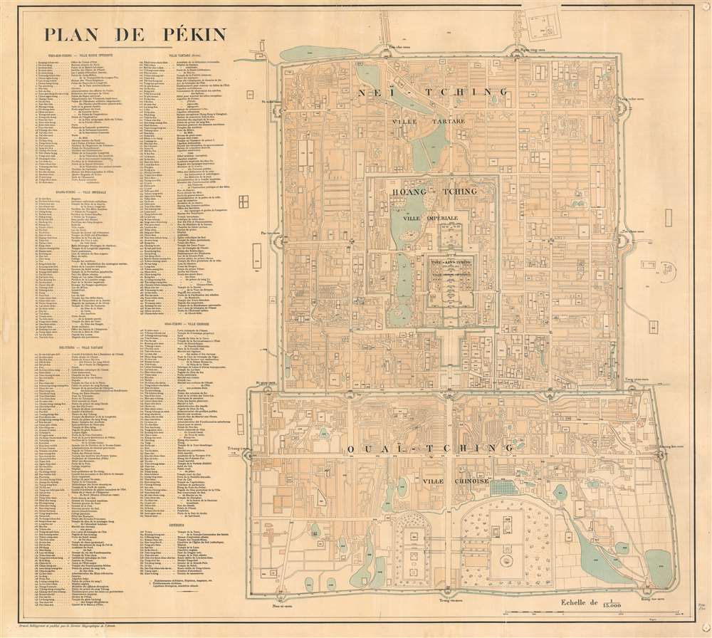
1900 Service Geographique de l'Armee City Map of Beijing / Peking, China
PlandePekin-servicegeographique-1900$3,000.00

Title
Plan de Pékin.
1900 (undated) 29 x 32.25 in (73.66 x 81.915 cm) 1 : 15000
1900 (undated) 29 x 32.25 in (73.66 x 81.915 cm) 1 : 15000
Description
This is a 1900 Service Géographique de l'Armée city plan or map of Beijing / Peking, China, created for French soldiers sent to China as part of the Expeditionary Force to suppress the Boxer Rebellion.
A Closer Look
Centered on the Forbidden City (Ville Interdite Rouge), the Imperial City (Ville Impériale), Tartar City, and Chinese City are all depicted. The map is impressively detailed, with 384 different locations corresponding to an index situated to the left of the map. Noted sites include palaces, gardens, and gates of the Forbidden City, along with streets, churches, temples, schools, lakes, and numerous other locations.Service Géographique de l'Armée Maps Created for the Boxer Rebellion
In the 1901 edition of 'Annales de géographie', a section dedicated to the maps of the Service Géographique de l'Armée directly references this map and two others. It readsFrom the beginning of 1900, the Service Géographique, aware of the events happening in China, rushed to create certain relevant cartographic documents that would be done in time for the troops of the expeditionary corps; they are: 1) A Map of the Theater of Operations in China at 1 : 1000000; 2) A Map of the Theater of Operations in China (Environs of Peking) at 1 : 300000, with an inset map of the city of Peking; and 3) A Map of Peking 1 : 15000.This these prescient maps were an essential tool in the suppression of the Yihetuan Movement.
The Geographical value of these publications are double due to the interest in the news; they have the value of having appeared at the moment when the public's attention was called to the regions in question, and, consequentially, appeared well before similar foreign maps were published
The Boxer Rebellion or Yihetuan Movement
The Boxer Rebellion or Yihetuan Movement (1899 - 1901, 義和團運動) was an anti-foreign anti-imperialist uprising marked by proto-nationalism in northeastern China. The rebellion was largely a response to Christian missionary activity in China. It was initially supported by the Qing Empress Dowager Cixi and her ministers, who distrusted the radical and unpredictable peasant movement but sympathized with their goal of driving foreign influence out of China. In June of 1900, some 20,000 Boxers, convinced that their spiritual and martial prowess gave them immunity to foreign weapons, attacked the Chinese Christians and foreign nationals living in Beijing's Legation Quarter. Although terrible violence ensued, the Legation Quarter was able to mount a ragtag defense - which is outlined on this map. Relief came about a month later in the form of the Eight-Nation Alliance China Relief Force, which, with an army of some 20,000, defeated the Boxers and occupied Beijing, as well as a number of other northern Chinese cities. The atrocities and looting that ensued, particularly at the hands of Russian and Japanese forces, are well-documented and horrifying.Publication History and Census
This map was created by the French Service Géographique de l'Armée and published in 1900. Five examples are recorded in the OCLC: Harvard, the University of Chicago, the University of Wisconsin-Milwaukee, the Bibliothèque Nationale de France, and the Bibliothèque Nationale et Universitaire in Strasbourg, France.Cartographer
Service Géographique National (c. 1956 - 1990) was national mapping service established in Vientiane, Laos, following independence from France. The SGN was built upon the French Indo-Chinese Surveys, completed in the 1930s, and more modern surveys conducted with American assistance. In 1990 the service was redesignated as the 'National Geographic Department.' More by this mapmaker...
Condition
Good. Exhibits pinholing at corners. Even overall toning.
References
OCLC 51600377.

