1936 Booth Pictorial Map of Rhode Island and Narragansett Bay

RhodeIslandProvidence-booth-1936-2
$750.00
Rhode Island and Providence Plantations A Pictorial Map Showing Historical and Present Day Points of Interest. - Main View
Processing...

1936 Booth Pictorial Map of Rhode Island and Narragansett Bay

RhodeIslandProvidence-booth-1936-2

Rhode Island's Tercentenary.
$750.00

Title


Rhode Island and Providence Plantations A Pictorial Map Showing Historical and Present Day Points of Interest.
  1936 (dated)     21 x 14.25 in (53.34 x 36.195 cm)     1 : 253440

Description


An extremely scarce 1936 Phillips D. Booth pictorial map of Rhode Island, offering a compelling portrait of the state on its tercentenary.
A Closer Look
The map depicts Rhode Island and Narragansett Bay, with Block Island along the bottom border. Banners mark cities and towns, while historical sites, reservoirs, appealing tourist destinations, and airports are labeled. Icons identify airports, yacht clubs, golf clubs, and lighthouses. Views above and below the map highlight historic buildings, such as the State House, churches, and old courthouses. The coats of arms of cities and towns throughout Rhode Island line all four sides.
Publication History and Census
This map was designed by Phillips D. Booth, edited by Howard M. Chapin, engraved by Advertisers Engraving Co, and printed by Port Press, Inc. This piece is not cataloged in OCLC, nor have we found records of holdings in any institutional collections. We know of one other example, which is in private hands.

Cartographer


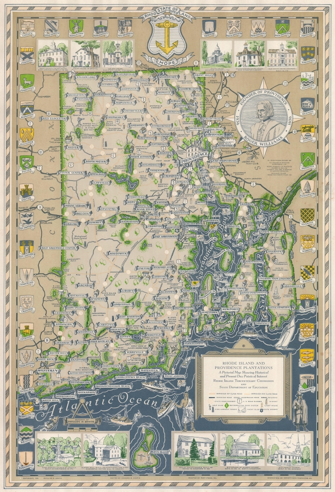
Phillips Dudley Booth (September 24, 1900 - January 14, 1983) was an American editor and art director. He was born in Randolph, Vermont, and by 1910 he was living with his family in Providence. Booth made at least two pictorial maps of Rhode Island. More by this mapmaker...

Condition


Very good. Light soiling.