This item has been sold, but you can get on the Waitlist to be notified if another example becomes available.
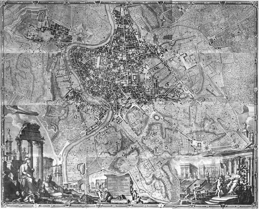
1748 Nolli Wall Map of Rome
Rome-nolli-1748$11,500.00

Title
Alla Santita' Di Nostro Signore Papa Benedetto XIV La Nuova Topografia Di Roma Ossequiosamente Offerisce E Dedica L'Umilissimo Servo Giambattista Nolli Comasco.
1748 (undated) 41.25 x 51 in (104.775 x 129.54 cm) 1 : 2500
1748 (undated) 41.25 x 51 in (104.775 x 129.54 cm) 1 : 2500
Description
This is a 1748 Giambattista Nolli city map or plan of Rome, which ranks as one of the best city plans ever produced. The map depicts the city in astonishing detail from the Villa Pamphili to the Tempio di Venere e Cupido and from the Vatican to the Porta San Sebastiano. Commissions by Pope Benedict XIV in an attempt to better understand the formal demarcations between Rome fourteen Rioni (traditional districts dated to the 12th century), Nolli's plan is impressive not only for its scale and accuracy, but because it is an ichnographic plan.
This map was created by Giambattista Nolli, who spend twelve years worling on the map, from 1736 until it was finally completed in 1748.
What is Ichnography?
Ichnography, per Merriam-Webster, is 'a horizontal section (as of a building) showing true dimensions according to geometric scale.' This means that Nolli not only presents the layout of the Eternal City, but also illustrates most of Rome's iconic buildings as horizontal cross-sections, rendering walls, columns, doorways, interior passages, and even staircases in minute detail. It have even be recognized that Nolli, with an incredible degree of accuracy, was able to capture the asymmetry of the Spanish Steps.A Closer Look At This Iconic City Plan
As stated above, the level detail included here is astonishing. Each of Rome's seven hills are labeled, along with myriad streets, piazzas, and gardens. Too many buildings to list here are illustrated ichnographically, but among them are the Colosseum, the Pantheon, the Castel Sant'Angelo, and St. Peter's Basilica. The Nolli Plan is so remarkable that it was still in use by the city government as an administrative plan as late as the 1970s. Even today, due to its incredible detail and sophistication, it is still particularly admired by city planners and architects.This map was created by Giambattista Nolli, who spend twelve years worling on the map, from 1736 until it was finally completed in 1748.
Cartographer
Giambattista Nolli (April 9, 1701 – July 1, 1756) was an Italian cartographer and architect w active in the first half of the 18th century. Born in Como, Nolli moved to Rome under the patronage of the Albani and Corsini families. Most famous as the cartographer of his iconic 1748 plan of Rome, Nolli's architectural projects included work on the churches of Sant'Alessio on the Aventine Hill (1743) and Santa Dorotea in Trastevere (1751–1756). More by this mapmaker...
Condition
Good. Even overall toning.
References
OCLC 645822414.

