This copy is copyright protected.
Copyright © 2025 Geographicus Rare Antique Maps
Digital Image: 1751 Daniele Farlati Map of Ancient Salona (Solin, Croatia)
Salona-farlati-1751_d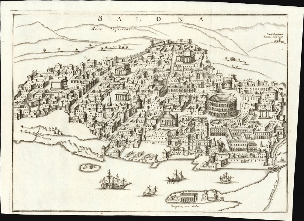

FOR THE ORIGINAL ANTIQUE MAP, WITH HISTORICAL ANALYSIS, CLICK HERE.
Digital Map Information
Geographicus maintains an archive of high-resolution rare map scans. We scan our maps at 300 DPI or higher, with newer images being 600 DPI, (either TIFF or JPEG, depending on when the scan was done) which is most cases in suitable for enlargement and printing.
Delivery
Once you purchase our digital scan service, you will receive a download link via email - usually within seconds. Digital orders are delivered as ZIP files, an industry standard file compression protocol that any computer should be able to unpack. Some of our files are very large, and can take some time to download. Most files are saved into your computer's 'Downloads' folder. All delivery is electronic. No physical product is shipped.
Credit and Scope of Use
You can use your digial image any way you want! Our digital images are unrestricted by copyright and can be used, modified, and published freely. The textual description that accompanies the original antique map is not included in the sale of digital images and remains protected by copyright. That said, we put significant care and effort into scanning and editing these maps, and we’d appreciate a credit when possible. Should you wish to credit us, please use the following credit line:
Courtesy of Geographicus Rare Antique Maps (http://www.geographicus.com).
How Large Can I Print?
In general, at 300 DPI, you should at least be able to double the size of the actual image, more so with our 600 DPI images. So, if the original was 10 x 12 inches, you can print at 20 x 24 inches, without quality loss. If your display requirements can accommodate some loss in image quality, you can make it even larger. That being said, no quality of scan will allow you to blow up at 10 x 12 inch map to wall size without significant quality loss. For more information, it is best consult a printer or reprographics specialist.
Refunds
If the high resolution image you ordered is unavailable, we will fully refund your purchase. Otherwise, digital images scans are a service, not a tangible product, and cannot be returned or refunded once the download link is used.
Daniele Farlati (February 22, 1690 April 25, 1773) was a church historian and Jesuit. He was born in San Daniele del Friuli, and studied in Gorizia. He entered the Society of Jesus in Bologna in 1707, for whom he taught classics in Padua. He completed his theological studies in Rome and entered the priesthood in 1722. Returning to Padua, he assisted Filippo Riceputi in the preparation of an ecclesiastical history of Illyricum, a project he had begun in 1720. Together they researched this project for twenty years, traveling to Dalmatia to consult Roman-era archives of the province and assembling a monumental 300 volumes of mansuscript with their research. Riceputi died in 1742; Farlati was left with the task of organizing the remainder of the work, with the assistance of Giovanni Giacomo Coleti. The first volume of Illyricum Sacrum was first published in 1751, focusing on the Church in Salona up to the fourth century: this covered an important period, in which Salona became the de facto capital of the Western Roman Empire during the life of the last western Roman Emperor. Farlati saw the completion of four volumes; his partner Coleti continued the work on the remaining four, finally completed in 1818. More by this mapmaker...
Copyright © 2025 Geographicus Rare Antique Maps | Geographicus Rare Antique Maps
This copy is copyright protected.
Copyright © 2025 Geographicus Rare Antique Maps