This item has been sold, but you can get on the Waitlist to be notified if another example becomes available, or purchase a digital scan.
1951 Promotional Map and Materials for Sanford, Seminole County, Florida
SanfordSeminoleCounty-williams-1951$150.00


Title
Sanford, Florida / Seminole County, Florida.
1951 (undated) 22 x 18.5 in (55.88 x 46.99 cm) 1 : 14500
1951 (undated) 22 x 18.5 in (55.88 x 46.99 cm) 1 : 14500
Description
A detailed c. 1942 pair of maps of Sanford, Florida and Seminole County, of which Sanford is the seat. Along with the accompanying promotional materials, they reflect the successful efforts of local 'boosters,' including the Chamber of Commerce, to promote the area to tourists and migrants.
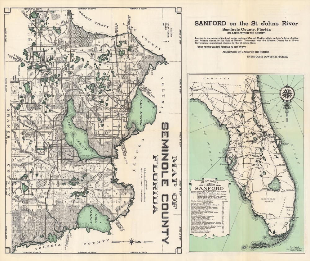
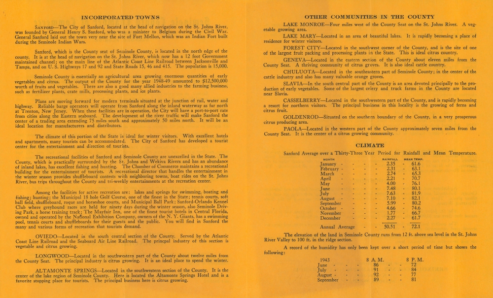
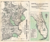
The verso represents all of Seminole County with survey lines and areas of good fishing, boats, and baits noted, along with rail lines, towns, waterways, and terrain features. At right, a map of Florida highlights Sanford's location relative to other cities and points of interest, which are recorded in a table with their distance from the city.
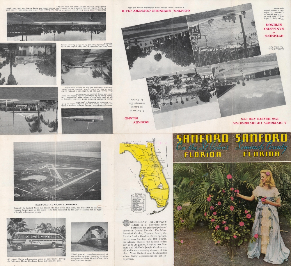
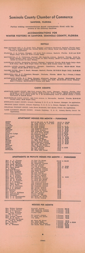
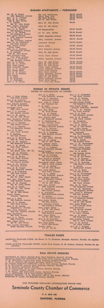
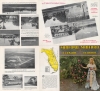
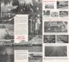
Accompanying promotional materials all appear to date from the mid-late 1940s. The 'Sanford, on the St. John's' photographic brochure refers to the Sanford Municipal Airport (now Orlando Sanford International Airport), likely due to the base being decommissioned in the late 1940s before being reactivated in 1950, rather than its permanent deactivation in the late 1960s.
The University of Chicago also holds a map of Sanford produced by Williams dated 1925 (OCLC 426060118), but it appears to be different from the present map. Regardless of publication date, in addition to the Touchton Map Library, the present map is quite scarce, only noted among the holdings of the Sanford Museum and the University of Wisconsin-Milwaukee.
A Closer Look
The recto map depicts Sanford, Florida on the banks of Lake Monroe and at the head of the navigable waters of the St. John's River. Circled numbers indicate points of interest around the town, listed in a key at bottom-left. Roads and rail lines are noted, along with streets, waterways, and housing developments, some with fanciful names such as 'Dreamworld.'The verso represents all of Seminole County with survey lines and areas of good fishing, boats, and baits noted, along with rail lines, towns, waterways, and terrain features. At right, a map of Florida highlights Sanford's location relative to other cities and points of interest, which are recorded in a table with their distance from the city.
Accompanying promotional materials all appear to date from the mid-late 1940s. The 'Sanford, on the St. John's' photographic brochure refers to the Sanford Municipal Airport (now Orlando Sanford International Airport), likely due to the base being decommissioned in the late 1940s before being reactivated in 1950, rather than its permanent deactivation in the late 1960s.
Selling Sanford
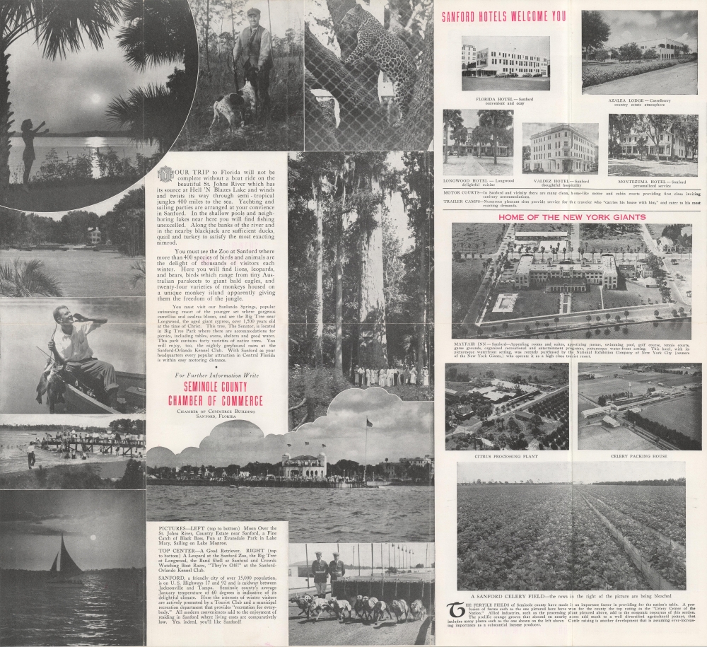
Sanford was founded by Henry Sanford, a Connecticut-born diplomat who sensed opportunity in Florida after the American Civil War (1861 - 1865) and bought a large tract of land around Lake Monroe from a former Confederate general. Though he was correct about Florida's ultimate prospects, his own ventures (including an orange plantation on Lake Monroe) were consistently unsuccessful. Nevertheless, the city and surrounding area developed into an agricultural center, especially for oranges and celery, and served as an important junction and divisional headquarters of the Atlantic Coast Line Railroad, which connected Jacksonville with the Tampa and points in between. Like Florida as a whole, the area benefitted from the increased exposure brought by the 1920s real estate boom, the development of highways, and the stationing of military personnel during and after World War II (1939 - 1945). The naval air base (Naval Air Station Sanford) established there in 1942 (number 40) was especially important for Sanford's later history; when it closed in 1968, the city's population temporarily decreased, but it has more than rebounded in the decades since thanks to proximity to Orlando and Disney World. More recently, the city was in national news for unfortunate reasons, being the site of the killing of Trayvon Martin in 2012.Publication History and Census
This map was produced by Civil Engineer Fred T. Williams and published by the Seminole County Chamber of Commerce. It is undated, but references to the New York Giants' Spring Training Facility and other structures suggest a date of 1951 or a bit earlier. The Touchton Map Library at the Tampa Bay History Center holds a dated edition from 1940, itself seemingly updated from a 1935 original. Therefore, it is possible that in 1951 the Chamber of Commerce republished an earlier map, with the circled numbers indicating changes in the subsequent years. This interpretation is supported by the naming of the baseball field here as Municipal Athletic Field with the Giants facility noted by a circled number nearby, the lack of the naval air base, and the last several numbered items in the key, which postdate the Second World War. The mention of the Municipal Airport in the key is likely the result of the naval air base being decommissioned for several years in the late 1940s.The University of Chicago also holds a map of Sanford produced by Williams dated 1925 (OCLC 426060118), but it appears to be different from the present map. Regardless of publication date, in addition to the Touchton Map Library, the present map is quite scarce, only noted among the holdings of the Sanford Museum and the University of Wisconsin-Milwaukee.
Condition
Very good. Some wear and toning along fold lines.