This item has been sold, but you can get on the Waitlist to be notified if another example becomes available, or purchase a digital scan.
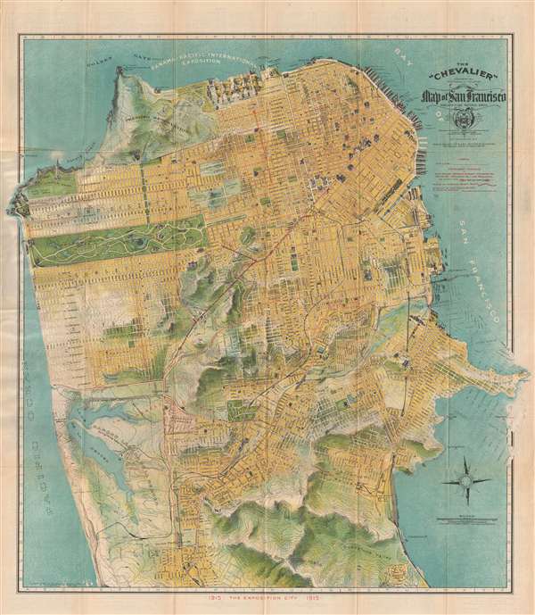
1915 Chevalier Map of San Francisco, California
SanFrancisco-chevalier-1915
Title
1915 (dated) 25 x 23.5 in (63.5 x 59.69 cm) 1 : 24000
Description
This map was copyrighted in 1912 but issued in anticipation of the 1915 Panama- Pacific International Exposition. The original map upon which it was based was a larger format wall map, also called the 'Chevalier,' published in 1903. The map was subsequently reduced to the present form and reissued in several editions, this being one of the more significant for its association with the Exposition. The map folds into its original paper binder with an art nouveau stamped cover.
Cartographer
August Chevalier (1871 – November 29, 1934) was a French-born American lithographer living and working in San Francisco, California. He came to the United States in 1890. Nothing is known about his early life and education, but he appears to have made his name with the publication of his 1904 work 'The Commercial, Pictorial and Tourist map of San Francisco': Chevalier's wife, Josephine, came to America from France that year, so perhaps the publication of his first map provided the means for bringing her to join him. Chevalier would go on to produce half a dozen plans of his home city, of which his magnificent 1912 topographical map of San Francisco known as 'The Chevalier' is best known. In 1931 he produced a series of 'Aero-Map-Views' of various regions of California, all of which appear to be quite rare. More by this mapmaker...

