This copy is copyright protected.
Copyright © 2025 Geographicus Rare Antique Maps
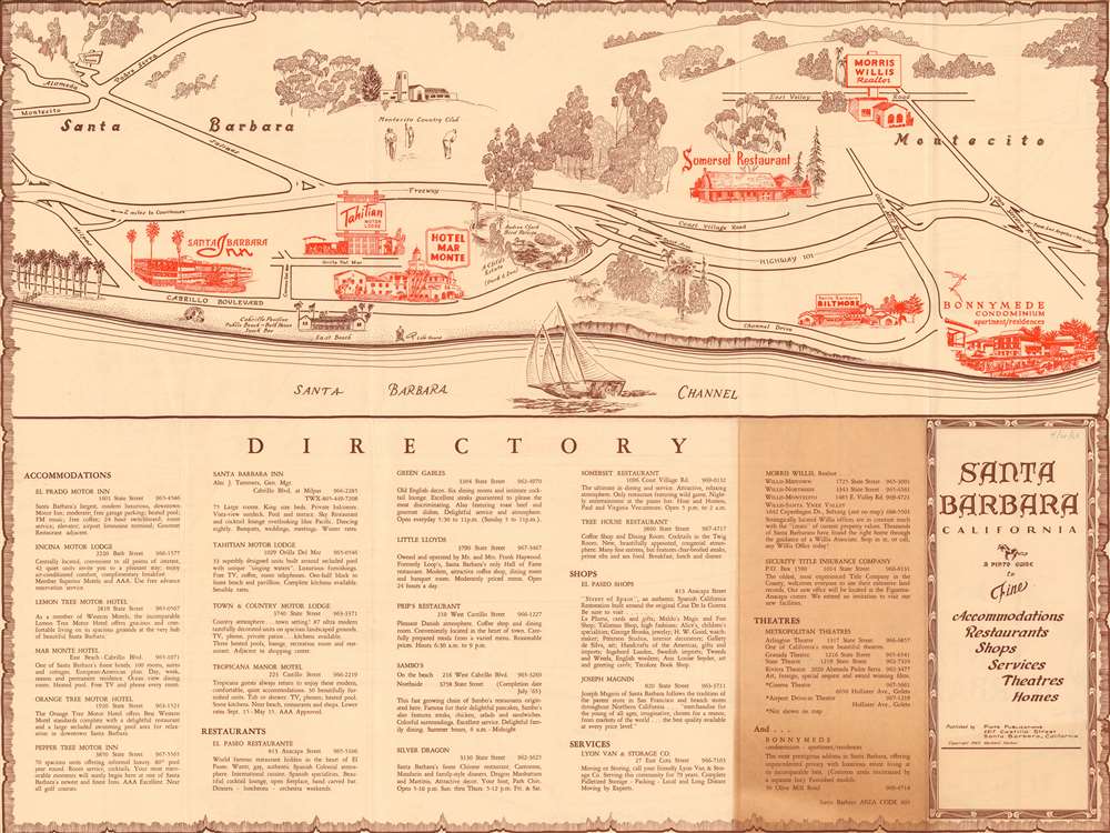
1965 Pinto Publications Bird's-eye View of Santa Barbara, California
SantaBarbara-pinto-1965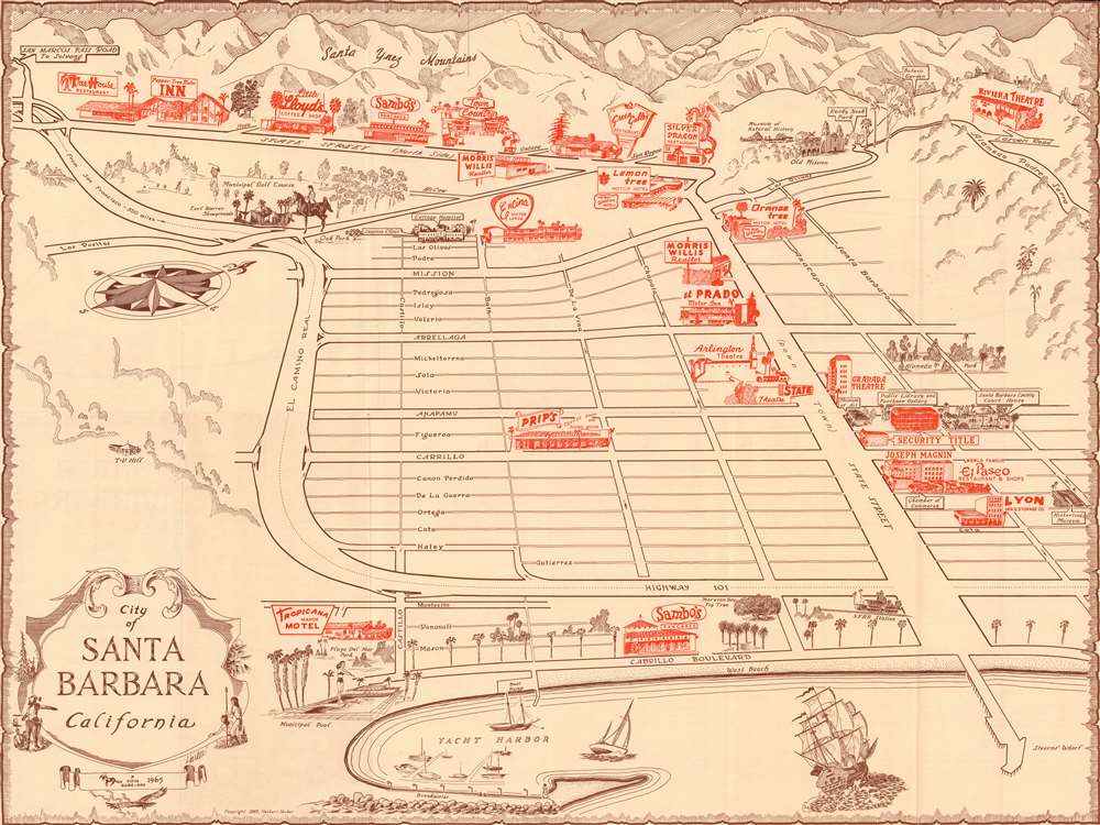

Copyright © 2025 Geographicus Rare Antique Maps | Geographicus Rare Antique Maps
This copy is copyright protected.
Copyright © 2025 Geographicus Rare Antique Maps