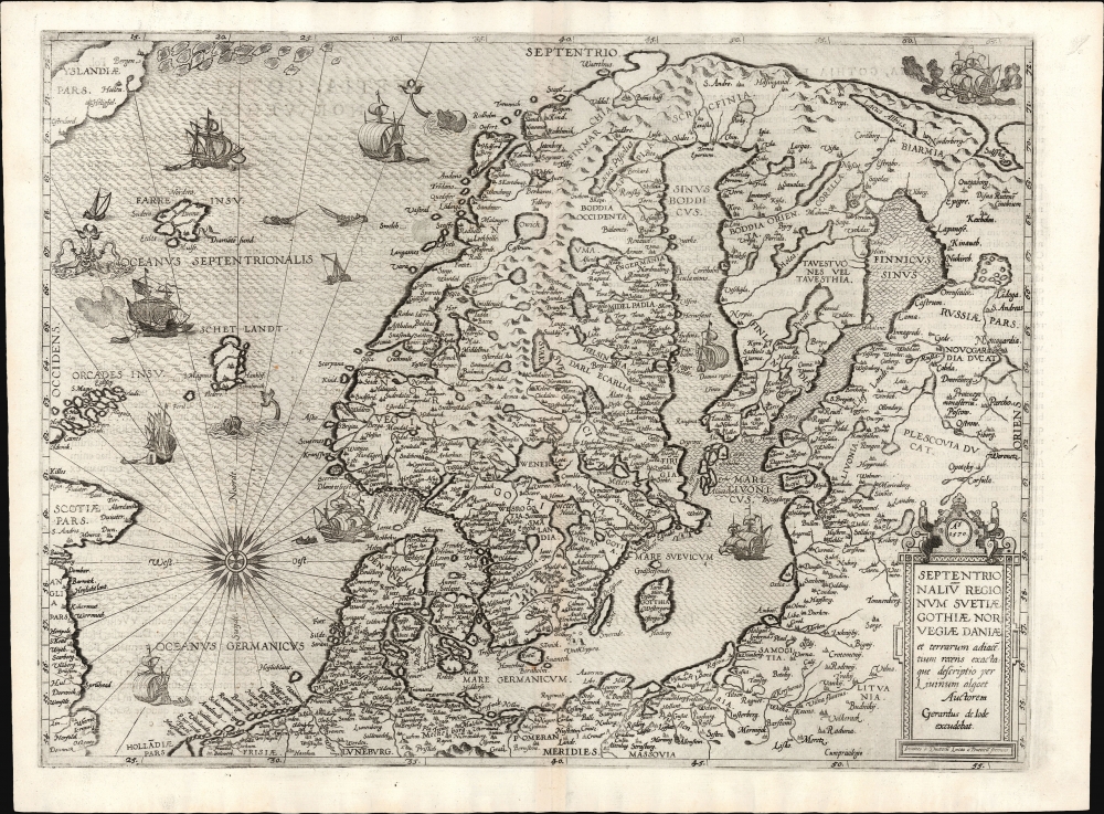
1570 / 1593 De Jode Map of Scandinavia
Scandinavia-jode-1570
Title
1570 (undated) 14.5 x 19.75 in (36.83 x 50.165 cm) 1 : 5800000
Description
A Closer Look
Coverage embraces the northern parts of Europe, including all of Denmark, Norway, Sweden, and Finland. Overall, it is the first detailed, single-sheet map specifically of Scandinavia. The preceding Ortelius spanned the North Atlantic and provided significantly less detail of Scandinavia itself. The Münster of 1544 focused on the same area as the present work and can be traced back to the same ultimate source, but it was much smaller and less detailed.The Sources
De Jode's map, engraved in 1570, was a reduction of Lieven Algoet's map of the region, printed to six sheets in 1562. The elder De Jode executed the engraving and printing of Algoet's map, making the younger De Jode's use of that map as a source understandable. (This precursor map, surviving in a sole copy in the Bibliothèque National de France, is not acquirable.) Algoet's own source was the 1539 Olaus Magnus Carta Marina. This lineage is most apparent on the single-sheet De Jode in the map's presentation of Iceland and its extensive ice floes. The map's masterful engraving presents rich cartographic detail and beautiful decorative elements - ships at sea, astonishing sea monsters, and a beautiful compass rose.Publication History and Census
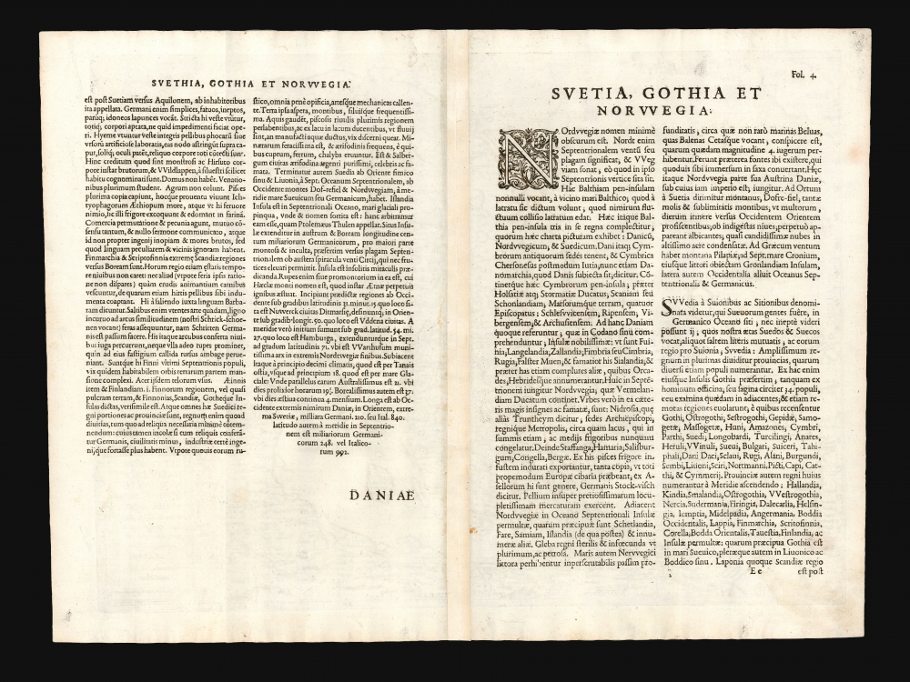
This map is rare. Dated 1570, it was among the first maps engraved for inclusion in Gerard De Jode's Speculum Orbis Terrarum. Ortelius' successful defense of his privilege to publish resulted in De Jode being unable to publish his work until 1578, and even then, the atlas appeared in only one edition prior to Gerard's death. His son, Cornelis, produced a second edition in 1593, also published in a sole edition. The map was not further reprinted, the plates having been acquired from De Jode's widow by Ortelius' executor, Vrients, and destroyed to remove them from the market. The present example conforms typographically to the 1593 edition and is of the second state, including the privilege lacking in the 1578 printing. This separate map appears in only 5 listings in OCLC, two of which correspond to this edition. Perhaps a dozen examples of the Speculum appear in institutional collections.CartographerS
Gerard De Jode (1516/17 - February 5, 1591) was a Dutch publisher, engraver and cartographer active in Antwerp in the mid-to-late 16th century. De Jode was born in Nijmegen. Following a period as an apprentice and journeyman, (about which nothing comes down to us), he was admitted as a free master to Antwerp's artists' Guild of Saint Luke in 1547. He received the right to publish in that city in 1551. Henceforth he worked as a publisher and printseller in that city - although records also refer to him as a bookseller, art seller, map painter, engraver, and plate printer. He became one of Antwerp's most successful and prolific printers: he built up a large and varied stock of more than 1,200 prints and maps, and in addition to his own children maintained a shop and was taking on apprentices as early as 1549. De Jode's shop was home to many of Antwerp's best engravers, including the famous Van Doetecum brothers.
His publication in 1579 of the Thesaurus sacrarumhistoriarum veteris testamenti set the standard for over a century of Biblical illustration. His cartographic work began with the printing of other mapmakers' work (for example Gastaldi's map of the world in 1555, Jacob van Deventer's map of Brabant in 1558, and Ortelius' eight sheet map of the world in 1564.) He is best known for his 1578 atlas Speculum Orbis Terrarum. Despite the excellence of this work, it performed poorly due to the overwhelming competition posed by Abraham Ortelius' Theatrum Orbis Terrarum, which had already been eight years in publication. Between the Theatrum's popularity (and Ortelius' superior political connections, employed successfully in a vigorous defense of his license and monopoly on the work) De Jode's atlas was never a strong seller. Gerard printed only one edition of the work, compared to something on the order of 40 for the Ortelius atlas. Gerard de Jode planned an enlarged edition, but died before it could be finished. His son Cornelis de Jode completed the labor, publishing the Speculum Orbis Terrae in 1593. This edition, too, of the Speculum failed to compete with Ortelius' powerhouse. On top of that, much of the De Jodes' stock was actively purchased and destroyed by Ortelius and his executors in order to remove it from the market. Thus, oneresult of De Jode's ill-starred competition with Ortelius is that while most of Ortelius' maps are relatively ubiquitous on the market, all of De Jode's maps are rare, and sought after by the discerning collector. More by this mapmaker...
Cornelis de Jode (1568 – October 17, 1600) was an Antwerp cartographer, engraver and publisher, He was the son and heir of Gerard de Jode, also a cartographer and publisher. Cornelis studied science at Academy of Douai, but it can be understood that his main education in the trade was at the hands of his father. On his father's death in 1591, Cornelis de Jode took over the work on his father's atlas, Speculum Orbis Terrarum. This had enjoyed publication in a single edition of 1578, overshadowed by the competition posed by Abraham Ortelius' (1527 - 1598) Theatrum Orbis Terrrum. Cornelis published a second edition, to which he added many updated maps to bring the work up to date with its competition. Despite the improvements brought to the atlas, both aesthetic and geographic, De Jode was unable to break Ortelius' grip on the market and there were no further editions of the atlas. After his death, the engraving plates were sold to Ortelius' executor Johannes Baptista Vrients (1552 - 1612), who was continuing to publish the Theatrum. Vrients would utilize several decorative plates from the Speculum, but the complete work and its maps were not published again - likely they were destroyed by Vrients to keep them from competing with his editions of the i>Theatrum. Learn More...
Lieven Algoet (Late 1400s - January 25, 1547) was a Southern Netherlandish humanist, secretary to Erasmsus, and an erstwhile mapmaker. He was born in Ghent to a large family of no great distinguishment. He attended university at Louvain, studying philology and languages. Erasmus employed him after university, apparently more as an adopted son than as a secretary. This was fortunate, as Erasmus proved disappointed with Algoet's lack of diligence. Nevertheless, Algoet would find employment with the diplomat Cornelis de Schepper. During this service, he began producing maps, including a world map, which has not survived (and for which he appears not to have been paid). Schepper served King Christian of Denmark and was considered an expert in the northern regions. This may have informed Algoet's map of Scandinavia, although that map was unlikely to have been produced before the 1539 Olaus Magnus. The manuscript is lost, but a single example of this six-sheet map, printed posthumously in 1562, survives and shows a clear debt owed to the 1539 Olaus Magnus Carta marina. In 1570, Algoet's map would be committed to a single plate for separate issue by Gerard De Jode, and the map would appear in both the 1578 and 1593 editions of the De Jode atlas. Learn More...
Olaus Magnus (October 1490 - August 1, 1557), whose name is Latinized from Månsson, was a Swedish writer and Catholic canon and archdeacon. A mission to secure an archbishopric for his brother Johannes led him to travel to Rome in 1524, and thereafter he remained broad engaged in diplomacy until the victory of the reformation in Sweden exiled him permanently, first to Poland and then to Rome in 1537. Magnus' contributions to geography are his 1539 map Carta marina et Descriptio septemtrionalium terrarum and his 1555 Historia de Gentibus Septentrionalibus (a collection of folklore and history which for a century remained the European authority on Sweden, its people and its climate.) Carta Marina, a 9-sheet woodcut map surviving in but two known copies, was deeply influential, providing the dominant model for the mapping of the northern parts of Europe prior to Ortelius. The map has withstood scrutiny even to this day in some respects. Modern oceanographers have analyzed Magnus' work and found his descriptions of currents between Iceland and the Faroe islands to be accurate. Learn More...


