
This item below is out of stock, but another example (left) is available. To view the available item, click "Details."
Details
1595 / 1609 Mercator Map of Scandinavia: First French Atlas Edition
$1,750.00
1595 Mercator Map of Scandinavia: First Atlas Edition
Scandinavia-mercator-1595$1,000.00

Title
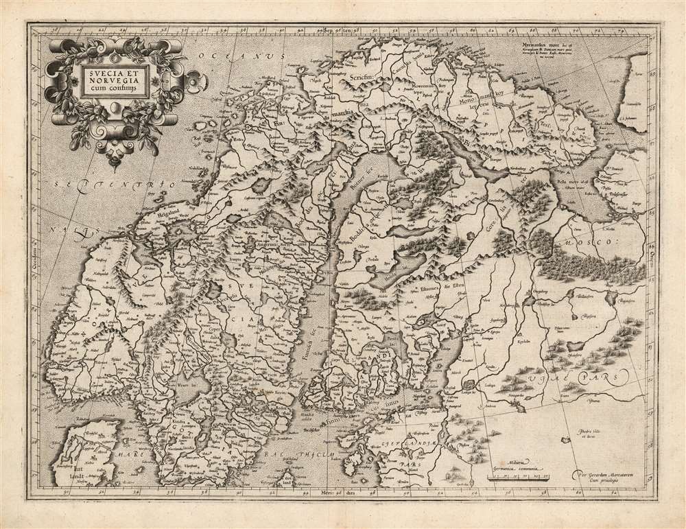
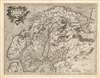
Suecia Et Norvegia cum confinijs.
1595 (undated) 14.25 x 18.75 in (36.195 x 47.625 cm) 1 : 4400000
1595 (undated) 14.25 x 18.75 in (36.195 x 47.625 cm) 1 : 4400000
Description
This is a superb example of the 1595 first atlas edition of Gerard Mercator's map of Scandinavia. Among the maps of the north parts of Europe produced in the sixteenth century, this is the first to focus narrowly on Scandinavia. Ginsberg, typically laconic in praise, notes that the map 'gave the Scandinavian peninsula its correct form' and 'became the model for nearly all subsequent maps of Scandinavia.' This basic model would stand until supplanted in the mid-seventeenth century by the work of Anders Bure.
The Scope
Mercator's map it is closely constrained to Norway, Sweden, Finland, and Lappia (Kola Peninsula). Thus, the map does also illustrate northwestern Russia, Estonia, and the northern part of Denmark. It is significantly richer in detail than the mapping of this region appearing on Mercator's 1569 world map, so while the two may share sources one is not copied from the other. Mercator additional drew on the work of Olaus Magnus.Publication History and Census
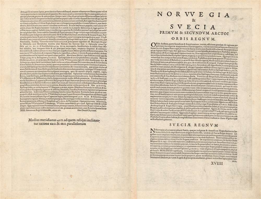
This map was engraved by Gerard Mercator some time after 1585, but was not published until 1595 by his heirs in the posthumous Atlas sive Cosmographicae. It was included in editions of the Mercator / Hondius atlas until 1633. The typography of the verso text conforms to examples of the 1595 first edition of the atlas. The separate map is well represented in institutional collections, but first edition examples are scarce on the market.Cartographer
Gerard Mercator (March 5, 1512 - December 2, 1594) is a seminal figure in the history of cartography. Mercator was born near Antwerp as Gerard de Cremere in Rupelmonde. He studied Latin, mathematics, and religion in Rupelmonde before his Uncle, Gisbert, a priest, arranged for him to be sent to Hertogenbosch to study under the Brothers of the Common Life. There he was taught by the celebrated Dutch humanist Georgius Macropedius (Joris van Lanckvelt; April 1487 - July 1558). It was there that he changed him name, adapting the Latin term for 'Merchant', that is 'Mercator'. He went on to study at the University of Louvain. After some time, he left Louvain to travel extensively, but returned in 1534 to study mathematics under Gemma Frisius (1508 - 1555). He produced his first world map in 1538 - notable as being the first to represent North America stretching from the Arctic to the southern polar regions. This impressive work earned him the patronage of the Emperor Charles V, for whom along with Van der Heyden and Gemma Frisius, he constructed a terrestrial globe. He then produced an important 1541 globe - the first to offer rhumb lines. Despite growing fame and imperial patronage, Mercator was accused of heresy and in 1552. His accusations were partially due to his Protestant faith, and partly due to his travels, which aroused suspicion. After being released from prison with the support of the University of Louvain, he resumed his cartographic work. It was during this period that he became a close fried to English polymath John Dee (1527 - 1609), who arrived in Louvain in 1548, and with whom Mercator maintained a lifelong correspondence. In 1552, Mercator set himself up as a cartographer in Duisburg and began work on his revised edition of Ptolemy's Geographia. He also taught mathematics in Duisburg from 1559 to 1562. In 1564, he became the Court Cosmographer to Duke Wilhelm of Cleve. During this period, he began to perfect the novel projection for which he is best remembered. The 'Mercator Projection' was first used in 1569 for a massive world map on 18 sheets. On May 5, 1590 Mercator had a stroke which left him paralyzed on his left side. He slowly recovered but suffered frustration at his inability to continue making maps. By 1592, he recovered enough that he was able to work again but by that time he was losing his vision. He had a second stroke near the end of 1593, after which he briefly lost speech. He recovered some power of speech before a third stroke marked his end. Following Mercator's death his descendants, particularly his youngest son Rumold (1541 - December 31, 1599) completed many of his maps and in 1595, published his Atlas. Nonetheless, lacking their father's drive and genius, the firm but languished under heavy competition from Abraham Ortelius. It was not until Mercator's plates were purchased and republished (Mercator / Hondius) by Henricus Hondius II (1597 - 1651) and Jan Jansson (1588 - 1664) that his position as the preeminent cartographer of the age was re-established. More by this mapmaker...
Source
Mercator, G., Atlas sive Cosmographicae, (Amsterdam: Mercator) 1595.
Mercator's Atlas is one of the most important works in the history of cartography. Although in fact Ortelius was the first to publish a proper atlas, the Teatrum Orbis Terrarum, Mercator's work the first book to employ the term Atlas for a collection of maps. The term is derived both from the mythical titan, Atlas, who was forced to bear the world upon his shoulders, and the Libyan king, philosopher, and astronomer of the same name that, so the legend goes, constructed the first globe. Mercator dedicated the final 25 years of his life to compile the Atlas. He published two parts during his lifetime in 1585 and 1589, but the final part published posthumously by his son Rumold Mercator, in 1595. The map plates for the Atlas were later acquired by Jodocus Hondius who published the most complete and well known edition in 1606. It was Jodocus who popularized the Atlas and who did the most to elevate Gerard Mercator's name.
Condition
Excellent. Light soiling and scuffing in margins. Else fine with generous margins and a bold, sharp strike.
References
OCLC 159839087. Rumsey 10501.118 (1607). Van der Krogt, P. C. J., Koeman's Atlantes Neerlandici, (3 Vols),1210:1A Ginsberg, W. Printed Maps of Scandinavia, no. 34, pp. 139-45. Ginsberg, W. Scandia: Important Early Maps of the Northern Regions and Maps and Charts of Norway, no. 27.