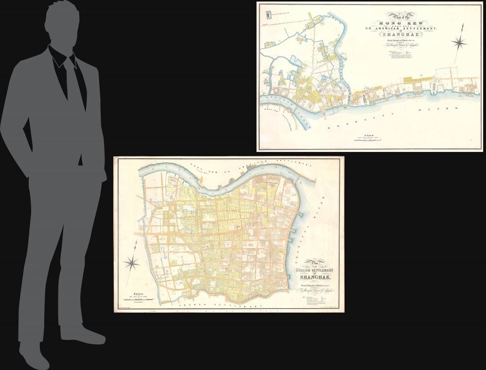
1866 Municipal Council Maps of Shanghai, China (British Concession, American Concession)
Shanghae-municipalcouncil-1866
Title
1866 (dated) 27.25 x 40.25 in (69.215 x 102.235 cm) 1 : 2400
Description
A Closer Look
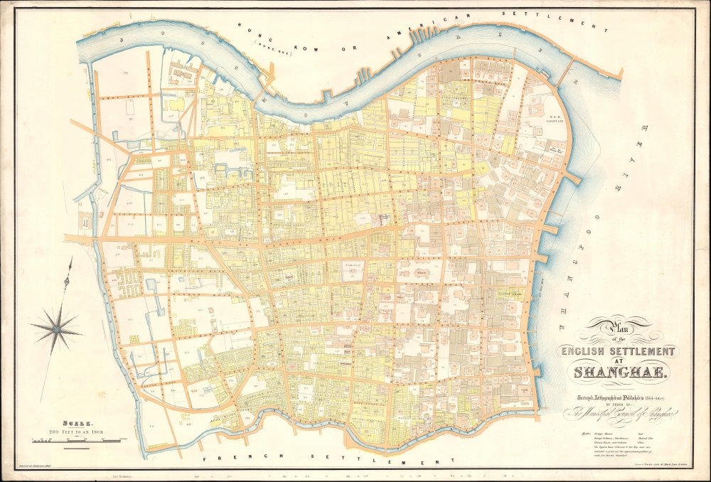
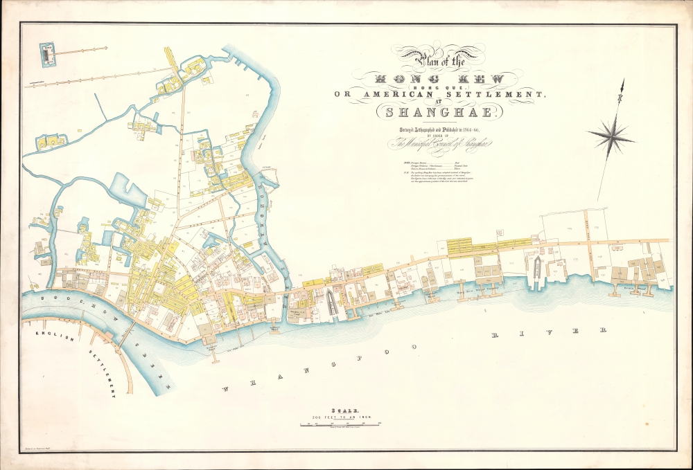
The maps are lavish productions by the British banking printer Nissin and Parker: large, finely engraved, and an impressive early instance of chromolithography. Each is oriented north by northwest and is presented at a uniform scale, 200 feet to the inch, allowing for supreme detail throughout. Key locations are named on the map, but each map also features additional numbered locations, 436 for the British Concession and 248 for the American. Color coding distinguishes building types: Foreign Houses (red), Foreign Warehouses (brown), Chinese Houses, and Godowns (yellow). The term 'Houses' seems not to have been used literally, and in some cases includes banks, social clubs, hotels, churches, cemeteries, schools, and similar institutions. Of the numbered locations, the key has unfortunately been lost to time, but many of the locations can be inferred based on later maps.The map of the British Concession embraces those extraterritorial lands originally ceded to the British in 1842. It is bounded on the west by Defense Creek (roughly modern-day Xizang Rd), on the north by Soochow Creek (Suzhou River) and the American Settlement (Hong Kew), on the south by Yang King Pang (roughly the modern-day Yan'an Viaduct) and the French Concession, and on the east by the Wangpoo River (Huangpu River).
This map covers the original American Concession from North Szechuan Road (modern-day Sichuan Rd), along the north bank of Soochow (Suzhou) Creek to Dent's Wharf. Although we are aware of only one edition of the British Concession map, Geographicus also owns another unrecorded variant of this American Concession that includes updates associated with the installation of sewer lines and drainage (c.f. ShanghaiAmericanConcession-municipalcouncil-1866).
Historical Context
This map set has no precedent. While not the first maps to illustrate Shanghai, they were the first to be derived from a detailed mathematical survey and thus offer significant detail. Earlier maps by F. B. Youel, Potter, and Becker were either rough outlines or nautical charts, focused more on the Huangpu River than the actual city. This is unsurprising, as the first two decades of the Concession Period (1842 - 1862) saw little development, especially along the riverfront. An 1861 painting shows the riverfront along the Bund in a near natural state, despite a few new jetties jutting into the river. Rough wooden platforms along the riverfront were not added until 1862.It was not until the 1863 consolidation of the British and American Concessions that urban development began in earnest. At this time, the Shanghai Municipal Council ordered a comprehensive survey. The survey work took from 1864 to 1866, resulting in these two magnificent maps, the first and by far the finest of the much-vaunted 'Municipal Council Series'. We begin to see the first major infrastructure projects beginning at this point: landfill along the waterfront, the establishment of the first gas company in 1865, paving of the streets, the construction of drainage channels and sewer lines (c.f. Geographicus: ShanghaiAmericanConcession-municipalcouncil-1866), gardens, and trees along major streets, etc.
The British Concession
The British Concession in Shanghai was established following the Treaty of Nanking (1842), which ended the First Opium War (1839 - 1842) and forced China to open several ports to foreign trade. Located along the western bank of the Huangpu River, the Concession was designated exclusively for British residents and governed under British extraterritorial laws. Over the subsequent 30 years, it grew into a prosperous area with British-style infrastructure, banks, trading firms, and residences, contributing significantly to Shanghai's development as a global financial hub. In 1863, the British Concession merged with the American Concession to form the International Settlement, governed jointly by Western powers but dominated by British influence. The area thrived during the late 19th and early 20th centuries as a center of trade, culture, and finance but faced upheavals during World War II and the eventual return of foreign concessions to Chinese control in 1943.The American Concession
In 1845, American missionary and Episcopalian bishop William Jones Boone (1811 - 1864) acquired a large parcel of land in Hongkou (虹口区), north of the British Concession, Shanghai. His initial plan was to build a church and sell real estate, but in 1848, he proposed a permanent American settlement similar to the British Concession. While construction on the settlement proceeded, the land was not formally established as an extraterritorial zone until June 25, 1863. On that day, Shanghai County Governor Huang Feng (黃芳) approved the request, and American Consul George Seward signed an agreement to create the American Extraterritorial Concession. A few months later, on September 21, 1863, the American Concession merged with the British Concession as the Shanghai International Settlement (上海公共租界). In the second half of the 19th century, the area of Hongkou became known for 'Shanghailanders', British and American expatriates who refused to pay taxes to the Qing. Initially, the International Settlement was reserved exclusively for those of European descent, but over time, it gradually opened to Chinese and Japanese. By the early 20th century, Hongkou came to be dominated by Japanese businesses and was a hotbed of unrest in the years leading up to the Second Sino-Japanese War (1937 - 1945) and World War II (1939 - 1945).Shanghai International Settlement
The Shanghai International Settlement was created in 1863 when the British and American Shanghai enclaves merged. These concessions had been granted to England and the United States as part of the Unequal Treaties that followed the Opium Wars. From about 1854, the settlements were governed by the Shanghai Municipal Council, a British-dominated board of government officials and powerful merchants. The board issued restrictions limiting Chinese habitation on International Settlement territory and oversaw the construction of public services, including trams, a sewage system, highways, and port buildings. The International Settlement expanded several times in the late 19th and early 20th century. In addition, they constructed and administered Extra-Settlement Roads into the surrounding country, which further allowed for informal expansion. It became an enclave of peace and prosperity when the Japanese invaded Shanghai in 1937, but this abruptly came to an end with the Japanese bombing of Pearl Harbor and subsequent invasion of the International Settlement in 1941. After the war, the International Settlement lands were returned to Chinese sovereignty.Publication History and Census
These seminal maps are based on surveys conducted between 1864 and 1866, immediately after the British Concession and the American Settlement consolidated their governance under the Shanghai Municipal Council. It was printed in London by the financial market printers Nissin and Parker. The map is exceedingly rare with no history on the market. We note examples in just four institutional collections - most in poor condition: the National Library of Scotland, the Southern Baptist Seminary, the Seward House Museum, and the Royal Geographical Society.CartographerS
Shanghai Municipal Council (July 11, 1854 - 1943) was an organization of businessmen leaders in Shanghai active from middle part of the 19th century to the early 20th century. The organization was formed on July 11, 1854 by a group of influential western businessmen who argued that Shanghai suffered under a lack of proper municipal governance. It laid down land regulations and began to assist in the construction of new roads, established refuse collection, and even initiated taxation. By the late-1860s Shanghai's official governing body had been practically transferred from the individual concessions to the Shanghai Municipal Council (工部局). The British Consul was the de jure authority in the Settlement, but he had no actual power unless the ratepayers (who voted for the council) agreed. Instead, he and the other consulates deferred to the Council, which was made of 9 figures, 5 from the British Settlement, 2 form the American Settlement, and 2 from the Japanese Settlement. No Chinese were permitted to serve on the council until 1928. By the 1880s the council acquired a virtual monopoly over city utilities, controlling gas-suppliers, electricity producers and water-companies. Later, in the early 20th century, they also took control of rickshaws, tramways, and regulated opium sales and prostitution. The council maintained its own police force, fire service, and military reserve, the Shanghai Volunteer Corps (萬國商團). The Municipal Council was disbanded in 1943, in World War II, when the Japanese closed all foreign concessions (except the French). More by this mapmaker...
Hilary Nicholas Nissen (1813 - August 25, 1877) was a British stationer, politician, sheriff, and businessman. Nissen founded the firm Nissen and Parker at 43 Mark Lane, London. Parker we have been unable to isolate. The firm is best known for servicing the London financial market, printing bank notes, checks, certificates, drafts, maps, and books. By 1867, they became Nissen, Parker, and Arnold. By the early 20th century, the firm changed to Nissen and Arnold. At its height, the firm serviced nearly 2000 banking and mercantile establishments. Nissen served as a London Sheriff in 1863 and 1864, about whom the following satirical poem was composed and published in the 1864 Eleventh Londoniad,
And here I was a new artistic strainNissen was also a master of the Fruitierers Company, a kind of London guild, initially associated with the fruit industry, that can trace its roots to the 14th century. Learn More...
For Hilary Nicholas Nissen of Mark-lane,
Whose fam'd house the first in Middlesex is,
Lo! His Improvement in Book Indexes;
I T' incorporate in th' Londoniad
Throught; but see th' great advance my hero made.
He the great triumph of th' age has shared -
Note, his Paper Chemicaly Prepared.
The great Art Controvertist hail; I hear
His name resound in either hemisphere,
And that few, if any, have such a brain
As the prime hero of science in Mark-lane.
Cheque-printer, him we first in England rank,
His name's in ev'ry public, ev'ry private bank;
But need I through the vast Catalogue range,
of 43, Mark-lane, near to the Corn Exchange'
It can never fall to my lot again,
To have Lord Mayor and Sheriff with such heart and brain.


