1973 Nisbet / Anderson Manuscript Geological, Oil and Gas Map of Southern California
SoCalGeology-nisbet-1973$500.00


Title
Morro Bay to San Diego California Generalized Areal Geology / Physical and Legal Limitations to Operations Morro Bay to San Diego California.
1973 (dated) 48.5 x 35 in (123.19 x 88.9 cm) 1 : 32000
1973 (dated) 48.5 x 35 in (123.19 x 88.9 cm) 1 : 32000
Description
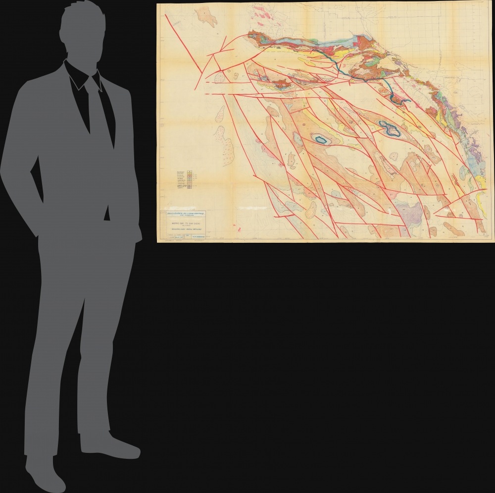
An unusual large-format composite manuscript and diazotype geological map of Southern California, produced in 1973 by G. J. Anderson of the Challenger Oil and Gas Co., based on an earlier 1966 map by J. M. Nisbet. In addition to geological information, the map also indicates coastal reserves open for development and traces the outlines of the region's historic Spanish and Mexican ranchos.
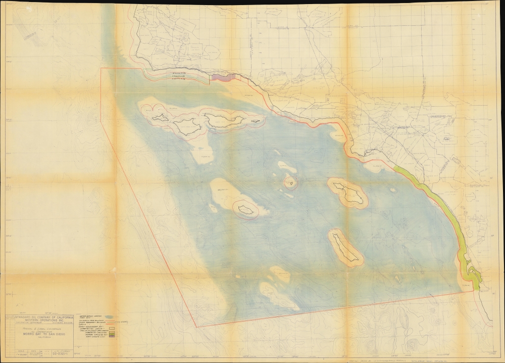
The verso presents the same diazotype base map as on the recto but instead highlights coastal areas suitable for oil and gas exploitation in light of legal considerations. It mentions the 1955 Shell-Cunningham Tidelands Act, a law passed by California's state legislature that amended an earlier 1938 law restricting offshore oil and gas development. The 1955 law provided for coastal 'sanctuaries,' especially near heavily populated areas, but otherwise opened up considerably more coastal waters to oil and gas development, as indicated here, with the State Lands Commission authorized to negotiate leases. Afterward, from the late 1950s to the late 1960s, many new leases were granted along the Southern California coast, allowing for increased offshore oil and gas field exploitation until environmental concerns in the 1970s saw a turn towards greater restrictions.
A Closer Look
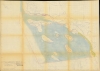
The map covers a large portion of Southern California from Morro Bay in the Central Coast region to the Mexican border, including Santa Barbara, the Los Angeles metropolitan area, and San Diego, with a focus on the coastal waters of the Pacific Ocean. Hachure lines mark submarine elevation, particularly along the closely packed ridges and basins of the Southern California Borderland, also known as the California Continental Borderland. A system of color shading explained at left differentiates geologic eras, volcanic, and intrusive rock. Areas shaded light red on land might indicate oil reserves, as in northern Santa Barbara County at top and at various points around Los Angeles County. In addition to the long eras of geologic time indicated, more recent features are illustrated on land, including county boundaries, highways, and railways. These include highly detailed documentation of the historic Spanish and Mexican ranchos of Southern California, which presumably have no geological significance.The verso presents the same diazotype base map as on the recto but instead highlights coastal areas suitable for oil and gas exploitation in light of legal considerations. It mentions the 1955 Shell-Cunningham Tidelands Act, a law passed by California's state legislature that amended an earlier 1938 law restricting offshore oil and gas development. The 1955 law provided for coastal 'sanctuaries,' especially near heavily populated areas, but otherwise opened up considerably more coastal waters to oil and gas development, as indicated here, with the State Lands Commission authorized to negotiate leases. Afterward, from the late 1950s to the late 1960s, many new leases were granted along the Southern California coast, allowing for increased offshore oil and gas field exploitation until environmental concerns in the 1970s saw a turn towards greater restrictions.
Diazo Print or Whiteprint
The diazo print (whiteprint or diazo for short) is a photo reproductive technique best understood as a reverse cyanotype or blueprint. The process yields distinctive blue lines on white paper. Like cyanotypes, the diazo process gained popularity in architecture circles, where it was a simple and effective way to duplicate documents in the field. The earliest diazotypes appeared around 1880 and were adopted for military and field cartographic use from about 1895. The diazo process was commercialized in 1923 when the German firm Kalle and Company developed Ozalid, a patented diazo paper that made diazotyping even easier. By the 1950s, it supplemented cyanotypes as the reprographic technique of choice for technical drawings.Publication History and Census
The recto map was originally prepared by J. M. Nisbet, seemingly of the Standard Oil Company of Southern California (later Chevron) in 1966, and the verso map was prepared by the same in 1965 (itself seemingly an update of an earlier 1963 map). The recto map was updated in 1973 by G. J. Anderson for the Challenger Oil and Gas Co. (a subsidiary of Global Marine Inc., different from today's company of the same name that operates in Northern Africa, which was founded in 1991). Though based on an earlier map, the annotations here are in manuscript, making it a unique production. Being diazotypes, these maps were meant for administrative use and were ephemeral in nature.Cartographer
John McHenry Nisbet, Jr. (fl. c. 1960 - 1970) was a geologist in the oil and gas industry in California. He was the son of John McHenry Nisbet, Sr. (1897 - 1962), a prominent oil executive with Cities Service Oil Company (later Citgo). Nisbet, Jr., appears to have moved around to different locations in Southern California during his career, working for Richfield Oil Company (among others) and may have later relocated to Seattle, Washington. He was active in the Pacific Section of the American Association of Petroleum Geologists. More by this mapmaker...
Condition
Good. Wear along original fold lines. Several tears along border and at fold junctions professionally repaired. Some surface scuffing.