Digital Image: 1915 U.S. Department of Agriculture Soil Map of Southern California
SoilSouthernCA-deptagriculture-1915_d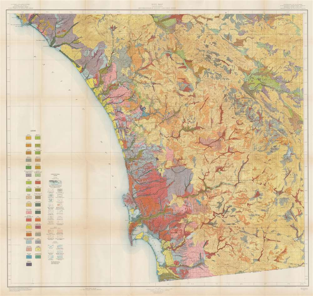

Title
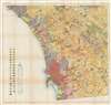
Soil Map. California. Reconnoissance Survey - San Diego Sheet.
1915 (dated) 37.5 x 39 in (95.25 x 99.06 cm) 1 : 125000
1915 (dated) 37.5 x 39 in (95.25 x 99.06 cm) 1 : 125000
Description
FOR THE ORIGINAL ANTIQUE MAP, WITH HISTORICAL ANALYSIS, CLICK HERE.
Digital Map Information
Geographicus maintains an archive of high-resolution rare map scans. We scan our maps at 300 DPI or higher, with newer images being 600 DPI, (either TIFF or JPEG, depending on when the scan was done) which is most cases in suitable for enlargement and printing.
Delivery
Once you purchase our digital scan service, you will receive a download link via email - usually within seconds. Digital orders are delivered as ZIP files, an industry standard file compression protocol that any computer should be able to unpack. Some of our files are very large, and can take some time to download. Most files are saved into your computer's 'Downloads' folder. All delivery is electronic. No physical product is shipped.
Credit and Scope of Use
You can use your digial image any way you want! Our digital images are unrestricted by copyright and can be used, modified, and published freely. The textual description that accompanies the original antique map is not included in the sale of digital images and remains protected by copyright. That said, we put significant care and effort into scanning and editing these maps, and we’d appreciate a credit when possible. Should you wish to credit us, please use the following credit line:
Courtesy of Geographicus Rare Antique Maps (http://www.geographicus.com).
How Large Can I Print?
In general, at 300 DPI, you should at least be able to double the size of the actual image, more so with our 600 DPI images. So, if the original was 10 x 12 inches, you can print at 20 x 24 inches, without quality loss. If your display requirements can accommodate some loss in image quality, you can make it even larger. That being said, no quality of scan will allow you to blow up at 10 x 12 inch map to wall size without significant quality loss. For more information, it is best consult a printer or reprographics specialist.
Refunds
If the high resolution image you ordered is unavailable, we will fully refund your purchase. Otherwise, digital images scans are a service, not a tangible product, and cannot be returned or refunded once the download link is used.
Cartographer S
L. Carl Holmes (fl. c. 1910 - c. 1924) worked for the Bureau of Soils of the U.S. Department of Agriculture for many years where he oversaw soil survey work for California. He was recognized as one of the best soils specialists in the western United States. While working for the Bureau of Soils, Holmes coauthored numerous studies and helped created several soil maps of regions in California. In March 1922 Holmes became the Assistant Farm Advisor for the Agricultural Extension Service and the Citrus Growers Department of the Los Angeles County Farm Bureau. More by this mapmaker...
Robert Larimore Pendleton (June 25, 1890 - June 23, 1957) was an American scientist and soils expert. Born in Minneapolis, Minnesota, Pendleton grew up in California. While working on his Ph.D. at the University of California-Berkeley, he worked on four soil surveys that garnered him junior authorship as well as one original critique of soil classification. Pendleton received his Ph.D. in soil science in 1917, and then went to India where he worked as an instructor in soils at Ewing Christian College. He remained in India until 1923 and worked as director of agriculture of Gwalior State. In 1923 he moved to the Philippines, where he remained until 1935, except for a two-year period when he was the chief soil technologist for the National Geological Survey of China. He wrote fifteen papers while working in China, and the years in the Philippines produced fifty academic papers. He moved on to Thailand (then called Siam) in 1935 where he was a soil technologist and agriculturist in the Royal Department of Agriculture and Fisheries. According to an obituary, Siam became home for Pendleton, and he loved the people and the land. He was interned during World War II but was able to return to the United States in 1942. He found work with the Office of Foreign Agricultural Relations, United States Department of Agriculture, which sent him to Central America and Peru. Pendleton was appointed to the new Department of Geography at The Johns Hopkins University in 1946, where he remained until he retired in 1955. However, Baltimore was not Bangkok, and while at Johns Hopkins he worked as an adviser to the Ministry of Agriculture in Thailand for four months in 1946, then from 1947 - 1948 Pendleton served as an agricultural advisor to the United Nations FAO Mission to Siam. He accompanied the Unites States Mutual Security Agency's Special technical and Economic Mission to Thailand in 1952 - 1953. Over the course of his career, Pendleton published over 160 works. After his retirement, he retuned to Thailand, where he died on June 23, 1957. Learn More...
The United States Geological Survey (1878 - Present), aka the U.S.G.S., is a scientific agency of the United States government, which was founded in 1879. USGS scientists study the landscape of the United States, its natural resources, and the natural hazards that threaten it. The organization has four major science disciplines: biology, geography, geology, and hydrology. It is a bureau of the United States Department of the Interior and is the department's only scientific agency. Learn More...
References
OCLC 55143188.