This item has been sold, but you can get on the Waitlist to be notified if another example becomes available, or purchase a digital scan.
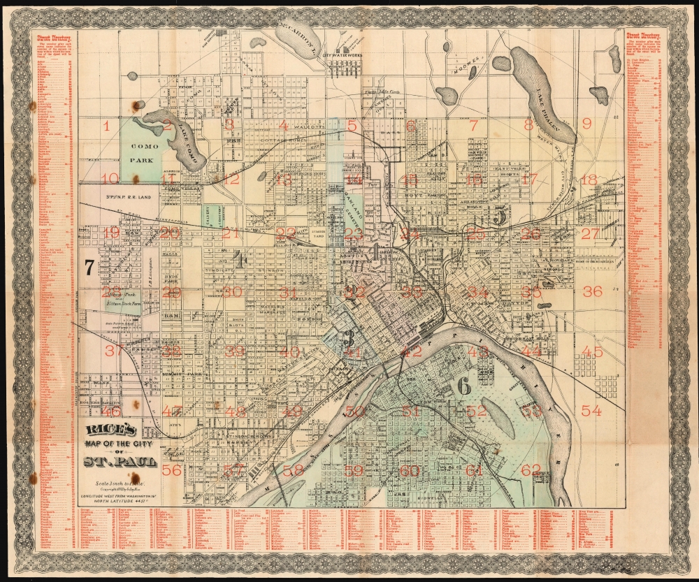
1885 Rice Map of Saint Paul, Minnesota
StPaulMn-rice-1885
Title
1885 (dated) 19.5 x 23.5 in (49.53 x 59.69 cm) 1 : 21120
Description
On the Map
The coves Saint Paul from Snelling Avenue in the west to just beyond English Avenue in the east; the southern limit is Annapolis Street, and the map reaches as far north as Mccarron's Lake and the city waterworks. Where blocks have been subdivided into lots, these are numbered; streets are named, as are railroads, parks, and municipal works. The map also numbers the city's electoral wards, to which this 1885 state of the map includes a seventh not present on the 1883 edition. A second, red-colored printing pass gives the map a detailed street directory keyed to numbers applied to the grid.Rails and Bridges
The city's identification as a rail hub crossing the Mississippi is underscored by no fewer than six railroad lines and two railway bridges. Two steamboat landings serve the city center, and a bridge for all other traffic connects Wabash street to Dakota Avenue.Publication History and Census
This map was published in St. Paul by Jay's 'Saint Paul Lithographic Company.' Variants of the map are known as early as 1873 and as late as 1888. There are perhaps 13 examples cataloged in OCLC in various issues - some without the red print, some without the wash color. This edition - with an 1883 copyright but dated 1885 on the cover - is cataloged only in the collection of the National Library of Scotland.Cartographer
Gilbert Jay Rice (February 22, 1816 - May 4, 1904) was a prominent American map publisher and lithographer based in Saint Paul, Minnesota and active in the late 19th century. Rice was born in Covington, New York, the oldest of a family of 6. In 1837 he moved to Logansport, Indiana, to join his half-brother, Benjamin O. Spencer, establishing the short-lived commission and grocery store, 'Spencer and Rice.' When the partnership dissolved, 1846, Rice acquired Spencer's interest and continued top operate under his own name. We have been unable to locate rice in the subsequent 20 years, but by 1868, Rice relocated to St. Paul, where he established a publishing an engraving concern, 'St. Paul Lithographic, Engraving and Publishing.' Rice live in 94 W. Fourth Street and the firm was located at 88 East 3rd Street, Saint Paul. Most of Rice's cartographic work focuses on Minnesota and the Dakotas. More by this mapmaker...

