This item has been sold, but you can get on the Waitlist to be notified if another example becomes available, or purchase a digital scan.
1917 Cassell Propaganda Map of Europe Calling for National Self Determination
SubjectNationalities-cassell-1917$375.00

Title
Subject Nationalities of the German Alliance.
1917 (dated) 14.25 x 19 in (36.195 x 48.26 cm) 1 : 8448000
1917 (dated) 14.25 x 19 in (36.195 x 48.26 cm) 1 : 8448000
Description
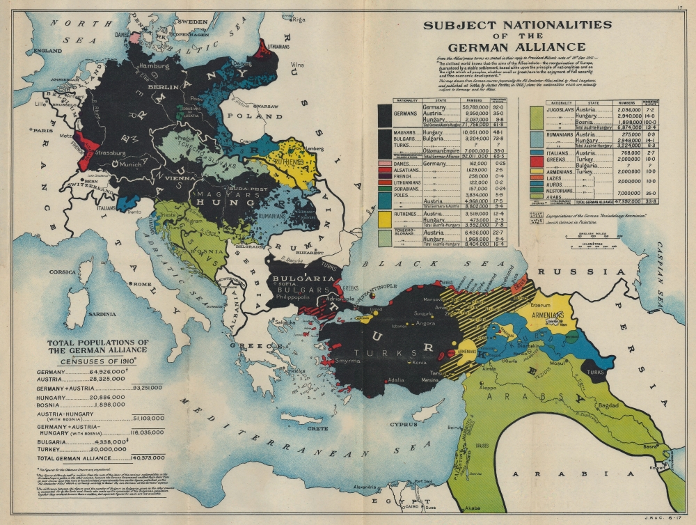
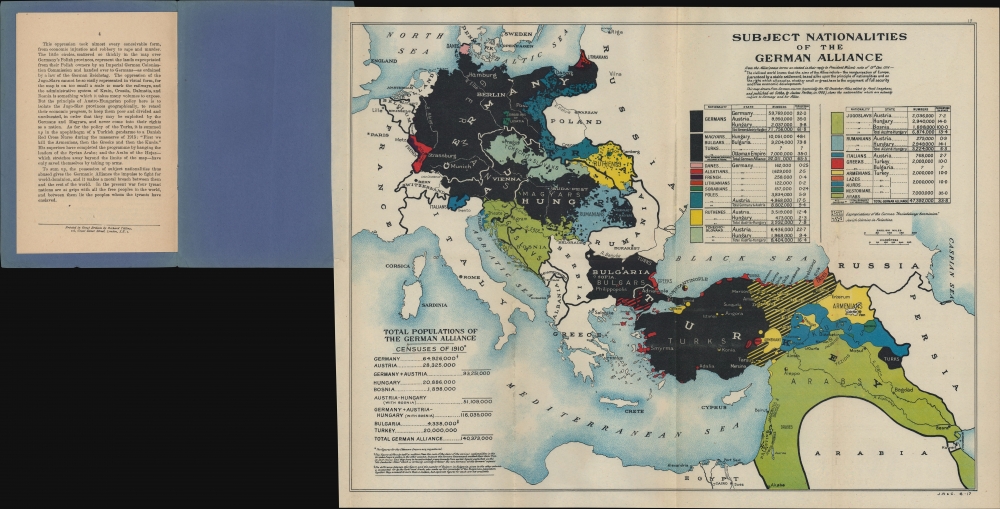
This is a 1917 Cassell propaganda map of Europe promoting national and ethnic self-determination.
The Cause of National Self Determination
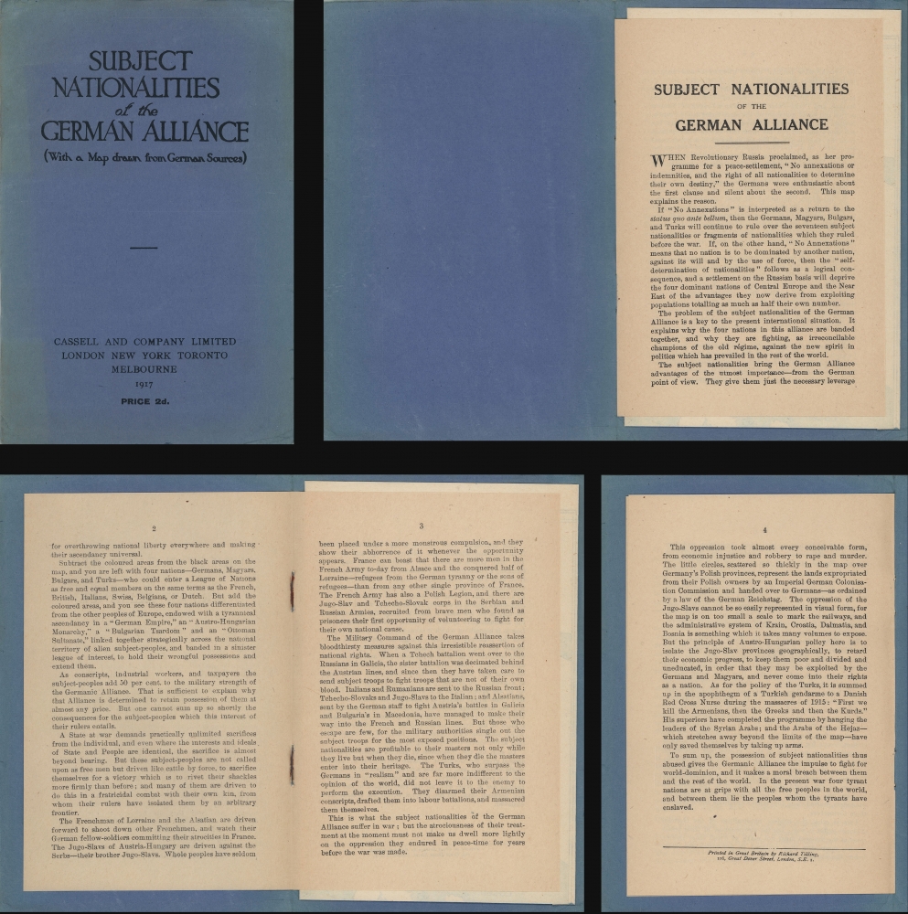
During World War I (1914 - 1918), Woodrow Wilson began calling for the self-determination for 'subject peoples', even including the concept in his Fourteen Points. Highlighting the territory then part of Germany, the Austro-Hungarian Empire, Bulgaria, and the Ottoman Empire (the Central Powers), the map illustrates the diversity of the territory dominated by the Germans, Magyars (Hungary), Bulgars (Bulgaria), and Turks (Ottoman Empire). According to the statistics provided, only 48% of the Austro-Hungarian Empire was Magyar, and only 35% percent of the Ottoman Empire was Turkish. The rest of the populations were other 'nationalities'. The Ottoman Empire alone consisted of Kurds, Armenians, Arabs, and Greeks, along with numerous other groups. Germany was the most homogenous, but still claimed territory populated by Danes, Alsatians, French, and Lithuanians. The map's argument is well summarized in the accompanying textSubtract the coloured areas from the black areas on the map, and you are left with four nations - Germans, Magyars, Bulgars, and Turks - who could enter a League of Nations as free and equal members on the same terms as the French, British, Italians, Swiss, Belgians, or Dutch. But add the coloured areas, and you see these four nations differentiated from the other peoples of Europe, endowed with a tyrannical ascendancy in a 'German Empire', an 'Austro-Hungarian Monarchy', a 'Bulgarian Tsardom', and an 'Ottoman Sultanate', linked together strategically across the national territory of alien subject-peoples, and banded in a sinister league of interest, to hold their wrongful possessions and extend them.
Results
While this map's British publishers advocated for national self-determination against their enemies, they ignored, and in many cases fought against, applying the concept to their own colonies. After World War I, the Austro-Hungarian and Ottoman Empires were divided into numerous smaller nations, including Czechoslovakia, Yugoslavia, Poland, and Romania. Germany lost Alsace, along with its other claimed territory, and became even more homogenous.Publication History and Census
This map was published by Cassell and Company Limited in 1917 in their pamphlet Subject Nationalities of the German Alliance (With a Map drawn from German Sources. This pamphlet is well represented in institutional collections, and we note an example with the PJ Mode Collection at Cornell University. A few editions of this map were published, including a wall map by Edward Stanford.Source
'Subject Nationalities of the German Alliance (With a Map drawn from German Sources)', (London: Cassell and Company Limited) 1917.
Condition
Very good. Light wear along original fold lines. Attached to original booklet.
References
Cornell University, Persuasive Maps: PJ Mode Collection, #1188. OCLC 9876563.


