Digital Image: 1836 James / Lee Map of the Republic of Texas in the Year it was Founded
Texas-lee-1836_d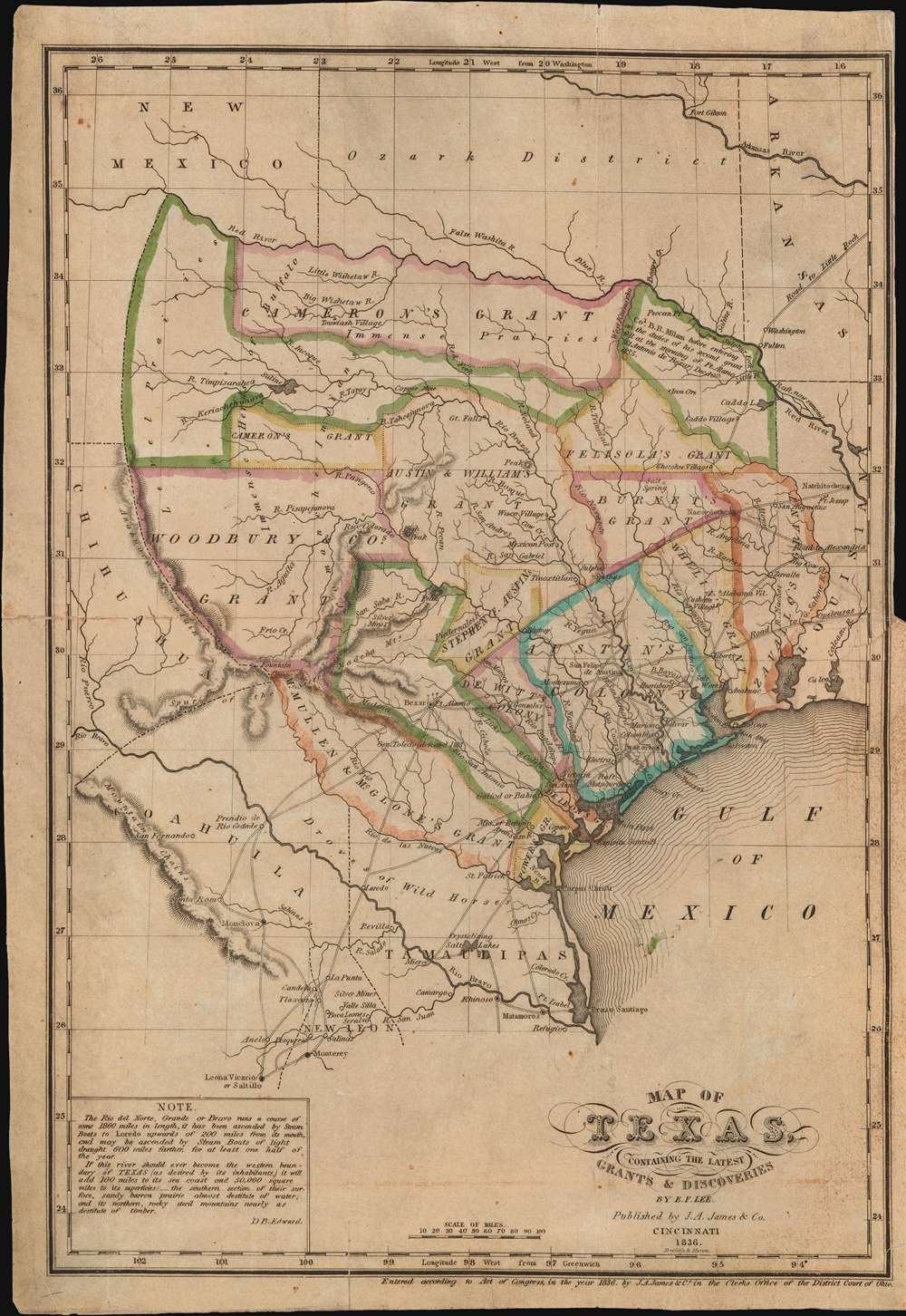

Title
Map of Texas, containing the latest Grants and Discoveries by E. F. Lee.
1836 (dated) 13 x 9.25 in (33.02 x 23.495 cm) 1 : 4435200
1836 (dated) 13 x 9.25 in (33.02 x 23.495 cm) 1 : 4435200
Description
FOR THE ORIGINAL ANTIQUE MAP, WITH HISTORICAL ANALYSIS, CLICK HERE.
Digital Map Information
Geographicus maintains an archive of high-resolution rare map scans. We scan our maps at 300 DPI or higher, with newer images being 600 DPI, (either TIFF or JPEG, depending on when the scan was done) which is most cases in suitable for enlargement and printing.
Delivery
Once you purchase our digital scan service, you will receive a download link via email - usually within seconds. Digital orders are delivered as ZIP files, an industry standard file compression protocol that any computer should be able to unpack. Some of our files are very large, and can take some time to download. Most files are saved into your computer's 'Downloads' folder. All delivery is electronic. No physical product is shipped.
Credit and Scope of Use
You can use your digial image any way you want! Our digital images are unrestricted by copyright and can be used, modified, and published freely. The textual description that accompanies the original antique map is not included in the sale of digital images and remains protected by copyright. That said, we put significant care and effort into scanning and editing these maps, and we’d appreciate a credit when possible. Should you wish to credit us, please use the following credit line:
Courtesy of Geographicus Rare Antique Maps (http://www.geographicus.com).
How Large Can I Print?
In general, at 300 DPI, you should at least be able to double the size of the actual image, more so with our 600 DPI images. So, if the original was 10 x 12 inches, you can print at 20 x 24 inches, without quality loss. If your display requirements can accommodate some loss in image quality, you can make it even larger. That being said, no quality of scan will allow you to blow up at 10 x 12 inch map to wall size without significant quality loss. For more information, it is best consult a printer or reprographics specialist.
Refunds
If the high resolution image you ordered is unavailable, we will fully refund your purchase. Otherwise, digital images scans are a service, not a tangible product, and cannot be returned or refunded once the download link is used.
Cartographer S
Edmund Francis Lee (1809 - July 18, 1857) was an American surveyor and civil engineer active in the early to mid-19th century. Lee is most famous for the 'Lee Map', the first survey of Mammoth Cave. Lee was born in Berlin, Connecticut and studied civil engineering at the American Literary, Scientific, and Military (A. L. S. M.) Academy. He relocated to Cincinnati, Ohio around 1835, where he drafted one of the first maps of Texas for Joseph A. James (1807 - 1882). Shortly thereafter he was contracted to chart the first 8 miles of Mammoth Cave. The subsequent map became the definitive map of Mammoth Cave until it was resurveyed in the 1880s. Subsequently in mid-1836, Lee relocated to Jeffersonville, Indiana where he taught geography, mathematics, drafting, surveying, and civil engineering in the newly formed Literary and Scientific Academy. He was apparently poorly suited to teaching, and resumed civil engineering, re-platting Jeffersonville and other towns in Kentucky in Indiana. In 1846 he was elected county surveyor of Louisville, Kentucky. In this position he completed, in 1850, a detailed topographical survey of Kentucky became the definitive map of the state throughout the Civil War (1861 - 1865). He also designed several cemeteries, including Cave Hill Cemetery, Louisville. More by this mapmaker...
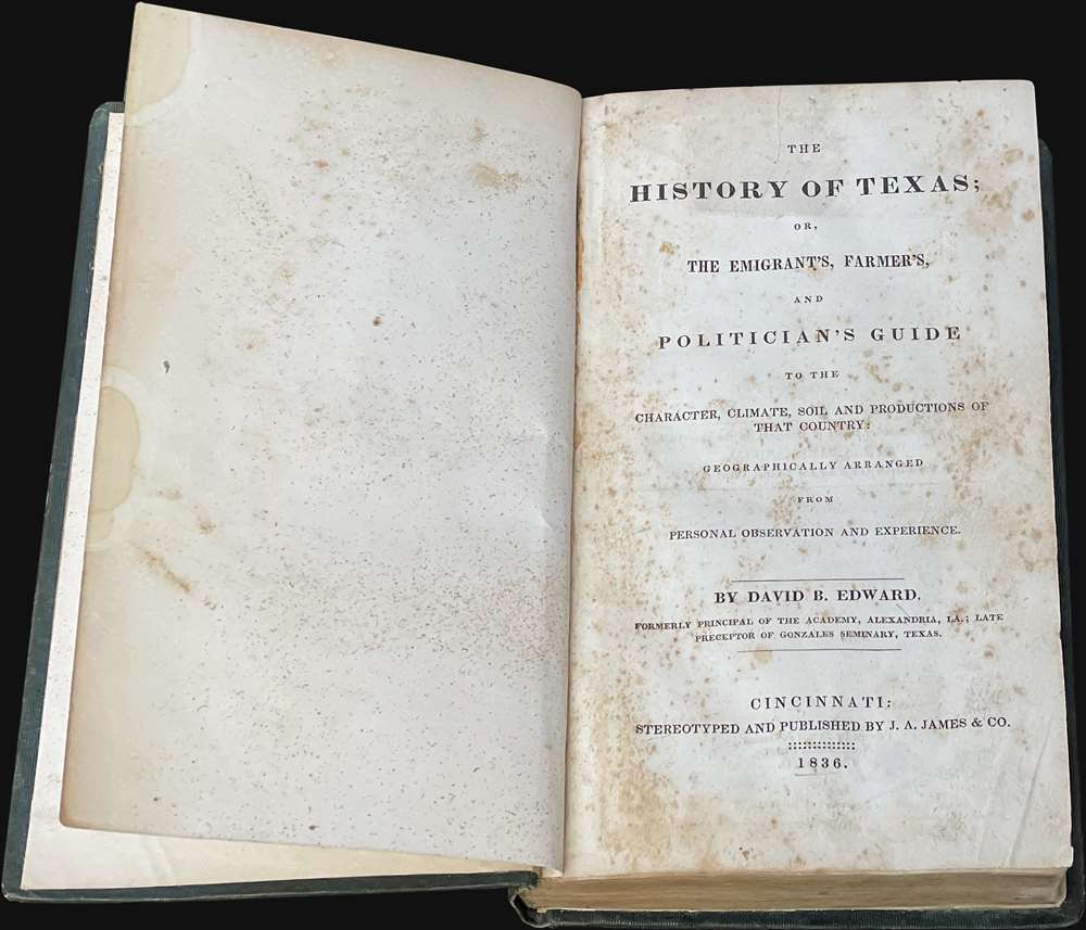
David Barnett Edward (1797 - 1870) was a Scottish-American educator, administer and explorer most associated with Texas. Edward was born in Forfarshire, Scotland. He lived in the West Indies and Columbia before immigrating to the United States in 1819. He worked as a teacher at the Academy of Alexandria, Louisiana before being transferred to the Gonzales Seminary at the DeWitt Colony, Texas. Around 1830, Edward participated in an exploratory mission around Texas, during which he formed a generally negative view of the English-speaking Empresarios then settling Texas. His subsequent work, The History of Texas: or, The Emigrant's, Farmer's, and Politician's Guide to the Character, Climate, Soil and Productions of that Country, written from 1831 to late 1835, and issued early in 1836, was issued on the eve of the Texan Revolution (March 1836). The work is detailed and based on first-hand knowledge, but generally pro-Mexican, anti-Anglo-Texan, and while thus unpopular in its day, is today considered one of the seminal publications on Texas. Around 1835, Edward, hated in Texas for his work, moved to Cincinnati, Ohio. He lived here until his 1870 death in Wheelersburg. Learn More...
Joseph Allen James (May 17, 1807 - March 27, 1882) was a bookseller, engraver, stereotype founder, and publisher active in Cincinnati in the early to late 19th century. He was born in Newark, New Jersey. His firm, J. A. James and Company was based at 1 Baker Street, between Walnut and Vine. Additionally, he partnered with his brother, Uriah Pierson James (1811 - 1889) in 'J.A. and U.P. James Company', also a stereotype foundry. He was also a partner in the printing concern 'James and Gazlay'. James died at Fort Monroe, Virginia in 1882. Learn More...
Curtis Miller Doolittle (August 26, 1799 - June 1, 1849) was an American artist, printer, and engraver. He was born in Westfield, Connecticut, the son of Amos Doolittle (1776 - 1858). Based upon the dates, this is not Amos Doolittle (1754 - 1832) the great American engraver, but may be his son, 'A. B. Doolittle', making Curtis Miller Doolittle his grandson. He relocated to Cincinnati, Ohio, sometime in the 1830s. From 1836, he partnered with Samuel Bishop Munson (1806 - 1880), likely a cousin, to found the bank note and map engraving firm of 'Doolittle and Munson.' Learn More...
Samuel Bishop Munson (May 29, 1806 - April 18, 1880) was an American engraver based in New Haven, Connecticut and later Cincinnati, Ohio. Munson was born in New Haven, Connecticut and studied engraving under Simeon Smith Jocelyn (1799 - 1879). He relocated to Cincinnati in 1836, immediately establishing a business partnership with Curtis Miller Doolittle (1799 - 1849), 'Doolittle and Munson', engravers of maps and bank notes. In 1838, he married Hannah Selina Sellew (1814 - 1861). Learn More...
Source
Edward, David, The History of Texas; or, The Emigrant's, Farmer's, and Poitician's Guide... (Cincinnati: J. A. James and Co.) 1836.