1945 83rd Infantry Div. WWII Pictorial Route Map of Western Europe w/ Booklet and Letter
ThunderboltAcrossEurope-83infdiv-1945$1,000.00

Title
83d United States Infantry Division. The Thunderbolt Division. The Thunderbolt Across Europe.
1945 (undated) 27.75 x 34.5 in (70.485 x 87.63 cm)
1945 (undated) 27.75 x 34.5 in (70.485 x 87.63 cm)
Description
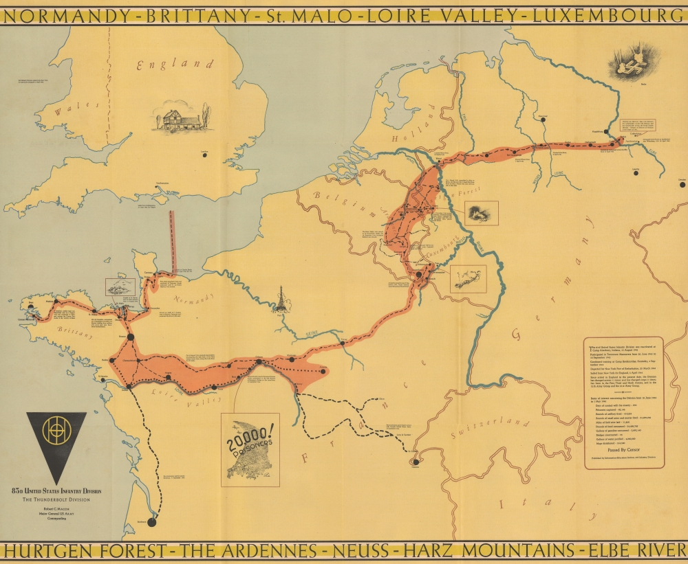
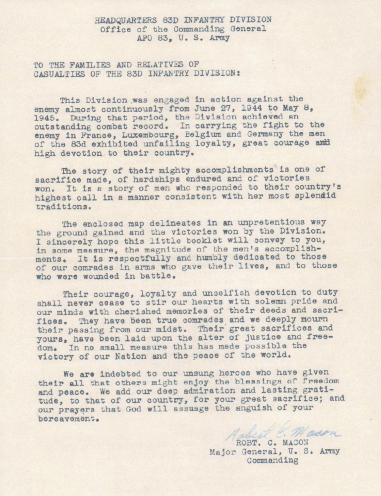
This is a 1945 83rd Infantry Division Information-Education Section World War II pictorial route map of Western Europe accompanied by a letter from General Robert Macon, the commanding officer of the 83rd Infantry Division. The letter offers unique insight into the production of this, and other, similar WWII route maps.
The Letter Describes the Map
Part of General Macon's letter reads as follows:The enclosed map delineates in an unpretentious way the ground gained and the victories won by the Division. I sincerely hope this little booklet will convey to you, in some measure, the magnitude of the men's accomplishments. It is respectfully and humbly dedicated to those of our comrades in arms who gave their lives, and to those who were wounded in battle.
A Closer Look
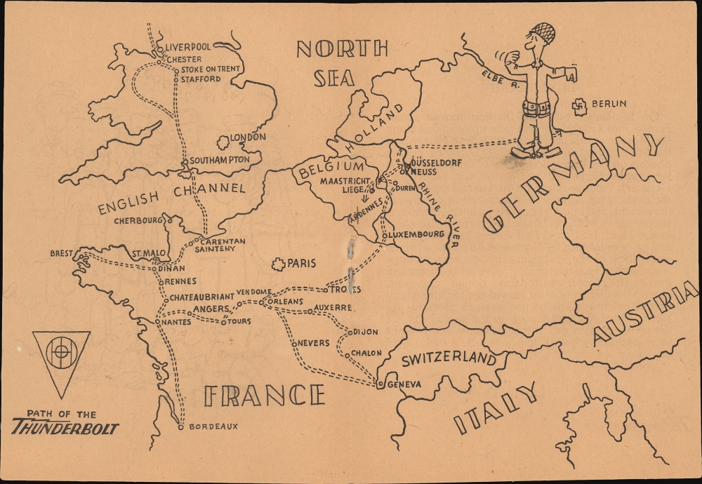
This piece is unusual as it was issued before V-E Day. The map follows the Division's movements from their departure from England on June 18, 1944, until they crossed the Elbe River and met the Soviet Red Army at Apollendorm on April 30, 1945. A burnt orange highlights this path, and small vignettes illustrate moments in the 83rd's drive across Europe, including the siege of the St. Servan citadel. Short texts provide context and describe events. A textbox in the lower right provides dates and statistics relevant to the Division's time in Europe, including the number of days of contact with the enemy (270), the number of prisoners captured (82,146), and the number of maps distributed (534,500).Verso Content
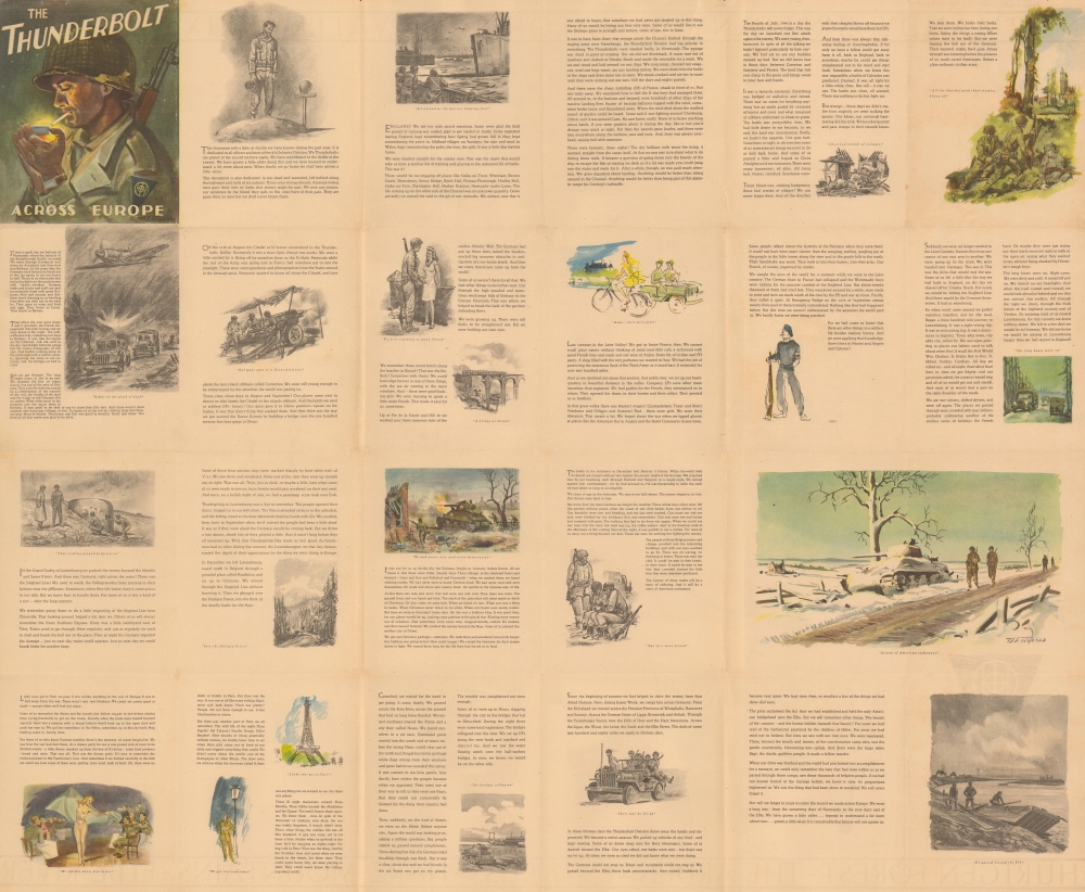
The verso features printed illustrations by Nicholas S. Firfires (1917 - 1990) and a detailed and candid history of the 83rd Infantry Division. This history chronicles the Division's movements from when it left England to its arrival on the Elbe River. Combat is discussed (but not in detail), and the joy experienced by liberated Europeans is often referenced. Women are also a prominent subject. There are also numerous very poignant statements. One of the most striking passages comes almost at the end:When our drive was finished and the world had proclaimed our accomplishment for a moment, we could only remember the hate that had risen within us as we passed through those camps, saw those thousands of helpless people. If we had not known hatred of the German before, we knew it now. Its proportions frightened us. We saw the thing that had been done to mankind. We will never forget it.
World War II Route Maps
Maps tracing unit movements during World War II were created by both American and British forces during and after the war. As a genre, these maps represent a broad range of aesthetics, from the purely functional that labels places and provides dates to the artistic, even comic. Many combine the three and provide a visually striking but historically informative summary of the unit's peregrinations.Publication History and Census
This map was created and published by the Information-Education Section of the 83rd Infantry Division and features illustrations by Nicholas S. Firfires (November 10, 1917 - September 21, 1990) on the verso. Firfires served with the combat engineers and created many 'on the spot' watercolor paintings of war scenes in Europe, as well as portraits of important military personnel. He went on to a distinguished career of scenes of cowboys and the American West. We note a single cataloged example in OCLC, located at Texas A and M University. The map appears on the private market occasionally.Condition
Very good. Light wear along original fold lines. Closed edge tears professionally repaired on verso. Verso repairs to fold separations. Small areas of infill at fold intersections and to pinholes in corners. Accompanied by letter from the commanding officer of the Division and a booklet unit history containing a small route map. The map has been removed from the booklet.
References
OCLC 1367363504.

