This item has been sold, but you can get on the Waitlist to be notified if another example becomes available, or purchase a digital scan.
1950 New World Press Pictorial Map of Tokyo
Tokyo-newworldpress-1950$75.00

Title
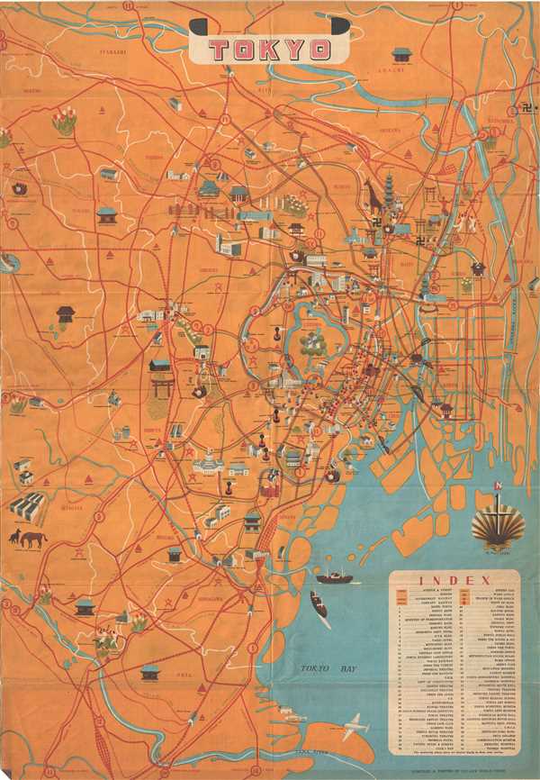
Tokyo.
1950 (undated) 30 x 21 in (76.2 x 53.34 cm)
1950 (undated) 30 x 21 in (76.2 x 53.34 cm)
Description
This is a beautiful c. 1950 pictorial map of Tokyo, Japan issued by the New World Press. Centered on the Imperial Palace, it covers from Tama River north to Itabashi. Throughout the map features beautifully illustrated temples, shrines, parks, bridges, buildings, monuments, government offices, activities, animals and other places of interest in profile. An index in the lower right quadrant notes the places marked on the map in the downtown area of Tokyo. Railway lines and streets are marked in red. Two ships are seen in the harbor. Verso features a pictorial map of the region. This map was drawn by T. Fujiyoshi and compiled and printed by the New World Press.
Condition
Very good. Minor wear along original fold lines, including some rips near intersections. Overall age toning and minor spotting.