This copy is copyright protected.
Copyright © 2025 Geographicus Rare Antique Maps
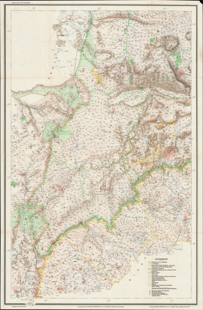
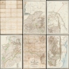
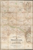
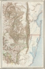
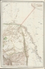
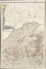
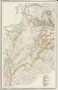
Digital Image: 1899 Jeppe Map of the Transvaal (5 sheets) w/ provenance
Transvaal-jeppe-1899_d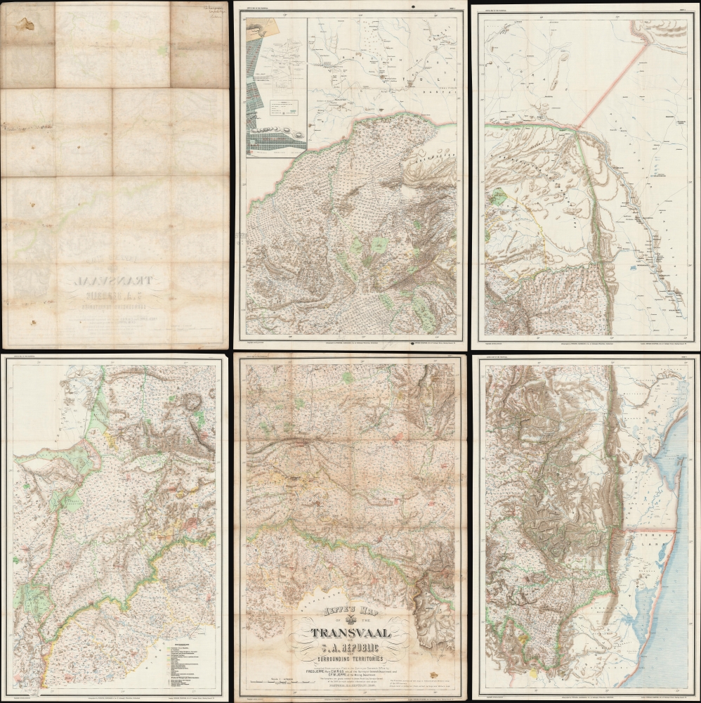


FOR THE ORIGINAL ANTIQUE MAP, WITH HISTORICAL ANALYSIS, CLICK HERE.
Digital Map Information
Geographicus maintains an archive of high-resolution rare map scans. We scan our maps at 300 DPI or higher, with newer images being 600 DPI, (either TIFF or JPEG, depending on when the scan was done) which is most cases in suitable for enlargement and printing.
Delivery
Once you purchase our digital scan service, you will receive a download link via email - usually within seconds. Digital orders are delivered as ZIP files, an industry standard file compression protocol that any computer should be able to unpack. Some of our files are very large, and can take some time to download. Most files are saved into your computer's 'Downloads' folder. All delivery is electronic. No physical product is shipped.
Credit and Scope of Use
You can use your digial image any way you want! Our digital images are unrestricted by copyright and can be used, modified, and published freely. The textual description that accompanies the original antique map is not included in the sale of digital images and remains protected by copyright. That said, we put significant care and effort into scanning and editing these maps, and we’d appreciate a credit when possible. Should you wish to credit us, please use the following credit line:
Courtesy of Geographicus Rare Antique Maps (http://www.geographicus.com).
How Large Can I Print?
In general, at 300 DPI, you should at least be able to double the size of the actual image, more so with our 600 DPI images. So, if the original was 10 x 12 inches, you can print at 20 x 24 inches, without quality loss. If your display requirements can accommodate some loss in image quality, you can make it even larger. That being said, no quality of scan will allow you to blow up at 10 x 12 inch map to wall size without significant quality loss. For more information, it is best consult a printer or reprographics specialist.
Refunds
If the high resolution image you ordered is unavailable, we will fully refund your purchase. Otherwise, digital images scans are a service, not a tangible product, and cannot be returned or refunded once the download link is used.
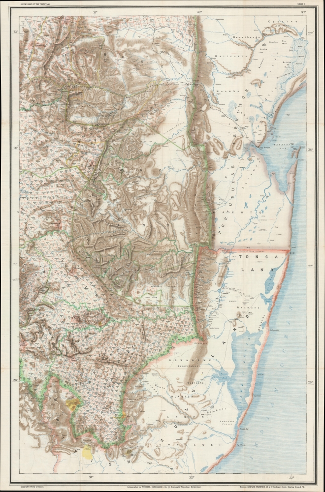
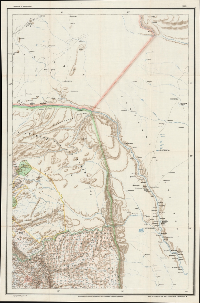
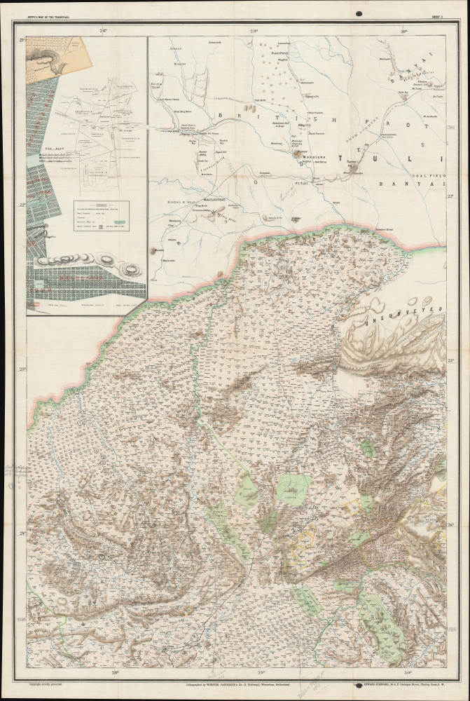
Friedrich Heinrich Jeppe (July 25, 1834 - July 17, 1898) was a German publisher, spy, and mapmaker active in South Africa during the second half of the 19th century. Jeppe was born in Rostock, Germany and relocated to South Africa with his two brothers in 1861. Although initial merchants, F. H. Jeppe took a position as postmaster in Potchefstrom, and later, became Postmaster-General of the Transvaal Republic, a position he maintained until 1875 - when he lost his appointment to political maneuvering. Jeppe published numerous important large-format maps of the Transvaal and South Africa from about 1867 onwards. He also published the Transvaal Almanac and Directory from about 1877 onwards. Also in that year, 1877, he was commissioned as Government Translator and Controller of Statistics in the office of the Colonial Secretary. Eventually he obtained the position of Chief Draughtsman in the Department of the Surveyor-General. There is considerable evidence to suggest that Jeppe was a British agent that actively channelled cartographic information to British authorities until the time of his death. Jeppe became ill with liver disease early in 1898 and died in Pretoria on July 17 of 1898 (interred at the Old Cemetery, Pretoria.) On the eve of his death, he was still actively working on his most ambitious map, and his final missive to friend and government official Johann Rissik, requested assistance to his son, Carlos Friedrich Wilhelm (Charles) Jeppe (1870 - 1900), in publishing the completed map. The massive 6-sheet map was finally published in 1899 - just in time for the Second Boer War (1899 - 1902). Although published posthumously, Jeppe's 1899 Map of the Transvaal or S.A. Republic. The maps was used by both sides during the war and proved one of the finest and most important maps of South Africa ever published. More by this mapmaker...
Jakob Schlumpf (August 7, 1857 - May 21, 1916) was a swiss printer based in Winterthur, Zurich, Switzerland. Schlumpf was born in Winterthur in 1857. He mastered lithography in French-speaking Switzerland from 1875 to 1879 before returning to Winterthur to set up his own press, Schnellpresse, in 1879. There he employed and trained his brother Heinrich Schlumpf. In 1890, he joined forces with Johann Randegger (1830 - 1900), who had earlier taken over the firm 'Joh. Wurster und Comp,' originally founded by Johann Ulrich Wurster (1814 - 1880) in 1842. The firm was renamed 'Wurster, Randegger und Cie.,' Schlumpf being the 'Cie.' As the youngest partner, the work of the firm fell increasingly on his shoulders, as did its good name. From 1890, when the elder surviving partner, Randegger, retired it was renamed 'Topographische Anstalt J. Schlumpf'. Under Schlumpf, the firm developed the novel technique of printing chromolithographic color on waxed silk or linen - a service popular with alpine enthusiasts, the military, and other enterprises that required durable filed maps. The publishing house adopted its last name, 'Kartographia Winterthur', in 1906. The firm formally closed its doors in 1924, when it filed for bankruptcy and was acquired by Orell Füssli Publishing. Learn More...
Edward Stanford (May 27, 1827 - November 3, 1904) was one of the most prolific map publishing firms of the late 19th century. The company began as a partnership in 1848 between the 21 year old Edward Stanford and the established map dealer Trelawney Saunders. By 1853 the partnership had dissolved and Edward Stanford took full control of the business. A subsequent series of expansions and exciting new map issues finally led to the production of Stanford's masterwork, "Stanford's Library Map of London". This map is still available and remains somewhat accurate. At the time of publishing it was hailed by the Royal Geographical Society as "the most perfect map of London that has ever been issued". In 1882 Edward Stanford Sr. passed the firm on to his son, Edward Stanford Jr. who continued in his father's proud tradition. Today the Stanford firm still publishes maps and remains one of the most important and prolific cartographic publishers in the world. Learn More...
Copyright © 2025 Geographicus Rare Antique Maps | Geographicus Rare Antique Maps
This copy is copyright protected.
Copyright © 2025 Geographicus Rare Antique Maps