Digital Image: 1796 Benjamin Taylor Manuscript Survey Map of Tribeca, New York and Indenture
Tribeca-taylor-1796_d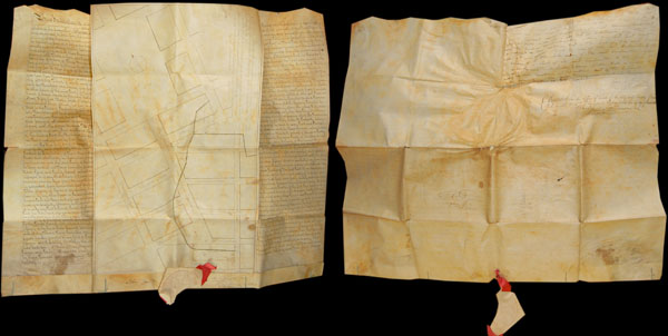

Title
A Map shewing the arrangemnt agreed to between the Corporation of Trinity Church, and the Proprietors of the Estate late Ireland's, with regard to Streets, &c. &c.
1796 (dated) 21 x 26 in (53.34 x 66.04 cm)
1796 (dated) 21 x 26 in (53.34 x 66.04 cm)
Description
FOR THE ORIGINAL ANTIQUE MAP, WITH HISTORICAL ANALYSIS, CLICK HERE.
Digital Map Information
Geographicus maintains an archive of high-resolution rare map scans. We scan our maps at 300 DPI or higher, with newer images being 600 DPI, (either TIFF or JPEG, depending on when the scan was done) which is most cases in suitable for enlargement and printing.
Delivery
Once you purchase our digital scan service, you will receive a download link via email - usually within seconds. Digital orders are delivered as ZIP files, an industry standard file compression protocol that any computer should be able to unpack. Some of our files are very large, and can take some time to download. Most files are saved into your computer's 'Downloads' folder. All delivery is electronic. No physical product is shipped.
Credit and Scope of Use
You can use your digial image any way you want! Our digital images are unrestricted by copyright and can be used, modified, and published freely. The textual description that accompanies the original antique map is not included in the sale of digital images and remains protected by copyright. That said, we put significant care and effort into scanning and editing these maps, and we’d appreciate a credit when possible. Should you wish to credit us, please use the following credit line:
Courtesy of Geographicus Rare Antique Maps (http://www.geographicus.com).
How Large Can I Print?
In general, at 300 DPI, you should at least be able to double the size of the actual image, more so with our 600 DPI images. So, if the original was 10 x 12 inches, you can print at 20 x 24 inches, without quality loss. If your display requirements can accommodate some loss in image quality, you can make it even larger. That being said, no quality of scan will allow you to blow up at 10 x 12 inch map to wall size without significant quality loss. For more information, it is best consult a printer or reprographics specialist.
Refunds
If the high resolution image you ordered is unavailable, we will fully refund your purchase. Otherwise, digital images scans are a service, not a tangible product, and cannot be returned or refunded once the download link is used.
Cartographer
Benjamin Taylor (1746 - 1832) was a New York city surveyor active in the post Revolutionary War period. Taylor was born in Yorktown, Westchester, New York. He enlisted with the Colonial Army at the age of 16 and served in several wars, including the French and Indian War and the American Revolutionary War. It was most likely during the war that Taylor developed his surveying expertise. After being discharged, on June 9th of 1783, Taylor established himself as contract surveyor in New York city. Taylor's corpus consists of countless surveys of various parts of New York, Brooklyn, Williamsburg, Harlem and Queens. He was a contemporary of Casmir Goerck, another well known surveyor of the period, and it is known that they collaborated on a number of important maps. Taylor is best known for his important map of New York City. He died in Fishkill, Dutchess County, New York in 1832. More by this mapmaker...
References
Dunn, J.P., Briefs and points: in miscellaneous proceedings…, volume 35, page 3.