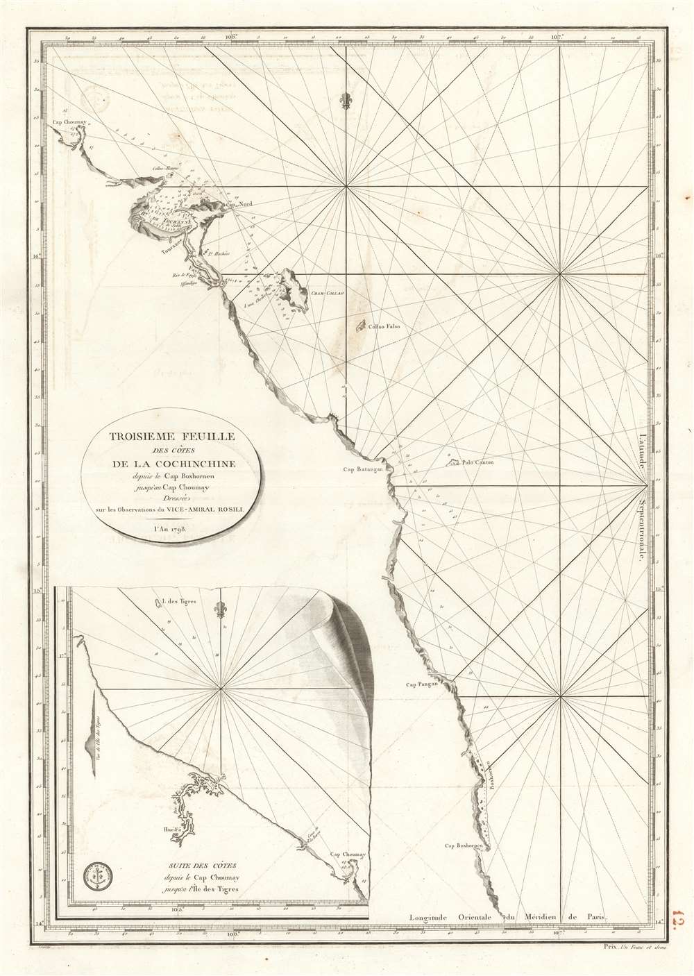
1798 Dépôt de la Marine Nautical Map of Vietnam
TroisiemeCochinchine-depot-1798
Title
1798 (dated) 28 x 19.5 in (71.12 x 49.53 cm) 1 : 500000
Description
A Closer Look
Coverage extends from modern-day Qui Nhon north to Chan May near Da Nang. A large inset in the bottom left covers the coast north of Cape Choumay (Chan May), including a coastal profile view.French Support for the Nguyễn Lord
When this map was surveyed, Vietnam was embroiled in the Tây Sơn Rebellion, a civil war that challenged the ruling Nguyễn and Trịnh lords. The Nguyễn lord, Nguyễn Ánh, was ousted from his stronghold in southern Vietnam and sought French assistance to regain power. Although the French government did not fully commit to supporting the Nguyễn, Pierre Pigneau de Behaine, a French advisor to Nguyễn Ánh, personally raised funds and recruited French officers and soldiers to support Nguyễn Ánh's cause. With this assistance, Nguyễn Ánh managed to modernize his army and navy, eventually defeating the Tây Sơn and establishing the Nguyễn Dynasty in 1802, becoming Emperor Gia Long, Vietnam's first unified emperor. By 1858, French support turned into French aggression, and by 1862, Emperor Tự Đức Nguyễn was forced to sign the Treaty of Saigon, ceding Gia Định (modern Saigon), Biên Hòa, and Định Tường (southern Vietnam) to France, marking the beginning of French colonial rule in Vietnam.Publication History and Census
The 1798 chart was compiled from the observations of Vice Admiral François Etienne de Rosily Mesros and engraved by P. Croisey for the Dépôt de la Marine.CartographerS
Dépôt des Cartes et Plans de la Marine (fl. 1720 - present), often called the Dépôt de Marine, was a French hydrographic mapping organization founded in 1720 under Charles-Hercule of Albert de Luynes (1674 - 1734). Much like the U.S. Coast Survey, the British Admiralty, and the Spanish Deposito Hydrografico, the Dépôt was initiated as a storehouse and distribution center of existing nautical and marine charts. Eventually the Dépôt initiated its own mapping activities in an attempt to improve and expand upon existing material. Some of the more prominent cartographers and hydrographers associated with the of Dépôt des Cartes were, Philippe Buache, Jacques-Nicholas Bellin, Giovanni Rizzi-Zannoni, Rigobert Bonne, and Jean Nicolas Buache. More by this mapmaker...
P. Croisey (fl. c. 1765 – c. 1800) was a French line-engraver active in the 18th century. Croisey was based in Versailles, France and is best known for his fine portrait of Marie Antoinette, when Dauphiness. He also maintained a location on Rue Haute-Feuille, Pairs. One of his early trade cards survives in which he describes himself as a geographical engineer and engraver of civil and military architecture, topography, and geography. His wife, Madame Croisey was also an engraver, specializing in music and text. He died around 1800. Learn More...

