This copy is copyright protected.
Copyright © 2025 Geographicus Rare Antique Maps
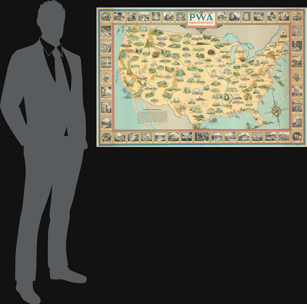
Digital Image: 1939 Earl Purdy PWA Pictorial Wall Map of the United States
UnitedStatesPBA-purdy-1939_d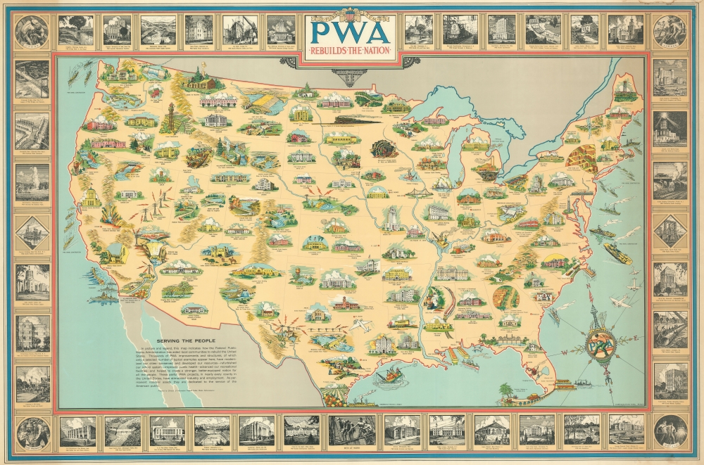

FOR THE ORIGINAL ANTIQUE MAP, WITH HISTORICAL ANALYSIS, CLICK HERE.
Digital Map Information
Geographicus maintains an archive of high-resolution rare map scans. We scan our maps at 300 DPI or higher, with newer images being 600 DPI, (either TIFF or JPEG, depending on when the scan was done) which is most cases in suitable for enlargement and printing.
Delivery
Once you purchase our digital scan service, you will receive a download link via email - usually within seconds. Digital orders are delivered as ZIP files, an industry standard file compression protocol that any computer should be able to unpack. Some of our files are very large, and can take some time to download. Most files are saved into your computer's 'Downloads' folder. All delivery is electronic. No physical product is shipped.
Credit and Scope of Use
You can use your digial image any way you want! Our digital images are unrestricted by copyright and can be used, modified, and published freely. The textual description that accompanies the original antique map is not included in the sale of digital images and remains protected by copyright. That said, we put significant care and effort into scanning and editing these maps, and we’d appreciate a credit when possible. Should you wish to credit us, please use the following credit line:
Courtesy of Geographicus Rare Antique Maps (http://www.geographicus.com).
How Large Can I Print?
In general, at 300 DPI, you should at least be able to double the size of the actual image, more so with our 600 DPI images. So, if the original was 10 x 12 inches, you can print at 20 x 24 inches, without quality loss. If your display requirements can accommodate some loss in image quality, you can make it even larger. That being said, no quality of scan will allow you to blow up at 10 x 12 inch map to wall size without significant quality loss. For more information, it is best consult a printer or reprographics specialist.
Refunds
If the high resolution image you ordered is unavailable, we will fully refund your purchase. Otherwise, digital images scans are a service, not a tangible product, and cannot be returned or refunded once the download link is used.
Earl Purdy (June 6, 1892 - April 22, 1971) was an American architect and artist active throughout the 20th century. Purdy as born in Cohoes, New York. He lived most of his lie in New Rochelle, New York. He served in the United States Navy during World War I before taking a degree in architecture at Colgate, then Cornell, the Columbia University. Graduating he worked with various architecture firms as a designer and draftsman. He was awarded the French Government Society des Archetects Première Medaille for excellence in design. As an artist, he completed work during the New Deal for the PWA, including a 1939 large-format pictorial map of the United States. He also designed the United Nations 'Geneva" stamp. His architectural work can be seen at the National Cemetery in Florence, the Veterans Hospital in Hawaii, Rye Playland, and Ringling House in Sarasota Florida. He was also a member of the American Institute of Architects, the American Watercolor Society, the University Men's Glee Club, and the University Club. He artworks includes a series of 34 caricatures hanging in the lounge of the Hotel Washington, Washington D.C., across the street from the White House. More by this mapmaker...
Copyright © 2025 Geographicus Rare Antique Maps | Geographicus Rare Antique Maps
This copy is copyright protected.
Copyright © 2025 Geographicus Rare Antique Maps