This item has been sold, but you can get on the Waitlist to be notified if another example becomes available, or purchase a digital scan.
1948 Highway 27 Association Pictorial Strip Highway Map of the Central United States
US27-highway27association-1948$125.00


Title
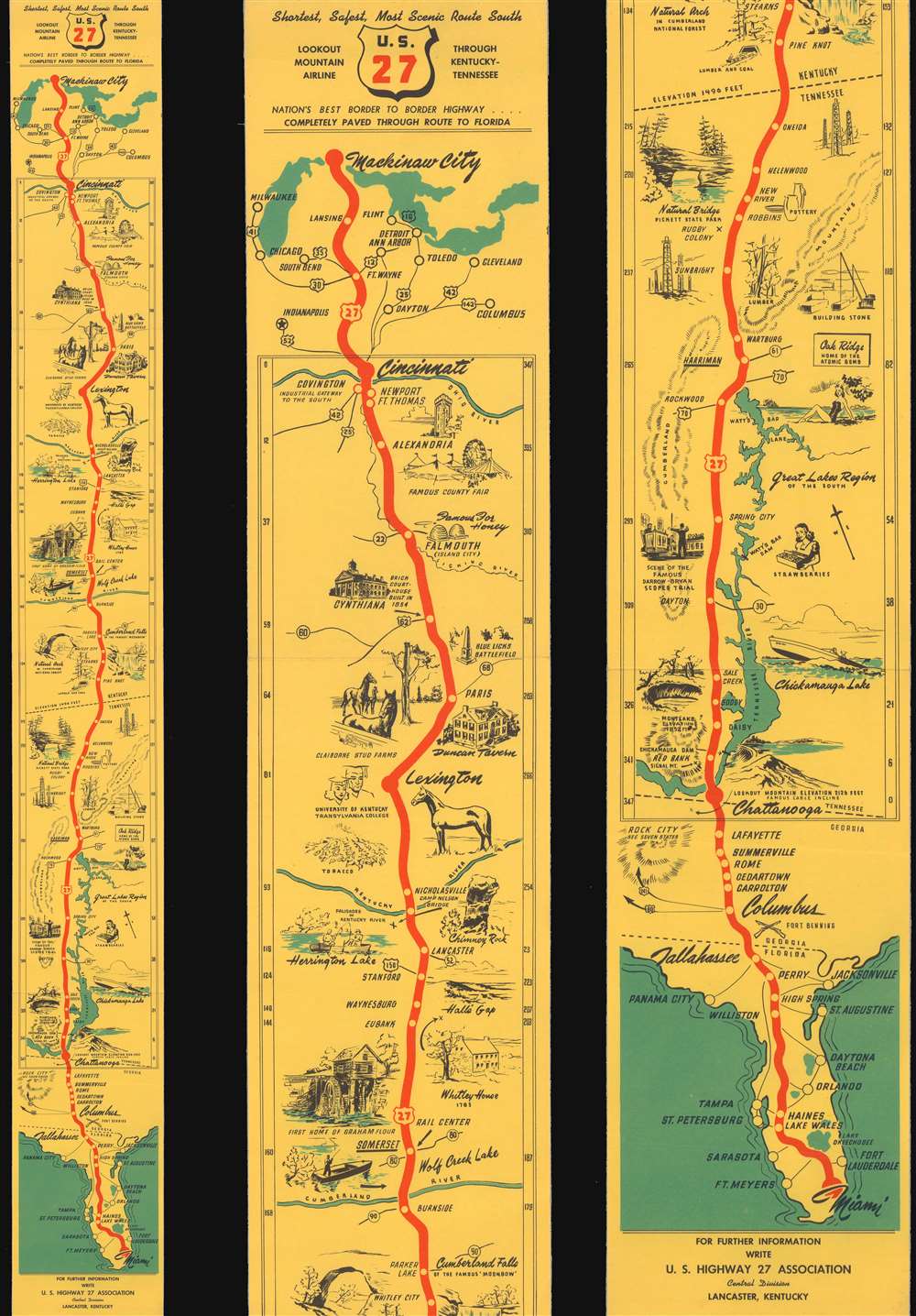
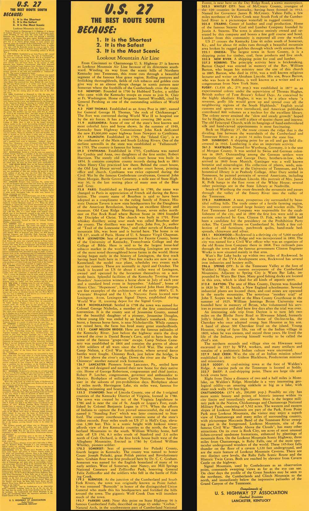
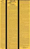
U.S. 27. Shortest, Safest, Most Scenic Route South. Nation's Best Border to Border Highway...Completely Paved Through Route to Florida.
1948 (undated) 34 x 4 in (86.36 x 10.16 cm)
1948 (undated) 34 x 4 in (86.36 x 10.16 cm)
Description
This is a c. 1948 U.S. Highway 27 Association pictorial strip highway map of central United States. The map traces Highway 27 from Mackinaw City in Michigan south through Indiana, Ohio, Kentucky, Tennessee, Georgia, and Florida all the way to Miami. The area between Cincinnati and Chattanooga is given particular attention, with pictorial vignettes highlighting potential sites of interest: a thoroughbred horse farm near Lexington, Kentucky, the nuclear facility at Oak Ridge, Tennessee, and the site of the famous (or infamous) Scopes Monkey Trial, Dayton, Tennessee.
Highway Associations
The movement promoting the construction of 'good quality' roads did not begin with the invention of the automobile, but rather with the bicycle. At the time, most interurban roads were unpaved and impractical for cycling. The 'Good Roads Movement' was inaugurated in May 1880 to advocate for bicycle enthusiasts, riding clubs, and manufacturers. By 1910, the American Automobile Association (AAA) jumped onboard, along with over one hundred other local and national organizations. 'Road booster' organizations emerged to promote specific, often branded, highways. By the 1920s, about 250 'named' highways, each with their own boosters, crossed the United States. 'Road boosters' still exist, but most disbanded in the 1950s and 60s with the emergence federally funded Interstate Highway System.Dating the Map
While undated, information printed on the verso allows us to approximate a publication date. When discussing the virtues of Burnside, Kentucky, the text states that 'the gigantic Wolf Creek Dam will inundate much of the town'. The Wolf Creek Dam was closed in 1950 and opened in 1951. As the map is using the future tense to describe the dam, is was likely published not long before completion.Publication History and Census
This map was created and published by the U.S. Highway 27 Association c. 1948. We note no other cataloged examples.Condition
Very good. Exhibits light wear along original fold lines. Text on verso.