This item has been sold, but you can get on the Waitlist to be notified if another example becomes available, or purchase a digital scan.
1948 Szapiro Map of the 1948 Arab - Israeli War in Hebrew
WarringIsrael-szapiro-1948$175.00

Title
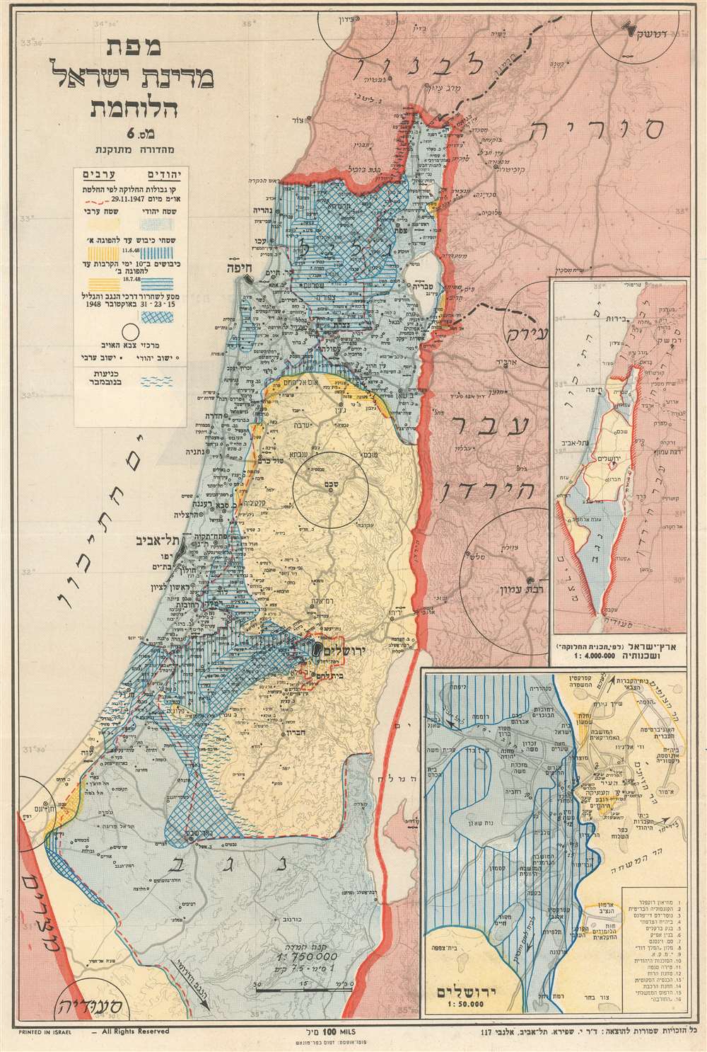
Map of the Warring State of Israel Revised Edition. / מפת מדינת ישראל הלוחמת מהדורה מתוקנת
1948 (undated) 17.25 x 11.5 in (43.815 x 29.21 cm) 1 : 750000
1948 (undated) 17.25 x 11.5 in (43.815 x 29.21 cm) 1 : 750000
Description
This is a c. 1948 Joseph Szapiro (Schapiro) map of Israel just after the end of the 1948 Arab-Israeli War which secured Israeli independence. Depicting the region from the Mediterranean Sea to Transjordan and from Lebanon to Saudi Arabia, the map focuses on the state of Israel as it existed after the war. Szapiro uses four different shading methods to trace the progress of the war, from the boundaries set for an Israeli State and and Arab State by the United Nations in November 1947, separated by the red dashed line, to the area conquered by the Israelis in October 1948 in Galilee and the Negev. Jerusalem, Haifa, and Tel Aviv are labeled and marked by black outlines of their city limits. Two inset maps are situated in the lower right corner. The smaller of the two depicts Eretz Israel as it existed per the 1947 United Nations agreement. The larger of the two details Jerusalem, labeling locations throughout the city, sixteen of which are numerically identified and correspond with a table in the lower right corner.
Publication History
This map was created by Dr. Joseph Szapiro and published and printed in Israel c. 1948.Condition
Very good. Light wear along original fold lines. Text on verso.