This item has been sold, but you can get on the Waitlist to be notified if another example becomes available, or purchase a digital scan.
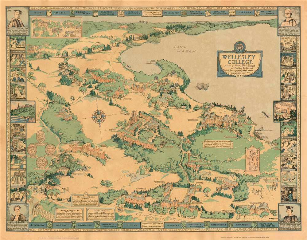
1943 Sturges Pictorial Map of Wellesley College
Wellesley-sturges-1943
Title
1943 (dated) 20.75 x 27.5 in (52.705 x 69.85 cm)
Description
Nisi Dominus aedificaverit domum, in vanum laboraverunt qui aedificant eum : Unless God builds the house, its builders work in vain.The composition is oriented to the south (as indicated with an elegant compass rose). Central Street forms the bottom limit of the map, with Lake Waban dominating the background. Amongst the campus' woods and fields are shown the College's buildings, with sharp architectural accuracy. Each is named - or in some cases, marked with symbols. For example, buildings associated with academic societies are marked with their emblems, and the College's Shakespeare society is marked with a thespian's mask. Students are pictured throughout the composition: some merely walking to and fro, but a crowd of mortarboarded graduates troops into Alumnae Hall, and groups of students can be seen at play: field hockey, lacrosse, tennis, badminton and rowing can all be found on the map.
A series of vignettes - drawn from photographs for the most part - highlight signal events in the College's history, as well as activities familiar to the Wellesley graduate but obscure to outsiders.
Mayling Returns
The year this view was produced saw a campus visit from Soong Mei-ling, otherwise known as Madame Chiang Kai-Shek. Mei-ling had been educated with her sisters in the United States, and she had graduated from Wellesley in 1917 having transferred there from Wesleyan. She majored in English Literature and minored in Philosophy, became a member of Tau Zeta Epsilon and was named a Durant Scholar, the highest academic distinction conferred by the College. By 1927, she was married to Chiang Kai-shek, a partnership that lasted 48 years. During the years of war with Japan, Mei-ling undertook several tours of the United States to lobby for support for the Nationalists' war effort, aided both by her American education (and Georgia accent.) It was during the 1943 tour that she visited her alma mater.After The Fire!
On March 17, 1914, a fire broke out on the fourth floor of College Hall, the main campus building. Though it spread rapidly, gutting he structure in hours, no lives were lost, thanks to a rigorous fire drill system. That year's graduation, students (seated, forming the numbers 1914) were photographed on the hillside under the gaping ruins. This picture has been reproduced here.Hoop Rolling
Amongst the various physical activities celebrated in the border vignettes (swimming, skiing, and basketball for example) the traditional Wellesley hoop rolling race appears prominently. The race is performed by graduating seniors, with participating roles for 'Little Sisters'. It runs the length of Tupelo Lane (not named on the map but visible, connecting Founders' and Billings Halls, and running on towards the lake - presumably to Tupelo Point, which is marked and named.) The winner of the race is proclaimed to be the first of the graduating class to achieve happiness and success, and is then hurled by her classmates into Lake Waban.Publication History and Census
The map was published locally, at Hathaway House (which even appears in the view, at the corner of Central and Weston.) It is scarce. OCLC lists two examples only, both at Harvard University. While we are aware of two examples that have appeared on the market, there are no catalogue or auction records for this piece.Cartographer
Rosalind Howe Sturges (1907-1999) was an American artist and architectural cartographer known for illustrated pictorial maps using architectural images to create a sense of place. She was the daughter of an antiques dealer and an architect, and became architecture early on. Her first professionally produced map was a view of Vassar College, executed the year she graduated from that school, in 1928. Her oeuvre focused on New England and the Mid-Atlantic region, and includes views of Annapolis, Bristol, Providence, Chestnut Hill and Philadelphia, Blackstone Valley, Deerfield, Groton, Hingham, Princeton, and Worcester, and the campus of Wellesley College. Her manuscripts and working materials are housed at Vassar College. More by this mapmaker...

