Digital Image: 1952 Glaubke Wild Bill Hickok Pictorial Treasure Map of the United States
WildBillTreasureMap-glaubke-1952-2_d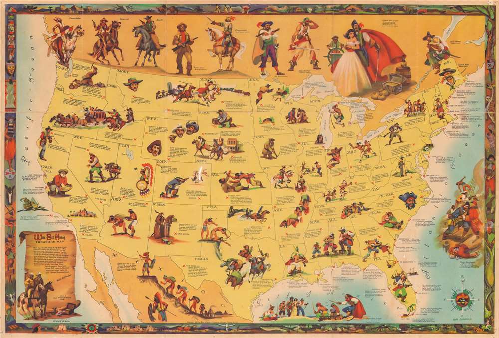


Title
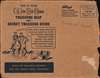
Wild Bill Hickok Treasure Map.
1952 (dated) 23.75 x 35.25 in (60.325 x 89.535 cm) 1 : 5850000
1952 (dated) 23.75 x 35.25 in (60.325 x 89.535 cm) 1 : 5850000
Description
FOR THE ORIGINAL ANTIQUE MAP, WITH HISTORICAL ANALYSIS, CLICK HERE.
Digital Map Information
Geographicus maintains an archive of high-resolution rare map scans. We scan our maps at 300 DPI or higher, with newer images being 600 DPI, (either TIFF or JPEG, depending on when the scan was done) which is most cases in suitable for enlargement and printing.
Delivery
Once you purchase our digital scan service, you will receive a download link via email - usually within seconds. Digital orders are delivered as ZIP files, an industry standard file compression protocol that any computer should be able to unpack. Some of our files are very large, and can take some time to download. Most files are saved into your computer's 'Downloads' folder. All delivery is electronic. No physical product is shipped.
Credit and Scope of Use
You can use your digial image any way you want! Our digital images are unrestricted by copyright and can be used, modified, and published freely. The textual description that accompanies the original antique map is not included in the sale of digital images and remains protected by copyright. That said, we put significant care and effort into scanning and editing these maps, and we’d appreciate a credit when possible. Should you wish to credit us, please use the following credit line:
Courtesy of Geographicus Rare Antique Maps (http://www.geographicus.com).
How Large Can I Print?
In general, at 300 DPI, you should at least be able to double the size of the actual image, more so with our 600 DPI images. So, if the original was 10 x 12 inches, you can print at 20 x 24 inches, without quality loss. If your display requirements can accommodate some loss in image quality, you can make it even larger. That being said, no quality of scan will allow you to blow up at 10 x 12 inch map to wall size without significant quality loss. For more information, it is best consult a printer or reprographics specialist.
Refunds
If the high resolution image you ordered is unavailable, we will fully refund your purchase. Otherwise, digital images scans are a service, not a tangible product, and cannot be returned or refunded once the download link is used.
Cartographer S
Robert Glaubke (fl. c. 1935 - 1970) was an American artist and illustrator. Glaubke lived in Chicago for most of his life and gained the nickname 'Hemingway of the paint brush'. He served as a combat artist in the South Pacific with the U.S. Marines during World War II. Glaubke drew inspiration from his experiences in World War II and from everyday life. On one trip to Mexico, he lived among peasants and returned with seventy-five painting and hundreds of slide films. Glaubke gained a reputation for authentic research and absolute truth in his work, which led him to be in demand by educational publishers. Over time he developed a specialty in adventure and wild life illustrations, and was also hired by Rand McNally to work on several pictorial maps. He graduated from the Chicago Academy of Fine Arts. More by this mapmaker...
Thomas Penfield (fl. c. 1955 - 1990) was an American author and treasure hunter. He wrote several books revolving around lost and hidden American treasure troves, including Lost Treasure Trails, Dig Here!, Western Sheriffs and Marshals, and Around the World with the Fighting Yanks. He graduated from the University of Nebraska. Learn More...
Rand, McNally and Co. (fl. 1856 - present) is an American publisher of maps, atlases and globes. The company was founded in 1856 when William H. Rand, a native of Quincy, Massachusetts, opened a print shop in Chicago. Rand hired the recent Irish immigrant Andrew McNally to assist in the shop giving him a wage of 9 USD per week. The duo landed several important contracts, including the Tribune's (later renamed the Chicago Tribune) printing operation. In 1872, Rand McNally produced its first map, a railroad guide, using a new cost effective printing technique known as wax process engraving. As Chicago developed as a railway hub, the Rand firm, now incorporated as Rand McNally, began producing a wide array of railroad maps and guides. Over time, the firm expanded into atlases, globes, educational material, and general literature. By embracing the wax engraving process, Rand McNally was able to dominate the map and atlas market, pushing more traditional American lithographic publishers like Colton, Johnson, and Mitchell out of business. Eventually Rand McNally opened an annex office in New York City headed by Caleb S. Hammond, whose name is today synonymous with maps and atlases, and who later started his own map company, C. S. Hammond & Co. Both firms remain in business. Learn More...
References
Rumsey 9527.000. OCLC 856903117, 494690020.