This copy is copyright protected.
Copyright © 2025 Geographicus Rare Antique Maps
1935 Mora Haynes Pictorial Map of Yellowstone National Park
Yellowstone-morahaynes-1935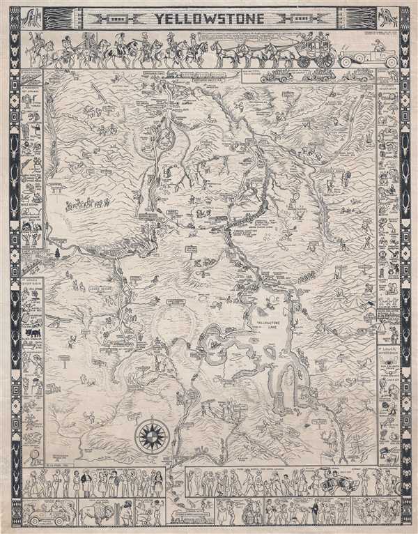

Joseph 'Jo' Jancito Mora (October 22, 1876 – October 10, 1947) was an Uruguayan born artist active in California during the first half of the 20th century. Mora immigrated to California as a young man. He studied art in Boston and, after graduating, worked there briefly before relocating to California. In cartographic circles Mora is known for pioneering the 20th century pictorial map. In a series he referred to as his 'cartes,' published between in 1926 and 1942, Mora developed a pictorial style that combined cartography with colorful cartoonish image of local figures, folklore, history, and natural wonders. His earliest maps were commissioned by the Hotel Del Monte and included California's Playground and The Seventeen Mile Drive. As he matured as a cartographer, his work became increasingly dense, often packed with tiny figures, each expressive of some aspect of regional life. Mora, often called the 'Renaissance man of the West' also worked as an illustrator, muralist, sculptor, photographer, and writer. His masterpiece is considered to be the Father Serra Cenotaph, a bronze and marble sculpture at the Memorial Chapel in El Carmelo Mission, Carmel, California. His map work included Monterey Penninsula (1927), and Seventeen Mile Drive (1927), California (1927), Grand Canyon (1931), Yosemite (1931), Yellowstone (1936), Carmel-By-The-Sea (1942), California (1945) (large and small versions), Map of Los Angeles (1942), among others. More by this mapmaker...
Jack Ellis Haynes (1884 – 1962) and his father Frank J. Haynes (1853 – 1921) are photo historians of Yellowstone National Park. Frank Haynes was originally employed by the Northern Pacific Railroad as a photographer to photograph the route from Minnesota to the West Coast for advertisements. In 1884, Frank obtained leases on two different four-acre plots of land in Yellowstone National Park, one near Old Faithful and the other near Mammoth Hot Springs, and opened his first photo shop. Frank eventually operated photo shops at all major sites within Yellowstone Park. When Frank retired in 1916, Jack took over the photo business. Jack married Isabel Haynes in 1830 and settled with her in Bozeman, Montana. Eventually, due to his dedication to the park, Jack earned the nickname 'Mr. Yellowstone'. After his death in 1962, Isabel operated the thirteen photo shops located within Yellowstone until she sold the business to Hamilton Stores in 1967. Learn More...
Copyright © 2025 Geographicus Rare Antique Maps | Geographicus Rare Antique Maps
This copy is copyright protected.
Copyright © 2025 Geographicus Rare Antique Maps