Digital Image: 1818 Pinkerton Map of Nubia, Sudan and Abyssinia
Abyssinia-pinkerton-1818_d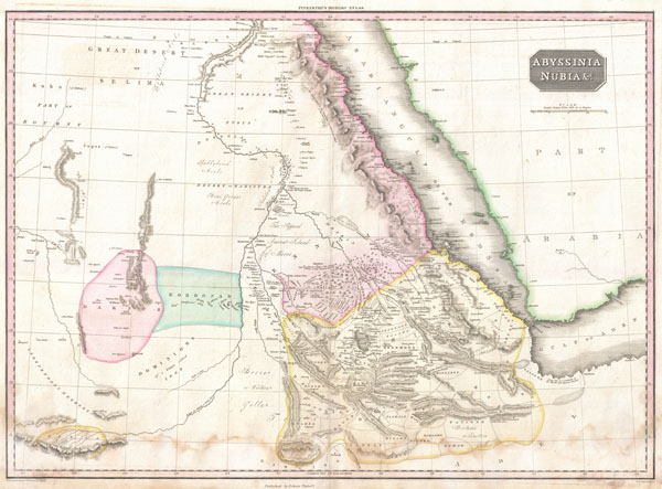

Title
Abyssinia, Nubia & c.
1818 (undated) 20 x 28 in (50.8 x 71.12 cm)
1818 (undated) 20 x 28 in (50.8 x 71.12 cm)
Description
FOR THE ORIGINAL ANTIQUE MAP, WITH HISTORICAL ANALYSIS, CLICK HERE.
Digital Map Information
Geographicus maintains an archive of high-resolution rare map scans. We scan our maps at 300 DPI or higher, with newer images being 600 DPI, (either TIFF or JPEG, depending on when the scan was done) which is most cases in suitable for enlargement and printing.
Delivery
Once you purchase our digital scan service, you will receive a download link via email - usually within seconds. Digital orders are delivered as ZIP files, an industry standard file compression protocol that any computer should be able to unpack. Some of our files are very large, and can take some time to download. Most files are saved into your computer's 'Downloads' folder. All delivery is electronic. No physical product is shipped.
Credit and Scope of Use
You can use your digial image any way you want! Our digital images are unrestricted by copyright and can be used, modified, and published freely. The textual description that accompanies the original antique map is not included in the sale of digital images and remains protected by copyright. That said, we put significant care and effort into scanning and editing these maps, and we’d appreciate a credit when possible. Should you wish to credit us, please use the following credit line:
Courtesy of Geographicus Rare Antique Maps (https://www.geographicus.com).
How Large Can I Print?
In general, at 300 DPI, you should at least be able to double the size of the actual image, more so with our 600 DPI images. So, if the original was 10 x 12 inches, you can print at 20 x 24 inches, without quality loss. If your display requirements can accommodate some loss in image quality, you can make it even larger. That being said, no quality of scan will allow you to blow up at 10 x 12 inch map to wall size without significant quality loss. For more information, it is best consult a printer or reprographics specialist.
Refunds
If the high resolution image you ordered is unavailable, we will fully refund your purchase. Otherwise, digital images scans are a service, not a tangible product, and cannot be returned or refunded once the download link is used.
Cartographer S
John Pinkerton (February 17, 1758 - March 10, 1826) was an Scottish writer, historian, and cartographer. Pinkerton was born in Edinburgh, Scotland. He was a studious youth with a passion for the classics. As a young man, he studied at Edinburgh University before apprenticing as a lawyer. Around this time, he began writing, with his first book, Elegy on Craigmillar Castle published in 1776. Pinkerton moved to London in 1781 to pursue his writing career in earnest. He successfully published several works of literature, poetry, and history. Pinkerton proved passionate in his literary and historical writings, but his correspondence with other cartographers has been labeled as aggressive, even insane. In addition to his work as a writer and historian, Pinkerton was one of the leading masters of the Edinburgh school of cartography which flourished from roughly 1800 to 1830. Pinkerton and his contemporaries (Thomson and Cary) redefined European cartography by abandoning typical 18th century decorative elements such as elaborate title cartouches and fantastical beasts in favor of detail and accuracy. Pinkerton's principle work is Pinkerton's Modern Atlas published from 1808 through 1815 with a special American reissue by Dobson and Co. in 1818. Pinkerton relocated to Paris in 1818, where he managed his publishing business until his death in 1826. More by this mapmaker...
Thomas Dobson (1751 - 1823) was an American publisher active in Philadelphia during the late 18th and early 19th centuries. Dobson was born in Edinburgh, Scotland in 1751 and emigrated to Philadelphia c. 1780. In Philadelphia, he established a successful printing business by republishing edited and updated versions of important British reference materials in matching quality but at a much lower price point. He is best known for publishing the first American edition of the Encyclopedia Britannica. He also published America's first Hebrew Bible. Cartographically Dobson's most notable work is 1818 republication of Pinkerton's fantastic Modern Atlas. Learn More...
References
Rumsey 0732.58. Phillips (Atlases) 724. National Maritime Museum, 409.