This copy is copyright protected.
Copyright © 2025 Geographicus Rare Antique Maps
Digital Image: 1852 Bocage Map of Africa
Afrique-bocage-1852_d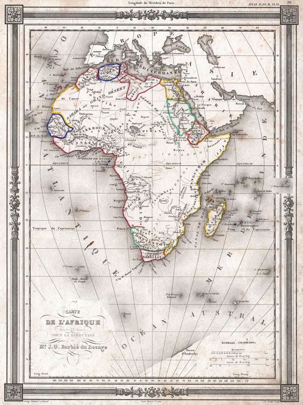

FOR THE ORIGINAL ANTIQUE MAP, WITH HISTORICAL ANALYSIS, CLICK HERE.
Digital Map Information
Geographicus maintains an archive of high-resolution rare map scans. We scan our maps at 300 DPI or higher, with newer images being 600 DPI, (either TIFF or JPEG, depending on when the scan was done) which is most cases in suitable for enlargement and printing.
Delivery
Once you purchase our digital scan service, you will receive a download link via email - usually within seconds. Digital orders are delivered as ZIP files, an industry standard file compression protocol that any computer should be able to unpack. Some of our files are very large, and can take some time to download. Most files are saved into your computer's 'Downloads' folder. All delivery is electronic. No physical product is shipped.
Credit and Scope of Use
You can use your digial image any way you want! Our digital images are unrestricted by copyright and can be used, modified, and published freely. The textual description that accompanies the original antique map is not included in the sale of digital images and remains protected by copyright. That said, we put significant care and effort into scanning and editing these maps, and we’d appreciate a credit when possible. Should you wish to credit us, please use the following credit line:
Courtesy of Geographicus Rare Antique Maps (http://www.geographicus.com).
How Large Can I Print?
In general, at 300 DPI, you should at least be able to double the size of the actual image, more so with our 600 DPI images. So, if the original was 10 x 12 inches, you can print at 20 x 24 inches, without quality loss. If your display requirements can accommodate some loss in image quality, you can make it even larger. That being said, no quality of scan will allow you to blow up at 10 x 12 inch map to wall size without significant quality loss. For more information, it is best consult a printer or reprographics specialist.
Refunds
If the high resolution image you ordered is unavailable, we will fully refund your purchase. Otherwise, digital images scans are a service, not a tangible product, and cannot be returned or refunded once the download link is used.
Jean Denis Barbie du Bocage (1760 - 1825) and his son Jean-Guillaume Barbie du Bocage (1795 - 1848) were French cartographers and cosmographers active in Paris during late 18th and early 19th centuries. The elder Barbie du Bocage, Jean Denis, was trained as a cartographer and engraver in the workshops of mapmaking legend J. B. B. d'Anville. At some point Jean Denis held the post of Royal Librarian of France and it was through is associations with d'Anville that the d'Anville collection of nearly 9000 maps was acquired by French Ministry of Foreign Affairs. The younger Barbie du Bocage, Jean-Guillaume, acquired a position shortly afterwards at the Ministry of Foreign Affairs and, in time, became its head, with the title of Geographe du Ministere des Affaires Etrangeres. More by this mapmaker...
Maison Basset (1819 - 1865) was a French publishing concern active through the mid to late 19th century. The firm can trace their roots to André Basset (or Bassett) (fl. 1768 - 1784), who starting publishing maps, prints, and books around 1768. Maison Basset, also Chez Basset, is the imprint under which the heirs of Paul-André Basset (1785 - 1819) operated after his death. From their offices at 64 Rue St. Jacques, then 33 Rue de Seine, Paris, France, Maison Basset published the works of such prominent French cartographers and engravers as Barbie du Bocage, A. Vuillemin, J. B. Charle, V. Levasseur, Tu. Duvotenay, H. Dufor, F. E. George, and others. Their library of publications is diverse and vast, but heavily focused on medical and scientific texts, including several important atlases. Learn More...
Copyright © 2025 Geographicus Rare Antique Maps | Geographicus Rare Antique Maps
This copy is copyright protected.
Copyright © 2025 Geographicus Rare Antique Maps