Digital Image: 1875 Mullins Map of Central Madagascar
CentralMadagascar-mullens-1875_d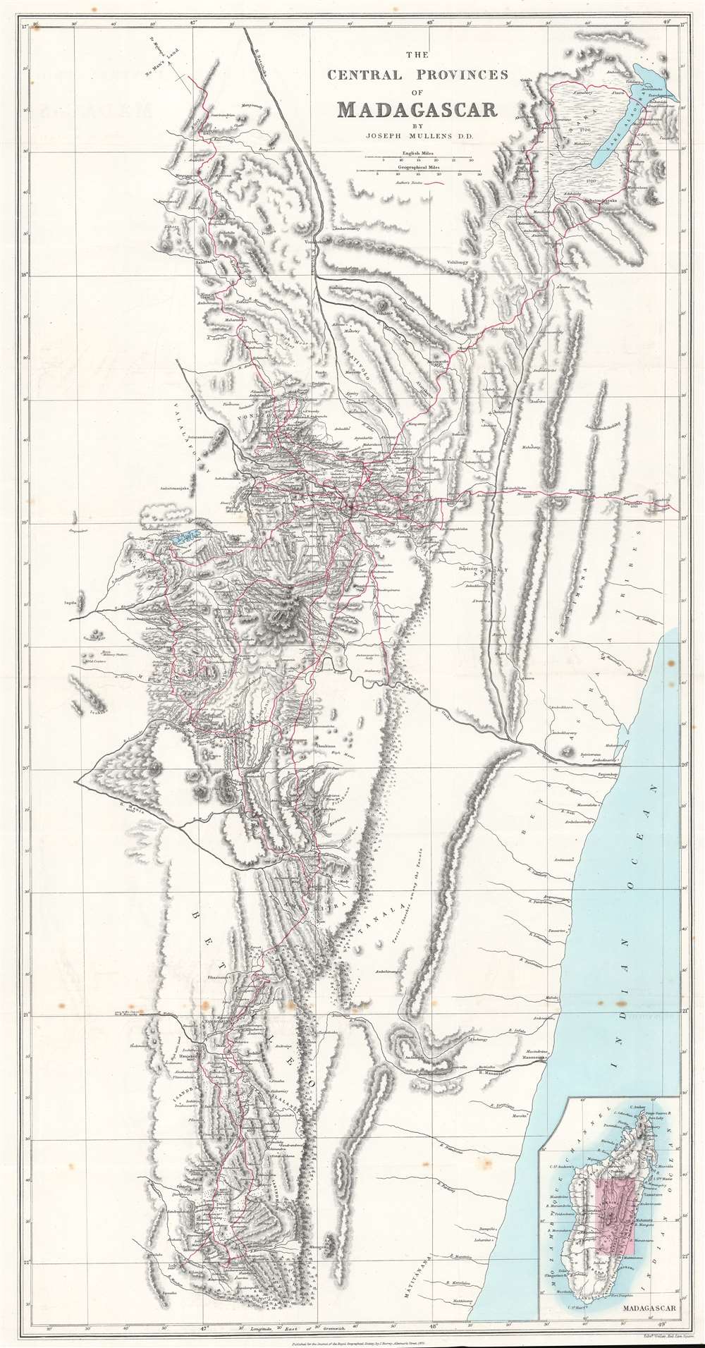

Title
The Central Provinces of Madagascar.
1875 (dated) 31.25 x 16.25 in (79.375 x 41.275 cm) 1 : 760320
1875 (dated) 31.25 x 16.25 in (79.375 x 41.275 cm) 1 : 760320
Description
FOR THE ORIGINAL ANTIQUE MAP, WITH HISTORICAL ANALYSIS, CLICK HERE.
Digital Map Information
Geographicus maintains an archive of high-resolution rare map scans. We scan our maps at 300 DPI or higher, with newer images being 600 DPI, (either TIFF or JPEG, depending on when the scan was done) which is most cases in suitable for enlargement and printing.
Delivery
Once you purchase our digital scan service, you will receive a download link via email - usually within seconds. Digital orders are delivered as ZIP files, an industry standard file compression protocol that any computer should be able to unpack. Some of our files are very large, and can take some time to download. Most files are saved into your computer's 'Downloads' folder. All delivery is electronic. No physical product is shipped.
Credit and Scope of Use
You can use your digial image any way you want! Our digital images are unrestricted by copyright and can be used, modified, and published freely. The textual description that accompanies the original antique map is not included in the sale of digital images and remains protected by copyright. That said, we put significant care and effort into scanning and editing these maps, and we’d appreciate a credit when possible. Should you wish to credit us, please use the following credit line:
Courtesy of Geographicus Rare Antique Maps (https://www.geographicus.com).
How Large Can I Print?
In general, at 300 DPI, you should at least be able to double the size of the actual image, more so with our 600 DPI images. So, if the original was 10 x 12 inches, you can print at 20 x 24 inches, without quality loss. If your display requirements can accommodate some loss in image quality, you can make it even larger. That being said, no quality of scan will allow you to blow up at 10 x 12 inch map to wall size without significant quality loss. For more information, it is best consult a printer or reprographics specialist.
Refunds
If the high resolution image you ordered is unavailable, we will fully refund your purchase. Otherwise, digital images scans are a service, not a tangible product, and cannot be returned or refunded once the download link is used.
Cartographer S
Joseph Mullens (September 2, 1820 - July 10, 1879) was an English missionary. Born in London, Mullens studied at Coward College (a dissenting academy that trained nonconformist ministers, i.e. ministers that did not conform with the Church of England) and graduated in 1837. He continued his education at the University of London (which was affiliated with Coward College) and graduated in 1841. Then, he continued his education in Edinburgh with the intention of working in India with the London Missionary Society (LMS). Mullens was ordained in September 1843 and soon after was on his way to India, where he joined the mission of Swiss missionary Alphonse François Lacroix near Calcutta. He married Lacroix's daughter, Hannah Catherine (who was fluent in Bengali), on June 19, 1845. Mullens continued to rise through the missionary ranks and returned to England on leave in 1858. A gifted publicist, throughout his career Mullens advocated for Protestant missionaries in general, not only those of the LMS. He returned to India in 1860, not long after a conference of Protestant missionaries in Liverpool. His wife Hannah died in India not long after their return, on November 21, 1861. Mullens was named joint foreign secretary for the LMS in 1865, and soon took a tour of LMS missions in China and India. He became the only foreign secretary in 1868. He toured the United States and Canada promoting the LMS in 1870. Mullens toured LMS missions in Madagascar in 1873. In 1879, while accompanying two inexperienced missionaries on a trip to Lake Tanganyika who were to replace the deceased incumbent there, Mullens fell ill and died. He was buried at a mission at Mpwapwa. More by this mapmaker...
Edward Weller (July 1, 1819 - 1884) was a cartographer and engraver based in London. Weller was a nephew of another well-known map publisher Sidney Hall (1788 - 1831), who gave him 50 Pounds to pay his apprenticeship fees. He engraved for many prominent mapmakers and was active enough in the community to be recommended for membership to the Royal Geographical Society in 1851 on the recommendation of John Arrowsmith, among others. He eventually inherited the Sidney Hall map business which led him to follow Arrowsmith as the unofficial geographer to the Royal Geographical Society. Weller was among the first map printers in London to embrace lithography. His best known work appears in Cassell's Weekly Dispatch Atlas, published in monthly segments for subscribers of the 'Weekly Dispatch' newspaper. This collection of maps eventually grew to include much of the known world. Published in various editions from 1855 through the early 1880s. Weller died in May of 1884, leaving behind a successful business and an unhappy widow. His son, Francis Sidney Weller (1849 - 1910), followed in his father's footsteps and continued the family map business. The atlas Mackenzie's Comprehensive Gazetteer of England and Wales was published in 1894 and bore F. S. Weller's signature on the maps. Learn More...
John Murray I (1737 - 1793) founded the British publishing firm John Murray (1768 - present) in London. Born in Edinburgh, Murray served as an officer in the Royal Marines and built a list of authors that included Isaac D’Israeli and published the English Review. Murray the elder also was one of the founding sponsors of the London evening newspaper The Star in 1788. John Murray II (November 27 1778 - June 27, 1843) continued the family publishing business and developed it into one of the most important and influential publishing houses in Britain. The list of authors published by the firm grew to include Jane Austen, Sir Walter Scott, Washington Irving, George Crabbe, and Lord Byron under his tenure. Murray II also moved the business to 50 Albermarle Street in Mayfair, which became famous for Murray’s tradition of ‘four o’clock friends’, which was afternoon tea with his writers. John Murray III (1808 - 1892) continued to grow the business, and the firm published the first English translation of Goethe’s Theory of Colours, David Livingstone’s Missionary Travels and Charles Darwin’s Origin of Species during his tenure. Murray also published Herman Melville’s first two books. The firm began publishing Murray Handbooks in 1836, an ancestor of all modern travel guides. Sir John Murray IV (1851 - 1928) was publisher to Queen Victoria. Three successive Murray’s after Murray IV led the business until it was purchased by Hodder Headline in 2002, which was acquired by the French conglomerate Lagardère Group in 2004. Today, Murray is an imprint of Lagardère under the imprint Hachette UK. Learn More...
Royal Geographical Society (fl. 1830 - present) is a British Society established in 1830 to promote geographical science and exploration. Originally titled the "Geographical Society of London", the RGS received its royal charter from Queen Victoria in 1859 shortly after absorbing several similar but more regional societies including the African Association, the Raleigh Club and the Palestine Association. The RGS sponsored many of the most important and exciting voyages of exploration ever undertaken, including the exploration of Charles Darwin, David Livingstone, Robert Falcon Scott, Richard F. Burton, John Speke, George Hayward, H. M Stanley, Ernest Shackleton and Sir Edmond Hillary. Today, the RGS remains a leading global sponsor of geographical and scientific studies. The Society is based in Lowther Lodge, South Kensington, London. Learn More...
Source
Mullens. J., 'On the Central Provinces of Madagascar', The Journal of the Royal Geographical Society Vol. 45, (London: John Murray) 1875.
References
Princeton University Library G8461.C1 1873 .R6. OCLC 1244493783.