This copy is copyright protected.
Copyright © 2025 Geographicus Rare Antique Maps
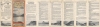
Digital Image: 1926 Routledge View of the Columbia River and the Columbia River Scenic Railroad
ColumbiaRiverScenicRoute-routledge-1928_d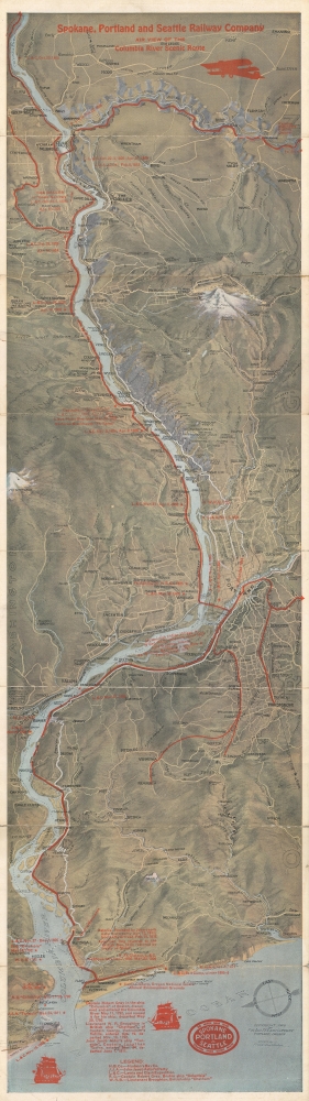


FOR THE ORIGINAL ANTIQUE MAP, WITH HISTORICAL ANALYSIS, CLICK HERE.
Digital Map Information
Geographicus maintains an archive of high-resolution rare map scans. We scan our maps at 300 DPI or higher, with newer images being 600 DPI, (either TIFF or JPEG, depending on when the scan was done) which is most cases in suitable for enlargement and printing.
Delivery
Once you purchase our digital scan service, you will receive a download link via email - usually within seconds. Digital orders are delivered as ZIP files, an industry standard file compression protocol that any computer should be able to unpack. Some of our files are very large, and can take some time to download. Most files are saved into your computer's 'Downloads' folder. All delivery is electronic. No physical product is shipped.
Credit and Scope of Use
You can use your digial image any way you want! Our digital images are unrestricted by copyright and can be used, modified, and published freely. The textual description that accompanies the original antique map is not included in the sale of digital images and remains protected by copyright. That said, we put significant care and effort into scanning and editing these maps, and we’d appreciate a credit when possible. Should you wish to credit us, please use the following credit line:
Courtesy of Geographicus Rare Antique Maps (http://www.geographicus.com).
How Large Can I Print?
In general, at 300 DPI, you should at least be able to double the size of the actual image, more so with our 600 DPI images. So, if the original was 10 x 12 inches, you can print at 20 x 24 inches, without quality loss. If your display requirements can accommodate some loss in image quality, you can make it even larger. That being said, no quality of scan will allow you to blow up at 10 x 12 inch map to wall size without significant quality loss. For more information, it is best consult a printer or reprographics specialist.
Refunds
If the high resolution image you ordered is unavailable, we will fully refund your purchase. Otherwise, digital images scans are a service, not a tangible product, and cannot be returned or refunded once the download link is used.
Fred A. Routledge (September 7, 1871 - April 1936) was an American artist and cartographer best known for his pictorial maps and bird's eye views. Born in Abilene, Kansas, Routledge spent most of his early life in Rockford, Illinois before moving to Portland, Oregon. Routledge worked with the publication West Shore for a short time before finding himself out of work. He found work with the Morning Oregonian beginning in 1895 as the head of its Art Department, a position he reportedly held until 1906. At that time it is clear that hand-drawn illustrations were being replaced by photographic images, but Routledge's work continued to appear in the Oregonian over the ensuing decades. Routledge also worked as artist and cartographer on illustrated books, two of which were published in 1915. Until his death, Routledge produced pictorial maps for many different companies, including Union Pacific, and as promotional material for scenic drives throughout Washington. He married fellow artist Lydia McGowan in 1896. More by this mapmaker...
Frank William Baltes (March 19, 1860 - 1932) was an American author and printer active in the Pacific Northwest during the end of the 19th century and the early 20th century. Baltes, born to German immigrants in the then Washington Territory was educated in Chicago before finding a position in the printing office of the Astorian in Astoria, Oregon in 1873. Baltes founded his own company, F.W. Baltes and Company, in 1882. Baltes also served as secretary of the Portland Tyothetae and served as a delegate to numerous meetings of the United Typothetae of America. Learn More...
Copyright © 2025 Geographicus Rare Antique Maps | Geographicus Rare Antique Maps
This copy is copyright protected.
Copyright © 2025 Geographicus Rare Antique Maps