This copy is copyright protected.
Copyright © 2025 Geographicus Rare Antique Maps
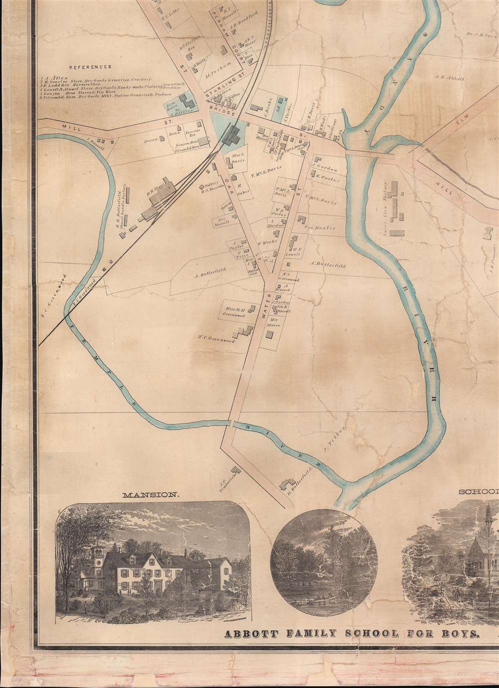
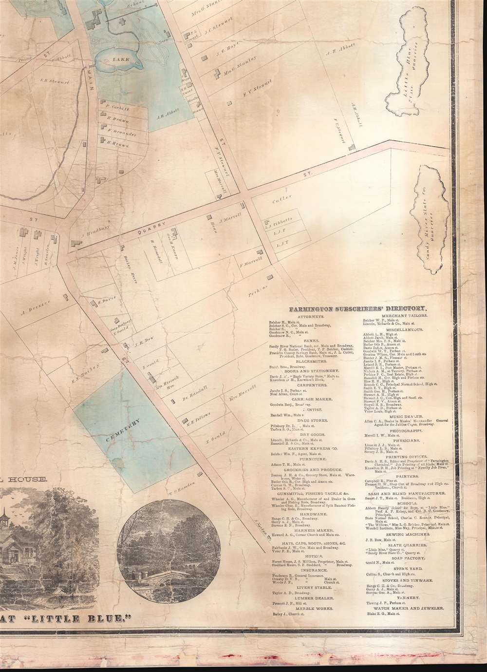
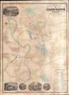
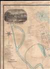
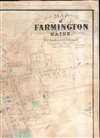
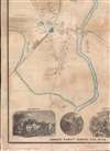
Digital Image: 1874 Sanford and Leggett City Plan or Map of Farmington, Maine
FarmingtonMaine-sanfordleggett-1874_d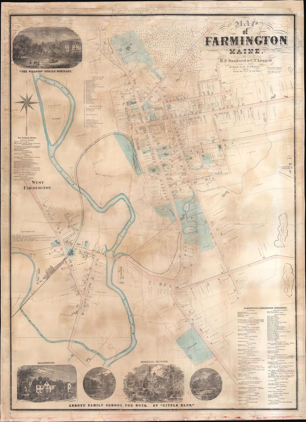


FOR THE ORIGINAL ANTIQUE MAP, WITH HISTORICAL ANALYSIS, CLICK HERE.
Digital Map Information
Geographicus maintains an archive of high-resolution rare map scans. We scan our maps at 300 DPI or higher, with newer images being 600 DPI, (either TIFF or JPEG, depending on when the scan was done) which is most cases in suitable for enlargement and printing.
Delivery
Once you purchase our digital scan service, you will receive a download link via email - usually within seconds. Digital orders are delivered as ZIP files, an industry standard file compression protocol that any computer should be able to unpack. Some of our files are very large, and can take some time to download. Most files are saved into your computer's 'Downloads' folder. All delivery is electronic. No physical product is shipped.
Credit and Scope of Use
You can use your digial image any way you want! Our digital images are unrestricted by copyright and can be used, modified, and published freely. The textual description that accompanies the original antique map is not included in the sale of digital images and remains protected by copyright. That said, we put significant care and effort into scanning and editing these maps, and we’d appreciate a credit when possible. Should you wish to credit us, please use the following credit line:
Courtesy of Geographicus Rare Antique Maps (http://www.geographicus.com).
How Large Can I Print?
In general, at 300 DPI, you should at least be able to double the size of the actual image, more so with our 600 DPI images. So, if the original was 10 x 12 inches, you can print at 20 x 24 inches, without quality loss. If your display requirements can accommodate some loss in image quality, you can make it even larger. That being said, no quality of scan will allow you to blow up at 10 x 12 inch map to wall size without significant quality loss. For more information, it is best consult a printer or reprographics specialist.
Refunds
If the high resolution image you ordered is unavailable, we will fully refund your purchase. Otherwise, digital images scans are a service, not a tangible product, and cannot be returned or refunded once the download link is used.
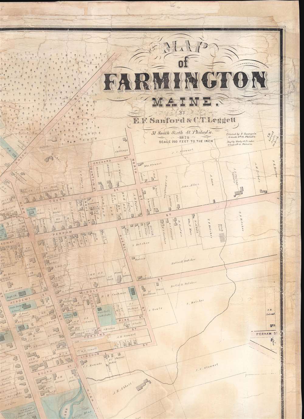
E.F. Sanford (fl. c. 1868 - c. 1875) was a map and atlas publisher active in Philadelphia during the mid-19th century. Sanford was part of the partnership Sanford, Everts, and Company, for a time. He also published maps with C.T. Leggett. Some of Sanford's maps were wall maps of New England towns. More by this mapmaker...
C.T. Leggett (fl. c. 1870 - 1895) was a surveyor and cartographer active during the mid to late 19th century. Leggett published maps with E.F. Sanford. He did surveying and canvassing work for several different map, view, and atlas publishers during his career throughout the United States. He worked in Kansas, Maine, Missouri, Vermont, and Wisconsin compiling work for maps and atlases. Learn More...
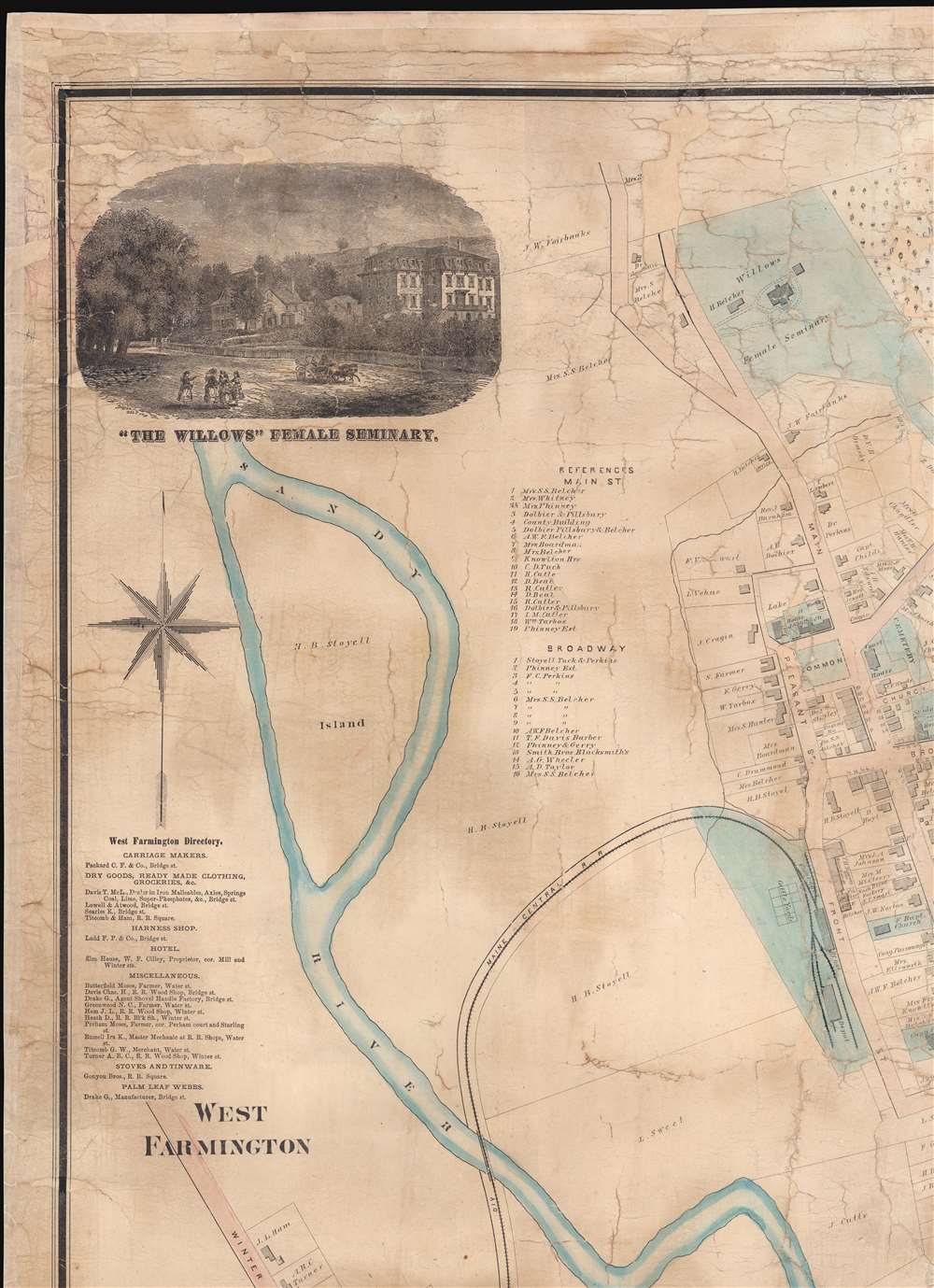
George Worley (c. 1819 - November 21, 1879) was an English lithographer active in Philadelphia. Born in England, Worley lived in Philadelphia by 1843 where he worked as an artist. He worked as a lithographer for Robert Pearsall Smith in his map publishing establishment from c. 1856 - 1859. In 1858 or 1859, Worley became a partner in the firm Worley, Bracher, and Matthias with William Bracher (1827 - 1912) and Benjamin Matthias. Worley, Bratcher, and Matthias lasted until 1860 when Matthais left. After Matthias's departure, Worley and Bracher renamed the firm Worley and Bracher and remained in operation until 1879, during which time they produced over 200 maps and atlases. Worley married Ann Thakeray on March 14, 1841 and died of liver disease. Learn More...
William Bracher (June 29, 1829 - May 14, 1912) was a Philadelphia based engraver and lithographer active in the late 19th century. Bracher was born in Göppingen, Badan-Württemberg, Germany. He was a 48er, who emigrated to the United States in 1848 with his wife Amelia A. M. Bracher (born Naigele), fleeing the failed Springtime of the Peoples Revolutions (1848 - 1849). He settled in Philadelphia, where he established himself as line and stipple engraver as early as 1861. He was naturalized as a U.S. citizen on March 27, 1854. Around 1858, Bracher partnered with George Worley and Benjamin Matthais to from the printing firm of 'Worley, Bracher and Matthias'. They were active at 600-602 Chestnut Street, Philadelphia, until 1860, when Matthias left the firm. At this time, the firm was renamed 'Worley and Bracher'. In 1866, they relocated to 104 Hudson Street (rear 320 Chestnut Street) and remained until 1873. From 1873 to 1875, the firm rented at 31 South Sixth Street and then at 27 South Sixth Street until 1891. The firm appears to have shared space and often worked with a variety of private Philadelphia engravers, including Frederick Bourquin (1808 - 1897), William Hart, James McGuigan, F. C. Paxson, Henry J. Toudy (fl. c. 1857 - c. 1877), and Thomas S. Wagner. Learn More...
Frederick Bourquin (1808 - 1897), also spelled Bourgin, was a Swiss American engraver and lithographer active in Philadelphia in the mid- to late-19th century. Bourquin was born in Bern, Switzerland, and emigrated to the United States in 1817 accompanied by his brother, Charles F. Bourquin, also an engraver. They lived briefly in Bucks County, Pennsylvania, and New York City, before relocating to Philadelphia in 1829 to join the lithographic firm of Kennedy and Lucas. Bourquin was naturalized as a U.S. citizen in 1834. From 1842 the brothers worked for Peter Stephen Duval (1804/5 - 1886) at 'P. S. Duval and Co.' They became partners in the firm in 1857. In 1858, Frederick left Duval to partner with Robert Pearsall Smith (1827 - 1898), one of the lead publishers in the Philadelphia-based county map and state atlas industry, publishing as 'F. Bourquin and Company' (602 Chestnut Street). Smith completely and inexplicably retired from publishing around 1865, leaving the business to Bourquin. Subsequently Bourquin shared premises and often published with William Bracher's (1829 - 1912) firm, 'Worley and Bracher'. In the mid-1850s Bourquin relocated to Camden, New Jersey, where he served on the City Council from the 1870s - 1880s and in the New Jersey State legislature in 1872. His sons, Frederick Bourquin, Jr., Gordon M. Bourquin, David L. Bourquin, and Charles L. Bourquin, were all, to a greater or lesser extent, involved in the lithographic and/or printing business. Learn More...
Copyright © 2025 Geographicus Rare Antique Maps | Geographicus Rare Antique Maps
This copy is copyright protected.
Copyright © 2025 Geographicus Rare Antique Maps