This copy is copyright protected.
Copyright © 2025 Geographicus Rare Antique Maps
Digital Image: 1839 Bradshaw Railroad Map of Great Britain
GreatBritain-bradshaw-1839_d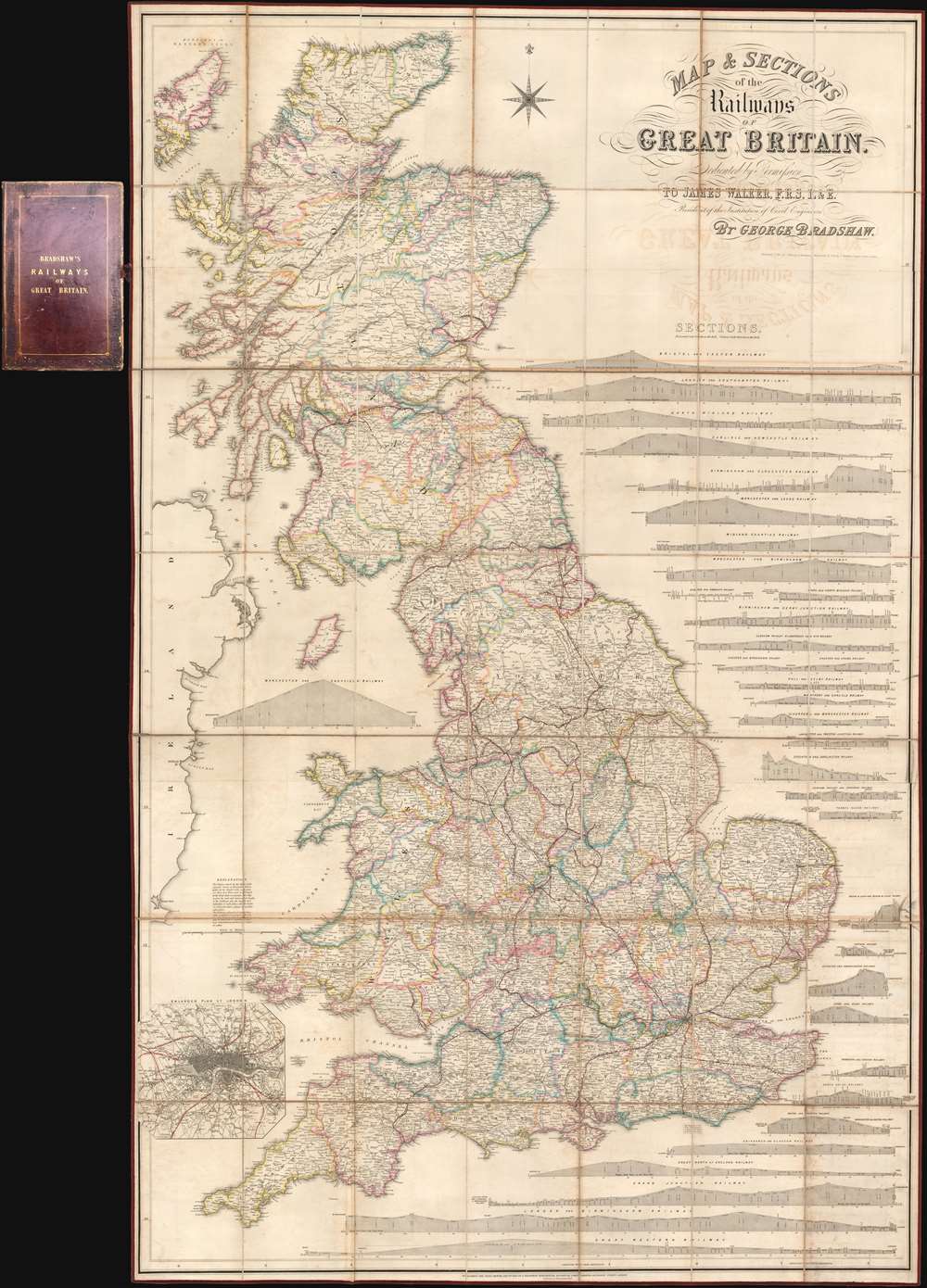

FOR THE ORIGINAL ANTIQUE MAP, WITH HISTORICAL ANALYSIS, CLICK HERE.
Digital Map Information
Geographicus maintains an archive of high-resolution rare map scans. We scan our maps at 300 DPI or higher, with newer images being 600 DPI, (either TIFF or JPEG, depending on when the scan was done) which is most cases in suitable for enlargement and printing.
Delivery
Once you purchase our digital scan service, you will receive a download link via email - usually within seconds. Digital orders are delivered as ZIP files, an industry standard file compression protocol that any computer should be able to unpack. Some of our files are very large, and can take some time to download. Most files are saved into your computer's 'Downloads' folder. All delivery is electronic. No physical product is shipped.
Credit and Scope of Use
You can use your digial image any way you want! Our digital images are unrestricted by copyright and can be used, modified, and published freely. The textual description that accompanies the original antique map is not included in the sale of digital images and remains protected by copyright. That said, we put significant care and effort into scanning and editing these maps, and we’d appreciate a credit when possible. Should you wish to credit us, please use the following credit line:
Courtesy of Geographicus Rare Antique Maps (http://www.geographicus.com).
How Large Can I Print?
In general, at 300 DPI, you should at least be able to double the size of the actual image, more so with our 600 DPI images. So, if the original was 10 x 12 inches, you can print at 20 x 24 inches, without quality loss. If your display requirements can accommodate some loss in image quality, you can make it even larger. That being said, no quality of scan will allow you to blow up at 10 x 12 inch map to wall size without significant quality loss. For more information, it is best consult a printer or reprographics specialist.
Refunds
If the high resolution image you ordered is unavailable, we will fully refund your purchase. Otherwise, digital images scans are a service, not a tangible product, and cannot be returned or refunded once the download link is used.
George Bradshaw (July 29, 1801 - September 6, 1853) was a British map publisher active in the middle part of the 19th century. Bradshaw was born in Windsor Bridge, Pendleton, Lancashire, England, the only son of Thomas Bradshaw and Mar Rogers. From 1815, when he was 14, he apprenticed in Manchester under the engraver J. Beale. After his apprenticeship, in 1820, he moved briefly to Belfast, where he worked as a printer and engraver. He returned to Manchester in 1821, and there concentrated on map engraving. Around 1839, he began publishing railroad timetables, maps, and guides, which he updated monthly. He had, by this time, taken on his own apprentice, William Thomas Blacklock, who joined the Bradshaw firm as a partner in 1842. The firm was thus renamed 'Bradshaw and Blacklock.' Bradshaw's railroad guides were extremely successful, earning him both fame and wealth. On a trip to Norway in 1853, Bradshaw contracted cholera and died in Christiania, where he is buried. The firm continued to publish under the 'Bradshaw and Blacklock' imprint for many years after his death. In addition to his publishing work, when he was 20 or so, Bradford became a Quaker, joining the Society of Friends. More by this mapmaker...
Copyright © 2025 Geographicus Rare Antique Maps | Geographicus Rare Antique Maps
This copy is copyright protected.
Copyright © 2025 Geographicus Rare Antique Maps