This copy is copyright protected.
Copyright © 2025 Geographicus Rare Antique Maps
Digital Image: 1704 Gerard Valk Map of Southern Italy (Kingdom of Naples)
ItaliaMeridionalis-valk-1704_d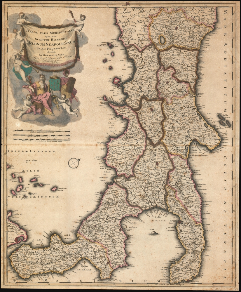

FOR THE ORIGINAL ANTIQUE MAP, WITH HISTORICAL ANALYSIS, CLICK HERE.
Digital Map Information
Geographicus maintains an archive of high-resolution rare map scans. We scan our maps at 300 DPI or higher, with newer images being 600 DPI, (either TIFF or JPEG, depending on when the scan was done) which is most cases in suitable for enlargement and printing.
Delivery
Once you purchase our digital scan service, you will receive a download link via email - usually within seconds. Digital orders are delivered as ZIP files, an industry standard file compression protocol that any computer should be able to unpack. Some of our files are very large, and can take some time to download. Most files are saved into your computer's 'Downloads' folder. All delivery is electronic. No physical product is shipped.
Credit and Scope of Use
You can use your digial image any way you want! Our digital images are unrestricted by copyright and can be used, modified, and published freely. The textual description that accompanies the original antique map is not included in the sale of digital images and remains protected by copyright. That said, we put significant care and effort into scanning and editing these maps, and we’d appreciate a credit when possible. Should you wish to credit us, please use the following credit line:
Courtesy of Geographicus Rare Antique Maps (http://www.geographicus.com).
How Large Can I Print?
In general, at 300 DPI, you should at least be able to double the size of the actual image, more so with our 600 DPI images. So, if the original was 10 x 12 inches, you can print at 20 x 24 inches, without quality loss. If your display requirements can accommodate some loss in image quality, you can make it even larger. That being said, no quality of scan will allow you to blow up at 10 x 12 inch map to wall size without significant quality loss. For more information, it is best consult a printer or reprographics specialist.
Refunds
If the high resolution image you ordered is unavailable, we will fully refund your purchase. Otherwise, digital images scans are a service, not a tangible product, and cannot be returned or refunded once the download link is used.
Gerard Valk (September 30, 1652 - October 21, 1726) (aka. Valck, Walck, Valcke), was a Dutch engraver, globe maker, and map publisher active in Amsterdam in the latter half of the 17th century and early 18th century. Valk was born in Amsterdam where his father, Leendert Gerritsz, was a silversmith. He studied mathematics, navigation, and cartography under Pieter Maasz Smit. Valk and moved to London in 1673, where he studied engraving under Abraham Blooteling (or Bloteling) (1634 - 1690), whose sister he married, and later worked for the map sellers Christopher Browne and David Loggan. Valke and Blooteling returned to Amsterdam in 1680 and applied for a 15-year privilege, a kind of early copyright, from the States General, which was granted in 1684. In 1687, he established his own firm in Amsterdam in partnership with Petrus (Pieter) Schenk, who had just married his sister, Agata. They published under the imprint of Valk and Schenk. Also, curiously in the same year Valk acquired the home of Jochem Bormeester, also engraver and son-in-law of art dealer Clement De Jonghe. Initially Valk and Schenk focused on maps and atlases, acquiring the map plates of Jodocus Hondius and Jan Jansson in 1694. Later, in 1701 they moved into the former Hendrick Hondius (the younger) offices where they began producing globes. Valk and Schenk soon acquired the reputation of producing the finest globes in the Netherlands, a business on which they held a near monopoly for nearly 50 years. In 1702, Valk joined the Bookseller's Guild of which he was promptly elected head. Around the same time, Gerard introduced his son, Leonard, who was married to Maria Schenk, to the business. Leonard spearheaded the acquisition of the map plates of Frederick de Wit in 1709. Nonetheless, Leonard was nowhere near as sophisticated a cartographer or businessman as his father and ultimately, through neglect, lost much the firm's prestige. After his death, the firm was taken over by his widow Maria. More by this mapmaker...
Copyright © 2025 Geographicus Rare Antique Maps | Geographicus Rare Antique Maps
This copy is copyright protected.
Copyright © 2025 Geographicus Rare Antique Maps